
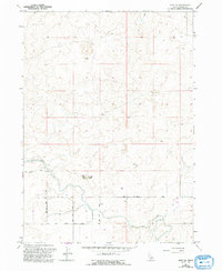
1964 Map of Hazelton NE
USGS Topo · Published 1965About this map
The high desert landscape of Jerome County is defined by its mid-century water management systems in this 1964 survey. The Milner Gooding Canal cuts across the southern terrain, supported by a network of infrastructure including a Flume and multiple Gaging Stations. This irrigation network was vital for transforming the arid soils into productive land, a process further evidenced by the Main Drain navigating the eastern sections.
Find a feature on this map
9 named features on this map. Tap any name to fly to it.
Don’t see what you’re looking for? This feature index may not catch every label — zoom into the map to look around manually.
Map Details
Editions of this 1964 Hazelton NE Map
2 editions found
Other maps of this area

1954 · Pocatello
USGS Topo · 1:250,000

1955 · Twin Falls
USGS Topo · 1:250,000

1958 · Twin Falls
USGS Topo · 1:250,000

1958 · Pocatello
USGS Topo · 1:250,000

1964 · Burley SW
USGS Topo · 1:24,000

1964 · Burley NW
USGS Topo · 1:24,000

1964 · Eden
USGS Topo · 1:24,000

1964 · Milner
USGS Topo · 1:24,000

1964 · Hunt
USGS Topo · 1:24,000
1965 · Milner
USGS Topo · 1:24,000