Old Maps of Eddyville, Idaho for Academic Research
Study the evolution of Eddyville with 14 high-resolution historic maps. Whether you're teaching, researching, or modeling changes in land use, these maps provide essential visual documentation of urban, environmental, and geographic change.
- Analyze long-term change: Track patterns in development, transportation, and natural features.
- Ideal for environmental or urban studies: Support academic projects with primary historical map data.
- Use in the classroom or lab: Educators and researchers rely on these maps to bring historical context to life.
These maps are a powerful tool for teaching, research, and visualizing how Eddyville has changed over the decades.
Eddyville, ID maps
(14)- 1903 Map of Rathdrum
 1903 Rathdrum1903 Print · USGSNorthern Idaho's transition from frontier outposts to a rail-and-timber economy is visible here just after the turn of the century. Researchers can trace the early layout of Rathdrum, locate Fort Sherman, and follow the Leiberg Trail through the mountains.4 unique versions available
 - 1955 Map of Spokane, 1965 Print
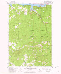
 1955 Spokane1965 Print · USGSInland Empire life in the fifties and sixties centers on the growth of Spokane and the heavy mining industry of northern Idaho. Trace mid-century landmarks like Fairchild Air Force Base, the Bunker Hill Mine, and early campuses such as Gonzaga University.2 unique versions available
 - 1957 Map of Lane, 1960 Print
 1957 Lane1960 Print · USGSThe eastern shores of Coeur d'Alene Lake and the surrounding national forest are captured here in the mid-fifties. Genealogists and local historians can trace the Union Pacific rail corridor through Lane, find old mining sites like the Caribou Mine, and locate the Mullan Tree Historic Site.2 unique versions available
 - 1958 Map of Spokane
 1958 Spokane1958 Print · USGSThe Inland Empire is shown at a mid-century peak of industrial and military activity, from the rail hubs of Spokane to the deep silver mines of northern Idaho. Researchers can trace the sprawling rail lines of the Union Pacific RR or locate landmarks like Fairchild Air Force Base and the Bunker Hill Smelter & Mine.
 - 1975 Map of Lane SW, 1977 Print
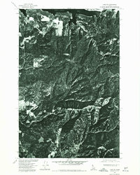 1975 Lane SW1977 Print · USGSThe timbered highlands of the Idaho panhandle come into focus in the mid-1970s through this aerial orthophoto. Trace the forest roads and topography surrounding Mount Coeur d'Alene, Wolf Lodge Bay, and Red Horse Mtn.
 - 1981 Map of Mt. Coeur D'Alene, 1982 Print
 1981 Mt. Coeur D'Alene1982 Print · USGSThe eastern shores of Coeur d'Alene Lake are shown here in the early eighties, highlighting a landscape defined by timber and mining. You can locate several named mineral sites including Caribou Mine, Gray Wolf Mine, and the high Lookout Tower.2 unique versions available
 - 1987 Map of Coeur D'Alene
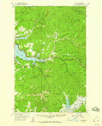
 1987 Coeur D'Alene1987 Print · USGSNorthern Idaho in the late eighties shows a landscape of deep-water lakes and heavy industry where the timber and mining economies meet growing valley settlements. Genealogists and historians can trace the footprints of the Sunshine Mine, the rail sidings at Corbin Junction, and the historic Old Mission State Park.3 unique versions available
 - 1996 Map of Mount Coeur D'Alene, 1999 Print
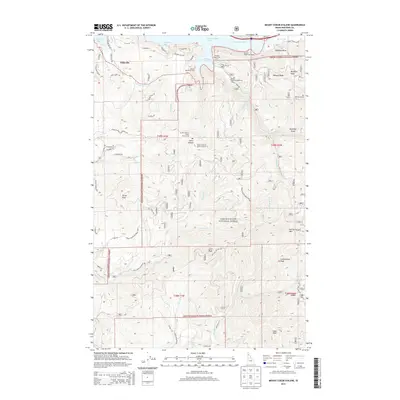
 1996 Mount Coeur D'Alene1999 Print · USGSKootenai County as it appeared in the late nineties shows a landscape of deep timber and historic mining activity. Trace mountain trails and old prospect sites like the Caribou Mine and Red Horse Mine, or locate the Mount Coeur d'Alene Lookout high above the lake.
 - 2011 Map of Mount Coeur D'Alene, 2011 Print
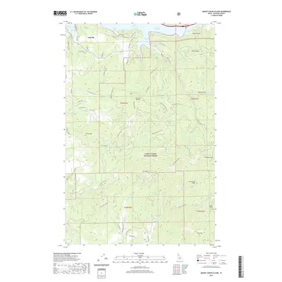
 2011 Mount Coeur D'Alene2011 Print · USGSCovers Eddyville, including Kootenai County, United States, and other nearby areas
 - 2013 Map of Mount Coeur D'Alene, 2013 Print
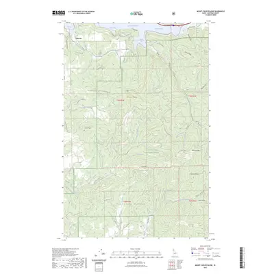
 2013 Mount Coeur D'Alene2013 Print · USGSCovers Eddyville, including Kootenai County, United States, and other nearby areas
 - 2017 Map of Mount Coeur D'Alene, 2017 Print
 2017 Mount Coeur D'Alene2017 Print · USGSCovers Eddyville, including Kootenai County, United States, and other nearby areas
 - 2020 Map of Mount Coeur D'Alene, 2020 Print
 2020 Mount Coeur D'Alene2020 Print · USGSCovers Eddyville, including Kootenai County, United States, and other nearby areas
 - 2023 Map of Mount Coeur D'Alene, 2023 Print
 2023 Mount Coeur D'Alene2023 Print · USGSCovers Eddyville, including Kootenai County, United States, and other nearby areas
 - 2024 Map of Mount Coeur D'Alene, 2024 Print
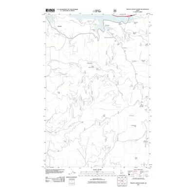
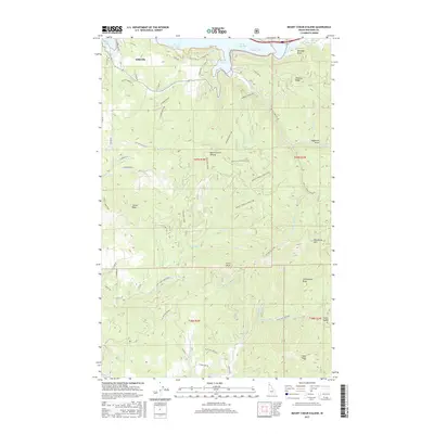
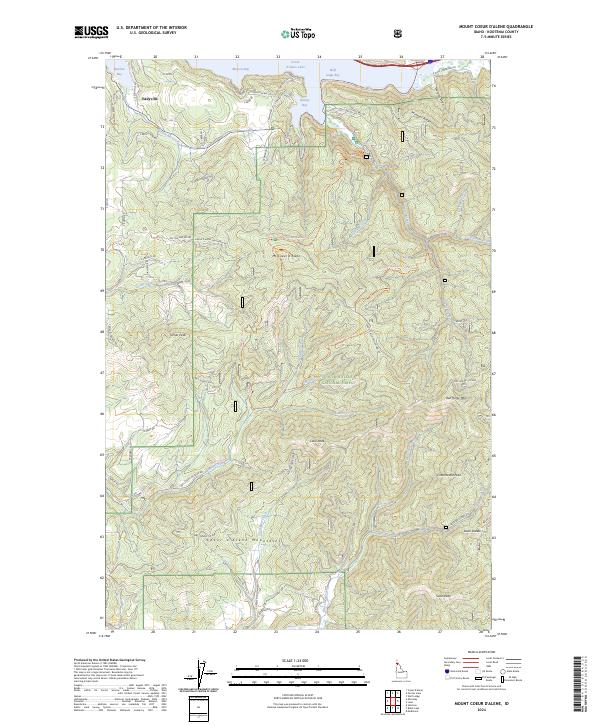 2024 Mount Coeur D'Alene2024 Print · USGSCoeur d'Alene Lake and its surrounding mountain peaks are shown here in modern detail, reflecting a landscape shaped by the timber industry and lakeside recreation. You can trace early settlement patterns at Eddyville or follow trail networks across Mt Coeur d'Alene and Mineral Ridge.
End of results
Showing maps 1-14 of 14
Top cities near Eddyville
- Coeur d'Alene historical maps
- Post Falls historical maps
- Hayden historical maps
- Rathdrum historical maps
- Dalton Gardens historical maps
- Hayden Lake historical maps
See more
Frequently asked questions
- What are the different types of historical maps available for Eddyville?
- What is the oldest map of Eddyville?
- Where can I purchase historical maps of Eddyville for my home or office?
- Where can I download high-res historical maps of Eddyville?
- Are there historical topographic maps available for Eddyville?
- Is there historical aerial imagery available for Eddyville?
- Where are historical maps of Eddyville sourced from?