Old Maps of Kootenai County, Idaho
Explore 106 old maps of Kootenai County, spanning from 1901 to today. These high-resolution historic maps reveal how streets, neighborhoods, landmarks, and natural features evolved over time — perfect for genealogy, metal detecting, research, and local history exploration.
What you can do with these maps:
- See how Kootenai County changed over time: Compare historical maps to modern-day views to trace roads, homesites, rail lines & more.
- View detailed metadata: Each map includes creators, publishers, year, scale, and archive source.
- Overlay maps with satellite & LiDAR: Visualize the past alongside modern tools to explore terrain & human change.
- Trusted historical sources: Maps sourced from the USGS, Library of Congress, and other archives.
- Access maps your way: View online, download high-res files, or order prints for personal or research use.
Start exploring old maps of Kootenai County to uncover forgotten places, hidden landmarks, and the deep history beneath your feet.
Kootenai County, ID maps
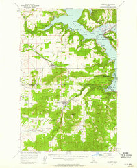
(106)- 1901 Map of Spokane
 1901 Spokane1901 Print · USGSCovers Kootenai County, including Spokane, Spokane Valley, and other nearby areas6 unique versions available
 - 1903 Map of Oakesdale
 1903 Oakesdale1903 Print · USGSCovers Kootenai County, including Tekoa, Rosalia, and other nearby areas
 - 1903 Map of Rathdrum
 1903 Rathdrum1903 Print · USGSCovers Kootenai County, including Coeur d'Alene, Post Falls, and other nearby areas4 unique versions available
 - 1905 Map of Oakesdale
 1905 Oakesdale1905 Print · USGSCovers Kootenai County, including Tekoa, Rosalia, and other nearby areas3 unique versions available
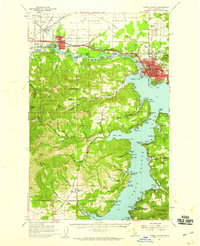
 - 1909 Map of Cataldo, 1954 Print
 1909 Cataldo1954 Print · USGSCovers Kootenai County, including Kellogg, Pinehurst, and other nearby areas
 - 1911 Map of Cataldo
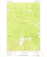
 1911 Cataldo1911 Print · USGSCovers Kootenai County, including Kellogg, Pinehurst, and other nearby areas2 unique versions available
 - 1943 Map of Mt Spokane
 1943 Mt Spokane1943 Print · USGSCovers Kootenai County, including Hauser, Peone, and other nearby areas2 unique versions available
 - 1949 Map of Greenacres, 1961 Print
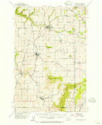
 1949 Greenacres1961 Print · USGSCovers Kootenai County, including Spokane Valley, Post Falls, and other nearby areas3 unique versions available
 - 1950 Map of Mt Spokane, 1952 Print
 1950 Mt Spokane1952 Print · USGSCovers Kootenai County, including Hauser, Peone, and other nearby areas3 unique versions available
 - 1950 Map of Rochat Peak, 1976 Print
 1950 Rochat Peak1976 Print · USGSCovers Kootenai County, including Benewah County, United States, and other nearby areas2 unique versions available
 - 1950 Map of Twin Crags, 1980 Print
 1950 Twin Crags1980 Print · USGSCovers Kootenai County, including Shoshone County, Benewah County, and other nearby areas
 - 1951 Map of Greenacres
 1951 Greenacres1951 Print · USGSCovers Kootenai County, including Spokane Valley, Post Falls, and other nearby areas2 unique versions available
 - 1952 Map of Rochat Peak
 1952 Rochat Peak1952 Print · USGSCovers Kootenai County, including Benewah County, United States, and other nearby areas
 - 1952 Map of Twin Crags
 1952 Twin Crags1952 Print · USGSCovers Kootenai County, including Shoshone County, Benewah County, and other nearby areas
 - 1954 Map of Fairfield, 1956 Print
 1954 Fairfield1956 Print · USGSCovers Kootenai County, including Fairfield, Rockford, and other nearby areas3 unique versions available
 - 1955 Map of Spokane, 1965 Print
 1955 Spokane1965 Print · USGSCovers Kootenai County, including Spokane, Spokane Valley, and other nearby areas2 unique versions available
 - 1957 Map of St. Maries, 1958 Print
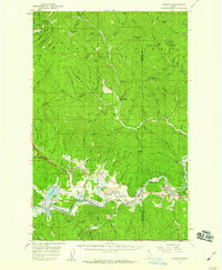
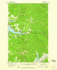
 1957 St. Maries1958 Print · USGSCovers Kootenai County, including Saint Maries, Medimont, and other nearby areas3 unique versions available
 - 1957 Map of Kingston, 1959 Print
 1957 Kingston1959 Print · USGSCovers Kootenai County, including Kingston, Canyon, and other nearby areas3 unique versions available
 - 1957 Map of Plummer, 1959 Print
 1957 Plummer1959 Print · USGSCovers Kootenai County, including Plummer, Harrison, and other nearby areas2 unique versions available
 - 1957 Map of Coeur D'Alene, 1959 Print
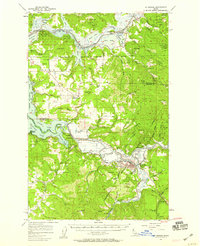
 1957 Coeur D'Alene1959 Print · USGSCovers Kootenai County, including Coeur d'Alene, Post Falls, and other nearby areas2 unique versions available
 - 1957 Map of Lane, 1960 Print
 1957 Lane1960 Print · USGSCovers Kootenai County, including Coeur d'Alene, Dalton Gardens, and other nearby areas2 unique versions available
 - 1957 Map of St. Joe, 1960 Print
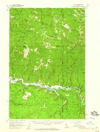 1957 St. Joe1960 Print · USGSCovers Kootenai County, including Saint Joe, Shoshone County, and other nearby areas3 unique versions available
 - 1958 Map of Spokane
 1958 Spokane1958 Print · USGSCovers Kootenai County, including Spokane, Spokane Valley, and other nearby areas
 - 1961 Map of Hayden, 1962 Print
 1961 Hayden1962 Print · USGSCovers Kootenai County, including Hayden, Rathdrum, and other nearby areas2 unique versions available
 - 1961 Map of Bayview, 1962 Print
 1961 Bayview1962 Print · USGSCovers Kootenai County, including Bayview, Bonner County, and other nearby areas
Showing maps 1-25 of 106
Top cities of Kootenai County
- Coeur d'Alene historical maps
- Post Falls historical maps
- Hayden historical maps
- Rathdrum historical maps
- Dalton Gardens historical maps
- Spirit Lake historical maps
See more
Frequently asked questions
- What are the different types of historical maps available for Kootenai County?
- What is the oldest map of Kootenai County?
- Where can I purchase historical maps of Kootenai County for my home or office?
- Where can I download high-res historical maps of Kootenai County?
- Are there historical topographic maps available for Kootenai County?
- Is there historical aerial imagery available for Kootenai County?
- Where are historical maps of Kootenai County sourced from?