1990s Maps of Kootenai County, Idaho
Explore 32 historic maps of Kootenai County from the 1990s. These maps offer a rare glimpse into what life looked like during the 1990s — showing old roads, neighborhoods, homes, and landmarks that have changed or disappeared over time.
Whether you're researching your family's past, planning a metal detecting trip, or studying how Kootenai County's landscape evolved across the 1990s, these high-resolution maps are a powerful tool for exploring the history of this region.
- Focus on a specific era: All maps on this page are from the 1990s, giving you a focused view of this time period.
- See what’s changed: Compare century-old streets, trails, and buildings to today's modern landscape using overlays and satellite layers.
- Research with precision: Use these maps for genealogy, historical research, land use analysis, or educational projects.
- View, download, or print: Maps are fully viewable online in high resolution, and can be downloaded or printed for your own records.
Start exploring Kootenai County's history through authentic maps from the 1990s. This is your window into the past.
Kootenai County, ID maps
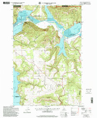
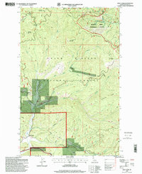
(32)- 1990 Map of Faset Peak, 1991 Print
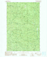
 1990 Faset Peak1991 Print · USGSThe high ridges of Shoshone and Bonner counties are documented here in the early 1990s as the national forests were managed for both timber and recreation. Researchers can trace the winding Ermine Ridge Trail, locate the INDEPENDENCE site, and follow the drainages of Spruce Creek.
 - 1990 Map of Spades Mountain, 1991 Print
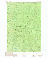
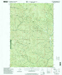
 1990 Spades Mountain1991 Print · USGSThe Idaho Panhandle's high timberlands are documented here during the late twentieth century, showing a landscape of mineral extraction and fire lookouts. Researchers can locate remote sites like the Bradbury Mine, the Lookout Tower atop Spades Mountain, and Burnt Cabin Summit.
 - 1990 Map of Lamb Peak, 1991 Print
 1990 Lamb Peak1991 Print · USGSThe deep forest of the Coeur d'Alene backcountry comes alive in this 1990s record of Shoshone and Kootenai Counties. Researchers can trace historic access routes like the Magee-Bear Trail and locate isolated landmarks like the Magee Historic Site and Erickson Ranch.
 - 1990 Map of Cataract Peak, 1991 Print
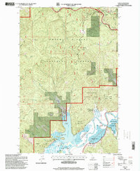
 1990 Cataract Peak1991 Print · USGSKootenai County's mountain interior is captured here in the late twentieth century, showing the intersection of river life and forest management. Trace high-altitude landmarks like Horse Heaven Landing Field, Cataract Peak, and the Cascade-Magee Road.
 - 1996 Map of Bumblebee Peak, 1999 Print
 1996 Bumblebee Peak1999 Print · USGSThe high ridges of Shoshone and Kootenai counties are documented here in the late nineties, showcasing the remote terrain of the Idaho panhandle. Researchers can trace the drainages of the Little North Fork Coeur d'Alene River and locate landmarks like Bumblebee Meadow or Skull Saddle.
 - 1996 Map of Fernan Lake, 1999 Print
 1996 Fernan Lake1999 Print · USGSKootenai County landscape in the late nineties shows the expansion of lakeside communities against the national forest. Trace local landmarks like Fernan Lake Village, the Yellowstone Trail, and the summit at Kern Butte.
 - 1996 Map of Hayden Lake, 1999 Print
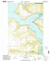
 1996 Hayden Lake1999 Print · USGSHayden Lake and the surrounding Coeur d'Alene National Forest are captured here in the late nineties as recreation and timber lands intersect. Researchers can trace the shoreline's history from Clarksville to Camp Mi-Voden, or locate upland sites like Shamrock Mine.
 - 1996 Map of Hayden, 1999 Print
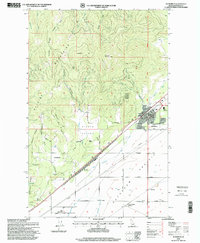
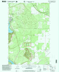
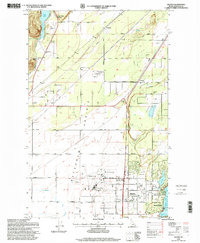 1996 Hayden1999 Print · USGSThe Hayden Lake and Rathdrum Prairie region are shown here in the mid-1990s as the area balanced its aviation and agricultural roots with growing residential development. Researchers can locate landmarks like Pine Grove Cemetery, the Hayden Lake Elementary School, and the Coeur d'Alene Air Terminal.
 - 1996 Map of Faset Peak, 1999 Print
 1996 Faset Peak1999 Print · USGSThe mountain backcountry of Shoshone and Bonner counties is captured here in the mid-1990s as it was managed by the Forest Service. Trace the high-altitude trails and springs of the Panhandle, from Faset Peak and Bishop Spring to the National Recreation Trail.
 - 1996 Map of Cataldo, 1999 Print
 1996 Cataldo1999 Print · USGSShoshone County, Idaho, is documented here in the late 1990s as the river-valley communities of the Coeur d'Alene flourished alongside deep-rooted history. Genealogists and historians can trace the grounds of the Cataldo Mission, locate the local Cem, and find industrial relics like the Sawmill and Mine Shaft.
 - 1996 Map of Medimont, 1999 Print
 1996 Medimont1999 Print · USGSThe river and lake systems of the Idaho Panhandle come alive in this mid-nineties survey of the Coeur d'Alene lowlands. Genealogists and historians can trace family roots around Medimont or locate industrial sites like the New Rainbow Mine and Old Rainbow Mine.
 - 1996 Map of Mount Coeur D'Alene, 1999 Print
 1996 Mount Coeur D'Alene1999 Print · USGSKootenai County as it appeared in the late nineties shows a landscape of deep timber and historic mining activity. Trace mountain trails and old prospect sites like the Caribou Mine and Red Horse Mine, or locate the Mount Coeur d'Alene Lookout high above the lake.
 - 1996 Map of Mount Spokane, 1999 Print
 1996 Mount Spokane1999 Print · USGSThe high peaks of the Selkirk Mountains are captured here in the late nineties, showing the intersection of state parklands and the Washington-Idaho border. Researchers can trace recreational development at Vista House or locate local landmarks like Camp Fosseen and the mine near Quartz Mountain.
 - 1996 Map of Lane, 1999 Print
 1996 Lane1999 Print · USGSKootenai County in the mid-1990s reveals a rugged mountain landscape where the Coeur d'Alene River meets the forest. You can trace historic pioneer routes at the Mullan Tree Historic Site and locate the small settlement of Lane near the shores of Killarney Lake.
 - 1996 Map of Rathdrum, 1999 Print
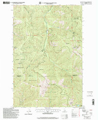
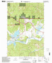
 1996 Rathdrum1999 Print · USGSNorthern Idaho's mountain-to-prairie transition is captured here in the mid-1990s as the community of Rathdrum grew. Genealogists and local historians can trace legacy sites like the Grange Hall and the early layout of Howelltown and East Greenacres.
 - 1996 Map of Rochat Peak, 1999 Print
 1996 Rochat Peak1999 Print · USGSThe St Joe Mountains of northern Idaho appear here in the 1990s, showing the intersection of tribal lands and national forests. Trace the Old Indian Reservation Boundary and find remote high-country landmarks like Rochat Peak and Crystal Lake.
 - 1996 Map of Lamb Peak, 1999 Print
 1996 Lamb Peak1999 Print · USGSNorth Idaho's mountain interior remained a land of forest management and remote outposts in the late twentieth century. Researchers can trace historic sites and early resource activity at the Magee Historic Site, Erickson Ranch, and the old Adit near Stewart Ridge.
 - 1996 Map of Lakeview, 1999 Print
 1996 Lakeview1999 Print · USGSLake Pend Oreille's southern reaches were still defined by a deep mining legacy in the late twentieth century. Trace the old workings of the Keep Cool and Idaho Lakeview Mines or locate the Lakeview Cemetery (Aband).
 - 1996 Map of Bayview, 1999 Print
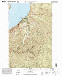
 1996 Bayview1999 Print · USGSThe Kootenai County shoreline of Lake Pend Oreille was a site of significant military research and recreation in the mid-1990s. Researchers can locate the Naval Reservation and its Naval Laboratory alongside the mountain settlements of Bunco Corners and Bayview.
 - 1996 Map of Black Lake, 1999 Print
 1996 Black Lake1999 Print · USGSThe Coeur d'Alene River valley in the late nineties is a network of lateral lakes and wetlands. Trace family landmarks and local infrastructure from Kootenai Sch to the shores of Black Lake and Shingle Bay.
 - 1996 Map of Harrison, 1999 Print
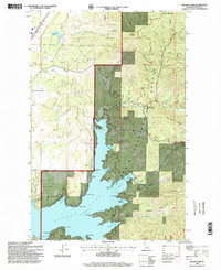
 1996 Harrison1999 Print · USGSThe eastern shores of Coeur d'Alene Lake come alive in the late nineties, showing a landscape defined by the confluence of major rivers and growing lakeside communities. Researchers can trace family sites near Harrison, locate the local Cem, and explore the boundaries of Heyburn State Park.
 - 1996 Map of Rose Lake, 1999 Print
 1996 Rose Lake1999 Print · USGSThe Kootenai County back-country comes into focus in the mid-1990s as it follows the river through the heart of the national forest. Researchers can trace the water-bound geography of Rose Lake and Bull Run Lake or locate early industrial sites like the local Sawmill.
 - 1996 Map of Spirit Lake East, 1999 Print
 1996 Spirit Lake East1999 Print · USGSThe Kootenai County timber and lake country comes into focus in the mid-nineties during a period of steady growth near the Bonner County line. Genealogists and historians can locate properties near Greenwood Cem, trace the shoreline at Echo Beach, or explore the limits of the Lone Mountain Seed Orchard.
 - 1996 Map of Wolf Lodge, 1999 Print
 1996 Wolf Lodge1999 Print · USGSThe timbered highlands of Kootenai County are captured here in the late nineties, showing a landscape defined by forestry and small-scale mining. Researchers can trace the drainage of Wolf Lodge Creek or locate local landmarks like the Homebuilder Mine and Wolf Lodge settlement.
 - 1996 Map of Spades Mountain, 1999 Print
 1996 Spades Mountain1999 Print · USGSKootenai County's high ridges and national forest lands are captured in the 1990s, during a period of active resource management. Local historians and genealogists can trace early mineral interests at the Bradbury Mine or navigate the terrain between Spades Mountain and the North Fork Coeur d'Alene River.
Showing maps 1-25 of 32
Top cities of Kootenai County
- Coeur d'Alene historical maps
- Post Falls historical maps
- Hayden historical maps
- Rathdrum historical maps
- Dalton Gardens historical maps
- Spirit Lake historical maps
See more
Frequently asked questions
- What are the different types of historical maps available for Kootenai County?
- What is the oldest map of Kootenai County?
- Where can I purchase historical maps of Kootenai County for my home or office?
- Where can I download high-res historical maps of Kootenai County?
- Are there historical topographic maps available for Kootenai County?
- Is there historical aerial imagery available for Kootenai County?
- Where are historical maps of Kootenai County sourced from?