1960s Maps of Kootenai County, Idaho
Explore 12 historic maps of Kootenai County from the 1960s. These maps offer a rare glimpse into what life looked like during the 1960s — showing old roads, neighborhoods, homes, and landmarks that have changed or disappeared over time.
Whether you're researching your family's past, planning a metal detecting trip, or studying how Kootenai County's landscape evolved across the 1960s, these high-resolution maps are a powerful tool for exploring the history of this region.
- Focus on a specific era: All maps on this page are from the 1960s, giving you a focused view of this time period.
- See what’s changed: Compare century-old streets, trails, and buildings to today's modern landscape using overlays and satellite layers.
- Research with precision: Use these maps for genealogy, historical research, land use analysis, or educational projects.
- View, download, or print: Maps are fully viewable online in high resolution, and can be downloaded or printed for your own records.
Start exploring Kootenai County's history through authentic maps from the 1960s. This is your window into the past.
Kootenai County, ID maps
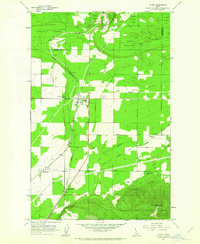
(12)- 1961 Map of Hayden, 1962 Print
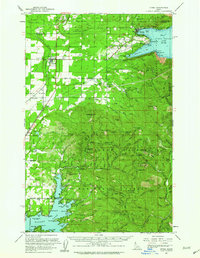
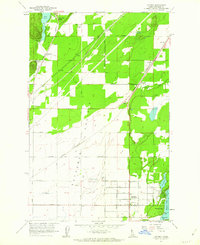 1961 Hayden1962 Print · USGSNorth of Coeur d'Alene in the early sixties, the landscape shows a transition from the industrial Rathdrum Prairie to the recreational shores of Hayden Lake. Researchers can trace family sites near Hayden, locate Pine Grove Cem, or follow the path of the Spokane International railroad.2 unique versions available
 - 1961 Map of Bayview, 1962 Print
 1961 Bayview1962 Print · USGSThe northern tip of Lake Pend Oreille meets the Idaho panhandle's deep forests in the early sixties. Researchers can trace the military history of the Naval Reservation near Bayview or locate remote landmarks like The Old Maids Clearing and Bunco Corners.
 - 1961 Map of Lakeview, 1962 Print
 1961 Lakeview1962 Print · USGSThe eastern shores of Pend Oreille Lake are shown during a period of active mountain mining in the early sixties. Genealogists and historians can trace the remote operations of the Idaho Lakeview Mine, Weber Mine, and the lakeside settlement at Lakeview.2 unique versions available
 - 1961 Map of Rathdrum, 1962 Print
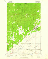 1961 Rathdrum1962 Print · USGSRathdrum served as a critical Idaho rail hub in the early sixties, where three major lines crossed at the edge of the mountains. Genealogists and historians can trace the town's original footprint, including the Grange Hall, and locate outlying settlements like Howelltown and East Greenacres.3 unique versions available
 - 1961 Map of Spirit Lake East, 1962 Print
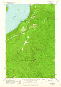
 1961 Spirit Lake East1962 Print · USGSThe timber and rail country of Kootenai County comes alive in the early sixties as the northern forests meet developing lakefronts. Genealogists and historians can trace the foundations of Spirit Lake, the Water Sch, and rail lines like the Northern Pacific.3 unique versions available
 - 1961 Map of Athol, 1962 Print
 1961 Athol1962 Print · USGSAthol served as a vital rail junction in the early 1960s, marking where the timberlands meet the open prairie of northern Idaho. Genealogists and historians can trace the foundations of Athol, the rural Mountain View Cem, and small crossings like Corbin Junction.2 unique versions available
 - 1961 Map of Spirit Lake West, 1963 Print
 1961 Spirit Lake West1963 Print · USGSThe northern Idaho timber and lake country comes into focus in the early sixties as recreational shores and mountain transport networks expand. Researchers can locate specific lakeside settlements like Silver Beach or trace the Milwaukee St Paul and Pacific railroad.3 unique versions available
 - 1961 Map of Lakeview, 1963 Print
 1961 Lakeview1963 Print · USGSThe Idaho Panhandle's rugged mining interior is captured here in the early 1960s, centered on the lakeside settlement of Lakeview. Researchers can trace old mountain operations like the Keep Cool Mine or locate the Erickson Ranch and Trail Creek Work Center.2 unique versions available
 - 1961 Map of Spirit Lake, 1963 Print
 1961 Spirit Lake1963 Print · USGSThe transition from the forested Idaho panhandle to the agricultural Rathdrum Prairie is captured here in the early sixties. Genealogists and rail historians can trace the paths of the Milwaukee Road and locate sites like the Hayden Lake School and Greenwood Cemetery.2 unique versions available
 - 1961 Map of Athol, 1963 Print
 1961 Athol1963 Print · USGSNorthern Idaho in the early sixties showcases the intersection of federal forest lands and lakeside settlements. Genealogists and researchers can trace local family landmarks like Mountain View Cem, the Cedar Mtn Sch, and numerous mountain sites including the Shamrock Mine.3 unique versions available
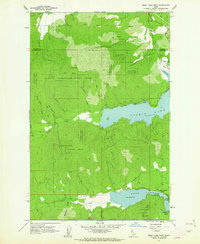
 - 1961 Map of Hayden Lake, 1963 Print
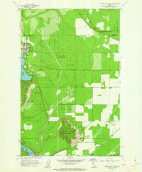
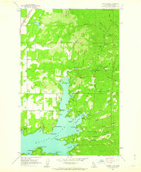 1961 Hayden Lake1963 Print · USGSHayden Lake and the surrounding national forest are captured here in the early sixties, showing a landscape of timber, mining, and growing shoreline recreation. Researchers can find old properties like The Clark House, traces of the Shamrock Mine, and the rail stops at Chilco and Garwood.3 unique versions available
 - 1967 Map of Bayview
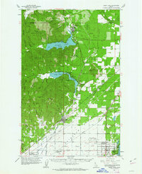
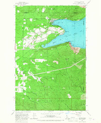 1967 Bayview1967 Print · USGSThe southern tip of Lake Pend Oreille comes alive in the 1960s as a hub for both naval research and public recreation at the edge of the Idaho panhandle. Researchers can trace the military footprint at the Naval Reservation or locate early settlements like Bunco Corners and Lewellen.3 unique versions available
End of results
Showing maps 1-12 of 12
Top cities of Kootenai County
- Coeur d'Alene historical maps
- Post Falls historical maps
- Hayden historical maps
- Rathdrum historical maps
- Dalton Gardens historical maps
- Spirit Lake historical maps
See more
Frequently asked questions
- What are the different types of historical maps available for Kootenai County?
- What is the oldest map of Kootenai County?
- Where can I purchase historical maps of Kootenai County for my home or office?
- Where can I download high-res historical maps of Kootenai County?
- Are there historical topographic maps available for Kootenai County?
- Is there historical aerial imagery available for Kootenai County?
- Where are historical maps of Kootenai County sourced from?