Old Maps of Madison County, Idaho for Academic Research
Study the evolution of Madison County with 116 high-resolution historic maps. Whether you're teaching, researching, or modeling changes in land use, these maps provide essential visual documentation of urban, environmental, and geographic change.
- Analyze long-term change: Track patterns in development, transportation, and natural features.
- Ideal for environmental or urban studies: Support academic projects with primary historical map data.
- Use in the classroom or lab: Educators and researchers rely on these maps to bring historical context to life.
These maps are a powerful tool for teaching, research, and visualizing how Madison County has changed over the decades.
Madison County, ID maps
(116)- 1943 Map of Garns Mtn, 1957 Print
 1943 Garns Mtn1957 Print · USGSEastern Idaho's high ridges and the winding Snake River corridor are captured here during the mid-1940s. Researchers can locate remote industrial sites like the Brown Bear Mine, early education landmarks such as the Upper Pine Creek Sch, and the Durrant Ranch.3 unique versions available
 - 1946 Map of Garns Mtn
 1946 Garns Mtn1946 Print · USGSHigh-country ranching and coal mining define this Idaho landscape in the 1940s, situated where the Snake River meets the Big Flat. Genealogists and historians can trace family locations at the Durant Ranch or follow the local mining economy through sites like the Mikesell Mine and Pintar Mine.
 - 1948 Map of Rigby, 1959 Print
 1948 Rigby1959 Print · USGSThe Upper Snake River Valley comes to life in this post-war survey, showing the agricultural engine of Jefferson County. Genealogists and local historians can trace the irrigation network through dozens of named features like the Rigby Canal or locate landmarks such as Garfield Sch and the Little Buttes.
 - 1948 Map of Parker, 1973 Print
 1948 Parker1973 Print · USGSFremont and Madison counties are captured here just after the war, showing the intensive irrigation and rail network of the upper Snake River Valley. Trace family roots and land use near Parker, Salem, and the Fort Henry Historic Monument.2 unique versions available
 - 1949 Map of Rexburg
 1949 Rexburg1949 Print · USGSThe Madison County landscape was defined by its irrigation networks and the growing influence of Rexburg in the late 1940s. Genealogists and historians can trace family-named landmarks and essential community sites like Ricks College, Thornton, and Burton Cem.4 unique versions available
 - 1949 Map of Rigby
 1949 Rigby1949 Print · USGSJefferson County in the late 1940s is defined by a massive irrigation network surrounding Rigby and Menan. Genealogists and historians can trace the paths of the Union Pacific, locate the Garfield Sch, and study the complex system of the Burgess Canal.3 unique versions available
 - 1949 Map of Newdale, 1966 Print
 1949 Newdale1966 Print · USGSSoutheast Idaho at the end of the 1940s is defined by a intricate network of irrigation and rail. Researchers can trace the agricultural development around Chester and Newdale, following features like the Chester Cem, the Union Pacific line, and the deep winding gorge of the Teton River.2 unique versions available
 - 1950 Map of Ririe
 1950 Ririe1950 Print · USGSSoutheast Idaho at mid-century reveals a landscape transformed by the Snake River and its vast irrigation network. Researchers can trace family ties through Ririe and Sunnydell, or locate rural landmarks like Clark Sch and Sutton Cem.3 unique versions available
 - 1950 Map of Parker
 1950 Parker1950 Print · USGSThe northern Snake River Plain comes into focus in this midcentury survey as agricultural irrigation meets the shifting Sand Dunes. Genealogists and historians can trace the irrigation networks of the St Anthony Canal, settlements like Parker, and the Fort Henry Historic Monument.
 - 1950 Map of Rexburg
 1950 Rexburg1950 Print · USGSRexburg and its surrounding irrigation district are shown at mid-century, just as the local economy was anchored by the railway and college. Genealogists and researchers can locate Ricks College, the Independence Ward Ch, and family plots in Rexburg Cem.
 - 1950 Map of Newdale
 1950 Newdale1950 Print · USGSEastern Idaho’s agricultural heartland is captured here in the 1950s, showing the complex irrigation network between the Teton River and Fall River. Researchers can trace the Union Pacific rail lines and early road systems connecting Newdale and Chester.
 - 1950 Map of St Anthony
 1950 St Anthony1950 Print · USGSMid-century Fremont County is defined here by the meeting of the Henrys Fork and the Teton River amidst a massive irrigation network. Researchers can trace the Union Pacific rail line through St. Anthony and locate the Idaho Industrial Training School or Riverview Cemetery.3 unique versions available
 - 1950 Map of Rigby, 1953 Print
 1950 Rigby1953 Print · USGSThe Snake River valley in the early postwar years was a thriving network of irrigated farms and railroad towns. Genealogists and local historians can trace the foundations of Rigby and Ririe, locating vanished landmarks like Bucks Sch (Aband) or Milo Cem.
 - 1951 Map of Moody, 1952 Print
 1951 Moody1952 Print · USGSMadison County's high-desert agricultural life is detailed here in the early fifties, showing the intricate canal systems and rail lines of the Snake River Plain. Trace family roots at Sugar City, the Teton Cem, or the rural schoolhouse at Moody Sch.2 unique versions available
 - 1951 Map of Hawley Gulch, 1952 Print
 1951 Hawley Gulch1952 Print · USGSThe high country of Madison and Bonneville counties is captured here in the early fifties, showing a rugged landscape of national forest land. Genealogists and historians can locate remote landmarks like the Hawley Gulch Ranger Station, Morning Glory Mine, and Table Rock.3 unique versions available
 - 1951 Map of Heise, 1952 Print
 1951 Heise1952 Print · USGSMadison and Jefferson counties are defined by a complex irrigation network and thermal springs in the early fifties. Genealogists and historians can trace the Union Pacific line near Byrne or locate family sites by Elkhorn Warm Spring and Butler Island.3 unique versions available
 - 1951 Map of Heise SE, 1952 Print
 1951 Heise SE1952 Print · USGSEastern Idaho ranching country near the Snake River is captured here in the early fifties, showing a landscape of family-run homesteads and public forest. Local historians can trace the heritage of the Spaulding Ranch, locate the Antelope Sch (Aban'd), or study the terrain around Rattlesnake Point.4 unique versions available
 - 1951 Map of White Owl Butte, 1952 Print
 1951 White Owl Butte1952 Print · USGSThe high ridges of Madison County are captured here in the early fifties, showing a landscape defined by dramatic buttes and deep draws. Researchers can trace the winding course of Long Hollow and locate landmarks like Bitters Butte and the Elbow of Moody Creek.
 - 1951 Map of Menan Buttes, 1953 Print
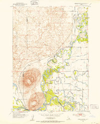 1951 Menan Buttes1953 Print · USGSMadison and Jefferson County lands in the early fifties show a river-driven landscape defined by the convergence of the Henrys Fork and Snake River. Researchers can locate the Beaver Dick Cemetery, the Historic Monument Site of First Ferry, and the Independence Sch.11 unique versions available
 - 1951 Map of Plano, 1953 Print
 1951 Plano1953 Print · USGSFremont and Madison counties are captured here in the early 1950s as irrigation canals transformed the desert into farmland. Genealogists can locate family names and burial sites at the Plano Cem near Plano and trace the path of the Independent Canal.2 unique versions available
 - 1955 Map of Driggs, 1967 Print
 1955 Driggs1967 Print · USGSEastern Idaho and Western Wyoming appear at a mid-century crossroads as the river valleys were fully settled and the high peaks protected. Genealogists and researchers can trace the rail towns of Rexburg and Driggs or follow the Snake River from Irwin to the Palisades Reservoir.3 unique versions available
 - 1958 Map of Driggs
 1958 Driggs1958 Print · USGSThe high Teton peaks and Snake River valleys are captured here in the mid-fifties, showing the region's agricultural and wilderness boundaries. Researchers can trace the Union Pacific rail corridor through Rexburg or locate early settlements like Clementsville and Tetonia.2 unique versions available
 - 1962 Map of Driggs
 1962 Driggs1962 Print · USGSThe Idaho-Wyoming borderlands are captured here in the early sixties, showing the peaks and valleys of the northern Rockies. Genealogists and historians can trace rail lines like the Union Pacific RR and isolated outposts like the National Elk Refuge or the Fort Hall Indian Reservation.
 - 1965 Map of Linderman Dam, 1967 Print
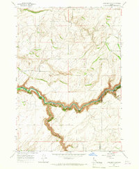 1965 Linderman Dam1967 Print · USGSEastern Idaho in the mid-sixties reveals a river-cut landscape shaped by the Teton River and local ranching. Trace the water infrastructure of the Linderman Dam Spillway and early community landmarks like the Grange Hall.2 unique versions available
 - 1965 Map of Wright Creek, 1967 Print
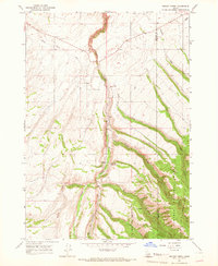 1965 Wright Creek1967 Print · USGSThe Madison County and Teton County borderlands come into focus in the mid-sixties, showing the rugged transition into the forest. Researchers can locate the Pincock Hot Springs and Swimming Pool, alongside a mountain Cem and the remote Smith settlement.2 unique versions available
Showing maps 1-25 of 116
Top cities of Madison County
Frequently asked questions
- What are the different types of historical maps available for Madison County?
- What is the oldest map of Madison County?
- Where can I purchase historical maps of Madison County for my home or office?
- Where can I download high-res historical maps of Madison County?
- Are there historical topographic maps available for Madison County?
- Is there historical aerial imagery available for Madison County?
- Where are historical maps of Madison County sourced from?