1970s Maps of Arbon Valley, Idaho
Explore 4 historic maps of Arbon Valley from the 1970s. These maps offer a rare glimpse into what life looked like during the 1970s — showing old roads, neighborhoods, homes, and landmarks that have changed or disappeared over time.
Whether you're researching your family's past, planning a metal detecting trip, or studying how Arbon Valley's landscape evolved across the 1970s, these high-resolution maps are a powerful tool for exploring the history of this region.
- Focus on a specific era: All maps on this page are from the 1970s, giving you a focused view of this time period.
- See what’s changed: Compare century-old streets, trails, and buildings to today's modern landscape using overlays and satellite layers.
- Research with precision: Use these maps for genealogy, historical research, land use analysis, or educational projects.
- View, download, or print: Maps are fully viewable online in high resolution, and can be downloaded or printed for your own records.
Start exploring Arbon Valley's history through authentic maps from the 1970s. This is your window into the past.
Arbon Valley, ID maps
(4)- 1971 Map of Schiller, 1974 Print
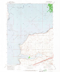 1971 Schiller1974 Print · USGSPower County, Idaho, is captured here in the early 1970s as the regional economy revolved around the Snake River shoreline and the Michaud Flats. Genealogists and historians can trace the Union Pacific rail line, the rural settlement of Schiller, and the Indian Cem within the Fort Hall Indian Reservation.
 - 1971 Map of Wheatgrass Bench, 1974 Print
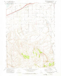 1971 Wheatgrass Bench1974 Print · USGSIn the early 1970s, the border of the Fort Hall Indian Reservation met a landscape of rising benches and essential water infrastructure. Trace historical sites like the Sun Dance Ground, the local Cem, and the industrial Big Siphon Wasteway.
 - 1971 Map of Michaud Creek, 1974 Print
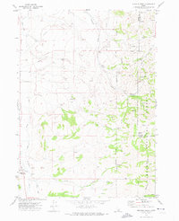 1971 Michaud Creek1974 Print · USGSPower and Bannock counties meet in this early 1970s landscape of high-desert canyons and reservation lands. Researchers can trace the boundary of the Fort Hall Indian Reservation and locate specific landmarks like Eagletail Rock, the local Cem, and Outlaw Spring.2 unique versions available
 - 1971 Map of Michaud, 1974 Print
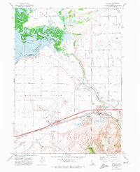 1971 Michaud1974 Print · USGSPower County and the Fort Hall Indian Reservation meet here in the early seventies as the Portneuf River feeds the reservoir. Genealogists and historians can trace family-named roads and sites like Reider Cemetery, Indian Cem, and the settlement of Michaud.4 unique versions available
End of results
Showing maps 1-4 of 4
Top cities near Arbon Valley
Frequently asked questions
- What are the different types of historical maps available for Arbon Valley?
- What is the oldest map of Arbon Valley?
- Where can I purchase historical maps of Arbon Valley for my home or office?
- Where can I download high-res historical maps of Arbon Valley?
- Are there historical topographic maps available for Arbon Valley?
- Is there historical aerial imagery available for Arbon Valley?
- Where are historical maps of Arbon Valley sourced from?