1950s Maps of Osburn, Idaho
Explore 6 historic maps of Osburn from the 1950s. These maps offer a rare glimpse into what life looked like during the 1950s — showing old roads, neighborhoods, homes, and landmarks that have changed or disappeared over time.
Whether you're researching your family's past, planning a metal detecting trip, or studying how Osburn's landscape evolved across the 1950s, these high-resolution maps are a powerful tool for exploring the history of this region.
- Focus on a specific era: All maps on this page are from the 1950s, giving you a focused view of this time period.
- See what’s changed: Compare century-old streets, trails, and buildings to today's modern landscape using overlays and satellite layers.
- Research with precision: Use these maps for genealogy, historical research, land use analysis, or educational projects.
- View, download, or print: Maps are fully viewable online in high resolution, and can be downloaded or printed for your own records.
Start exploring Osburn's history through authentic maps from the 1950s. This is your window into the past.
Osburn, ID maps
(6)- 1955 Map of Spokane, 1965 Print
 1955 Spokane1965 Print · USGSInland Empire life in the fifties and sixties centers on the growth of Spokane and the heavy mining industry of northern Idaho. Trace mid-century landmarks like Fairchild Air Force Base, the Bunker Hill Mine, and early campuses such as Gonzaga University.2 unique versions available
 - 1956 Map of Wallace, 1966 Print
 1956 Wallace1966 Print · USGSWestern Montana and the Idaho panhandle meet in this mid-century survey of the Bitterroot and Cabinet Mountains. Genealogists and historians can trace the rail-and-river economy through the Northern Pacific line and settlements like Thompson Falls or St. Ignatius.3 unique versions available
 - 1957 Map of Burke, 1959 Print
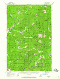 1957 Burke1959 Print · USGSShoshone County is captured here during the peak of its mid-century mining era, showing the remarkable density of the Silver Valley canyons. Genealogists and historians can trace family roots at Burke and Gem, locate the Beaver School, or identify specific industrial sites like the Tiger-Poorman Mine.2 unique versions available
 - 1957 Map of Wallace, 1959 Print
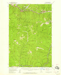 1957 Wallace1959 Print · USGSShoshone County mining towns and the rugged St. Joe watershed are frozen in time during the late fifties. Genealogists and industrial historians can trace the foundations of the Silver Valley via the Miners Union Cemetery, Morning Mine, and the Milwaukee Road.3 unique versions available
 - 1957 Map of Kellogg, 1959 Print
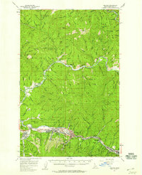 1957 Kellogg1959 Print · USGSShoshone County mining towns and mountain ridges are documented here during the late 1950s. Genealogists can trace family roots in Wardner and Pinehurst or locate industrial sites like the Bunker Hill Mine and Page Mine.2 unique versions available
 - 1958 Map of Spokane
 1958 Spokane1958 Print · USGSThe Inland Empire is shown at a mid-century peak of industrial and military activity, from the rail hubs of Spokane to the deep silver mines of northern Idaho. Researchers can trace the sprawling rail lines of the Union Pacific RR or locate landmarks like Fairchild Air Force Base and the Bunker Hill Smelter & Mine.
End of results
Showing maps 1-6 of 6
Top cities near Osburn
- Kellogg historical maps
- Pinehurst historical maps
- Wallace historical maps
- Mullan historical maps
- Smelterville historical maps
- Wardner historical maps
Frequently asked questions
- What are the different types of historical maps available for Osburn?
- What is the oldest map of Osburn?
- Where can I purchase historical maps of Osburn for my home or office?
- Where can I download high-res historical maps of Osburn?
- Are there historical topographic maps available for Osburn?
- Is there historical aerial imagery available for Osburn?
- Where are historical maps of Osburn sourced from?