Old Maps of Smiths Ferry, Idaho for Academic Research
Study the evolution of Smiths Ferry with 11 high-resolution historic maps. Whether you're teaching, researching, or modeling changes in land use, these maps provide essential visual documentation of urban, environmental, and geographic change.
- Analyze long-term change: Track patterns in development, transportation, and natural features.
- Ideal for environmental or urban studies: Support academic projects with primary historical map data.
- Use in the classroom or lab: Educators and researchers rely on these maps to bring historical context to life.
These maps are a powerful tool for teaching, research, and visualizing how Smiths Ferry has changed over the decades.
Smiths Ferry, ID maps
(11)- 1894 Map of Squaw Creek
 1894 Squaw Creek1894 Print · USGSCentral Idaho in the 1890s was a landscape of mountain valleys and river crossings where early pioneers established remote outposts. Trace the locations of historic river access at Smith Ferry and early industry at Walker Mill or the settlement of Ola.5 unique versions available
 - 1953 Map of Smiths Ferry, 1955 Print
 1953 Smiths Ferry1955 Print · USGSThe Payette River valley in the early fifties was a landscape of remote rail stops and mountain lookouts. Genealogists can trace rural school locations like Lower Alpha School (Aban'd) or follow the UNION PACIFIC line through Smiths Ferry.3 unique versions available
 - 1955 Map of Baker, 1964 Print
 1955 Baker1964 Print · USGSThe Oregon-Idaho borderlands are captured here in the mid-fifties as the Snake River underwent massive changes from dam construction. Trace the Oregon Trail Memorial Monument near Baker, find early mines like Virtue Mine, and follow the Union Pacific Railroad through Huntington.4 unique versions available
 - 1959 Map of Baker
 1959 Baker1959 Print · USGSThe Oregon and Idaho borderlands come alive in the late fifties, showing the rugged corridor along the Snake River and the high peaks of the Wallowa Mountains. Researchers can trace the legacy of the Union Pacific railroad or locate historic mining sites like the Flagstaff Mine and Virtue Mine.2 unique versions available
 - 1980 Map of Weiser, 1993 Print
 1980 Weiser1993 Print · USGSThe Snake River valley and the foothills of the Boise Mountains are captured here in the 1980s, showing the vital rail and water infrastructure of the region. Researchers can trace the Union Pacific line through Payette or locate rural landmarks like Hog Cove Butte and Wilburn Butte.
 - 1985 Map of Smiths Ferry, 1986 Print
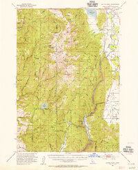
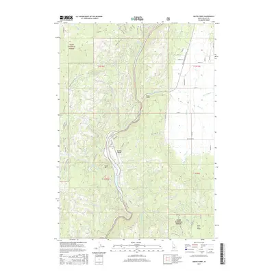
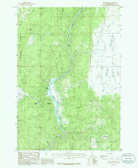 1985 Smiths Ferry1986 Print · USGSThe North Fork Payette River corridor and the settlement of Smiths Ferry are captured here in the mid-1980s. Local researchers can trace the transition from Boise National Forest timberlands to the ranching geography of Round Valley and the Tripod Reservoir.
 - 2011 Map of Smiths Ferry, 2011 Print
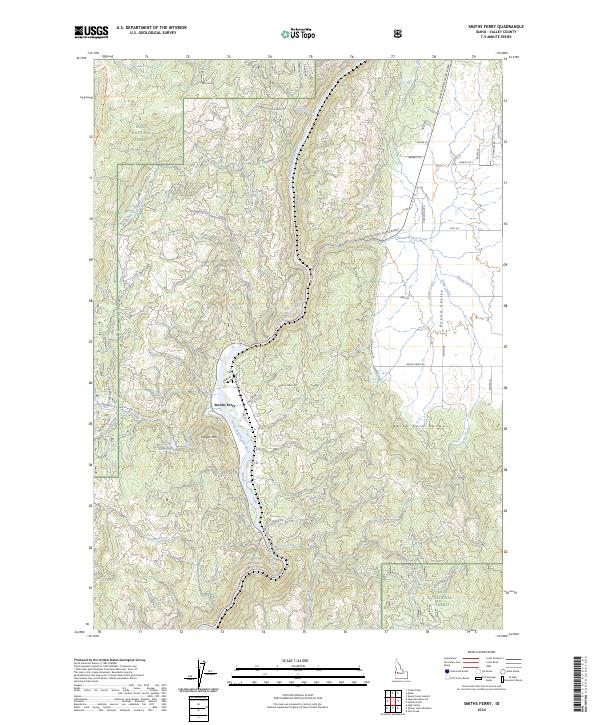
 2011 Smiths Ferry2011 Print · USGSCovers Smiths Ferry, including Valley County, United States, and other nearby areas
 - 2013 Map of Smiths Ferry, 2013 Print
 2013 Smiths Ferry2013 Print · USGSCovers Smiths Ferry, including Valley County, United States, and other nearby areas
 - 2017 Map of Smiths Ferry, 2017 Print
 2017 Smiths Ferry2017 Print · USGSCovers Smiths Ferry, including Valley County, United States, and other nearby areas
 - 2020 Map of Smiths Ferry, 2020 Print
 2020 Smiths Ferry2020 Print · USGSCovers Smiths Ferry, including Valley County, United States, and other nearby areas
 - 2024 Map of Smiths Ferry, 2024 Print
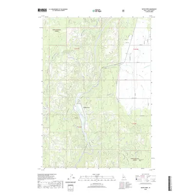
 2024 Smiths Ferry2024 Print · USGSThe North Fork Payette River corridor remains a vital Idaho passage in the early twenty-first century. Genealogists and local historians can trace modern road networks and forest access points around Smiths Ferry, the North Fork Range, and Round Valley.
End of results
Showing maps 1-11 of 11
Top cities near Smiths Ferry
Frequently asked questions
- What are the different types of historical maps available for Smiths Ferry?
- What is the oldest map of Smiths Ferry?
- Where can I purchase historical maps of Smiths Ferry for my home or office?
- Where can I download high-res historical maps of Smiths Ferry?
- Are there historical topographic maps available for Smiths Ferry?
- Is there historical aerial imagery available for Smiths Ferry?
- Where are historical maps of Smiths Ferry sourced from?