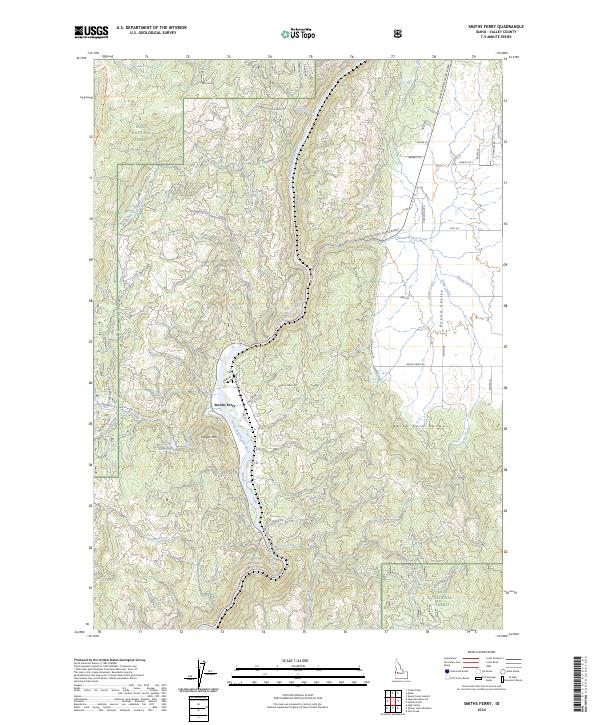
2024 Map of Smiths Ferry
USGS Topo · Published 2024About this map
Smiths Ferry serves as a central point along the North Fork Payette River in this modern survey of Valley County. The geography is defined by the sharp transition from the river canyon to the surrounding heights of the North Fork Range and Cougar Mtn. Within the Boise National Forest, a network of forest development roads and trails, including the West Mountain Trl, provides access to high-elevation points like the Tripod Reservoir. To the east, the terrain opens into the flat expanse of Round Valley, where Round Valley Creek and Bacon Creek meander through more level ground. The map details the modern infrastructure of the Payette River Scenic Byway alongside older local names like Neebs Mill Rd and Packer John Rd, reflecting the area's long history as a mountain passage.
Find a feature on this map
87 named features on this map. Tap any name to fly to it.
Don’t see what you’re looking for? This feature index may not catch every label — zoom into the map to look around manually.
Map Details
Editions of this 2024 Smiths Ferry Map
This is the sole edition of this map. No revisions or reprints were ever made.
Other maps of this area

1894 · Squaw Creek
USGS Topo · 1:125,000

1909 · Garden Valley
USGS Topo · 1:125,000

1953 · Smiths Ferry
USGS Topo · 1:62,500

1953 · Boiling Springs
USGS Topo · 1:62,500

1953 · Banks
USGS Topo · 1:62,500

1955 · Baker
USGS Topo · 1:250,000

1957 · Challis
USGS Topo · 1:250,000

1959 · Baker
USGS Topo · 1:250,000

1959 · Garden Valley
USGS Topo · 1:62,500

1960 · Challis
USGS Topo · 1:250,000