
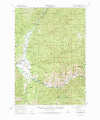
1959 Map of Garden Valley
USGS Topo · Published 1961About this map
The confluence of the Middle Fork Payette River and the South Fork Payette River anchors this 1959 survey of Boise County. The settlement at Garden Valley and the nearby town of Crouch serve as the primary hubs within the Boise National Forest, surrounded by a landscape defined by timber management and resource extraction. The southern portion of the map reveals a high concentration of mining history, particularly around Grimes Pass, where the Grimes Pass School and the Grimes Monument stand near a cluster of active and historical workings including the Klondike Mine, Missouri Mine, and Golden Age Mine.
Find a feature on this map
84 named features on this map. Tap any name to fly to it.
Don’t see what you’re looking for? This feature index may not catch every label — zoom into the map to look around manually.
Map Details
Editions of this 1959 Garden Valley Map
2 editions found
Other maps of this area

1892 · Boise
USGS Topo · 1:125,000

1894 · Squaw Creek
USGS Topo · 1:125,000

1894 · Idaho Basin
USGS Topo · 1:125,000

1897 · Boise
USGS Topo · 1:125,000

1909 · Garden Valley
USGS Topo · 1:125,000

1953 · Smiths Ferry
USGS Topo · 1:62,500

1953 · Boiling Springs
USGS Topo · 1:62,500

1953 · Banks
USGS Topo · 1:62,500

1953 · Deadwood Reservoir
USGS Topo · 1:62,500

1955 · Baker
USGS Topo · 1:250,000