1930s Maps of Bartlett, Illinois
Explore 2 historic maps of Bartlett from the 1930s. These maps offer a rare glimpse into what life looked like during the 1930s — showing old roads, neighborhoods, homes, and landmarks that have changed or disappeared over time.
Whether you're researching your family's past, planning a metal detecting trip, or studying how Bartlett's landscape evolved across the 1930s, these high-resolution maps are a powerful tool for exploring the history of this region.
- Focus on a specific era: All maps on this page are from the 1930s, giving you a focused view of this time period.
- See what’s changed: Compare century-old streets, trails, and buildings to today's modern landscape using overlays and satellite layers.
- Research with precision: Use these maps for genealogy, historical research, land use analysis, or educational projects.
- View, download, or print: Maps are fully viewable online in high resolution, and can be downloaded or printed for your own records.
Start exploring Bartlett's history through authentic maps from the 1930s. This is your window into the past.
Bartlett, IL maps
(2)- 1932 Map of Geneva
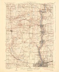 1932 Geneva1932 Print · USGSThe Fox River valley is a hive of early twentieth-century industry and civic life. Genealogists can trace family names through rural landmarks like Johnsons Mound or the many country schools, including Red Brick Sch and Stewart Sch.3 unique versions available
 - 1935 Map of Barrington, 1958 Print
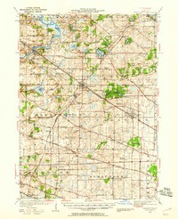 1935 Barrington1958 Print · USGSNortheastern Illinois appears here in the decades following the first World War as rural townships began to shift toward a suburban future. Genealogists can trace family roots through numerous district schools and local landmarks like St Johns Church, Lake Zurich, and Fox River Grove.
End of results
Showing maps 1-2 of 2
Top cities near Bartlett
- Aurora historical maps
- Naperville historical maps
- Elgin historical maps
- Schaumburg historical maps
- Arlington Heights historical maps
- Palatine historical maps
See more
Top neighborhoods of Bartlett
Frequently asked questions
- What are the different types of historical maps available for Bartlett?
- What is the oldest map of Bartlett?
- Where can I purchase historical maps of Bartlett for my home or office?
- Where can I download high-res historical maps of Bartlett?
- Are there historical topographic maps available for Bartlett?
- Is there historical aerial imagery available for Bartlett?
- Where are historical maps of Bartlett sourced from?