Old Maps of Brown County, Illinois for Metal Detecting
Plan your next treasure hunt with 93 historic maps of Brown County. Find old homesites, ghost towns, trails, and gathering spots that may be lost to time — perfect for identifying promising metal detecting locations.
- Locate forgotten sites: Uncover places like long-lost settlements, abandoned rail lines, or gathering spots.
- Plan better hunts: Use map overlays combined with LiDAR or satellite views to narrow in on historically rich areas.
- Made for detectorists: Thousands of hobbyists use these maps to discover relics, coins, and hidden history.
Use these historic maps to boost your research and find new opportunities beneath the surface of Brown County.
Brown County, IL maps
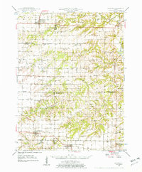
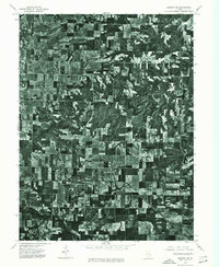
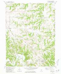
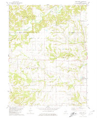
(93)- 1923 Map of Rushville, 1958 Print
 1923 Rushville1958 Print · USGSSchuyler County's agricultural and social landscape is captured here in the early 1920s, centered on the rail terminus at Rushville. Genealogists and historians can trace numerous rural schools and churches, including Muley School, Ebenezer Church, and Pokeberry School.
 - 1926 Map of Rushville
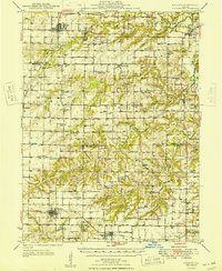
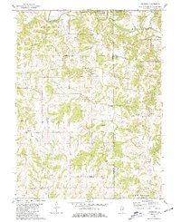
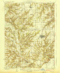 1926 Rushville1926 Print · USGSSchuyler and Brown counties appear in the mid-1920s as a landscape of small farmsteads and rural social hubs. Genealogists and historians can trace an extraordinary density of local institutions, from White Frame School to the Ebenezer Church and the rails of the Chicago Burlington and Quincy.2 unique versions available
 - 1926 Map of Mt Sterling, 1970 Print
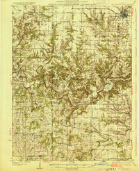
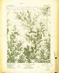
 1926 Mt Sterling1970 Print · USGSWestern Illinois at the mid-twenties reveals a landscape of ridge-top farms and creek-bottom crossings across Brown and Pike counties. You can trace the locations of dozens of vanished rural schoolhouses like Pea Green Sch and old river fords including Wilson Ford.
 - 1928 Map of Meredosia, 1958 Print
 1928 Meredosia1958 Print · USGSThe Illinois River valley in the late 1920s was a bustling corridor of river locks, pumping stations, and rail lines. Genealogists and local historians can trace family roots through numerous rural landmarks like Ham Sch, Reich Landing, and the Perry Spring's Sta rail stop.2 unique versions available
 - 1929 Map of Mt Sterling
 1929 Mt Sterling1929 Print · USGSIn the late 1920s, the borderlands of Brown and Pike counties were defined by a dense network of country schools and creek crossings. Genealogists can trace family farms and local hubs like Pea Green Sch, Fishhook, and Mountain View Ch, or locate the historic Shinnebarger Bridge on McKee Creek.2 unique versions available
 - 1931 Map of Meredosia
 1931 Meredosia1931 Print · USGSThe Illinois River valley in the late twenties is captured here at a peak of rail and river activity. Genealogists can trace family roots through numerous country schools like Sand Ridge Sch and the important La Grange Locks complex.2 unique versions available
 - 1946 Map of Augusta, 1957 Print
 1946 Augusta1957 Print · USGSWestern Illinois farm country at the end of the 1940s is detailed here as the rail-and-river economy transitions. Genealogists can trace family names at Sherwood Cem and Woodland Cem, or locate rural landmarks like Mt Horeb Ch and Timewell PO.2 unique versions available
 - 1948 Map of Quincy
 1948 Quincy1948 Print · USGSThe Mississippi and Illinois River valleys are captured at a post-war crossroads as rail and river travel met the expanding highway system. Genealogists can trace family settlements from Quincy to Hannibal and smaller towns like Vandalia and Jerseyville.2 unique versions available
 - 1949 Map of Augusta
 1949 Augusta1949 Print · USGSWestern Illinois at the end of the 1940s reveals a landscape of tight-knit rural communities and school districts. Genealogists can trace family footprints across dozens of local landmarks like Sulphur Springs Sch, Woodland Cem, and Mound Station Timewell PO.
 - 1956 Map of Quincy, 1967 Print
 1956 Quincy1967 Print · USGSThe river and rail corridors of the Illinois-Missouri border are documented here during the mid-1950s. Researchers can trace historic river landings and regional transit hubs from Quincy and Hannibal to smaller settlements like Meredosia and Roodhouse.3 unique versions available
 - 1958 Map of Burlington, 1968 Print
 1958 Burlington1968 Print · USGSThe tri-state river country of Iowa, Illinois, and Missouri is captured here in the mid-fifties, dominated by the Mississippi River and major rail lines. Genealogists and historians can trace the development of river towns like Keokuk or locate the sprawling Iowa Army Ammunition Plant.4 unique versions available
 - 1961 Map of Burlington
 1961 Burlington1961 Print · USGSThe tri-state borderlands along the Mississippi River are captured here during the late fifties and early sixties, showing the vital river-and-rail economy of Iowa, Illinois, and Missouri. Genealogists and historians can trace the development of major hubs like Galesburg and Macomb alongside landmark sites such as the Iowa Ordnance Plant and the historic river town of Nauvoo.
 - 1963 Map of Burlington
 1963 Burlington1963 Print · USGSThe tri-state river country of the Mississippi and Illinois valleys comes alive in this mid-century survey. Genealogists and historians can trace the industrial and academic growth of the region, from the Iowa Ordnance Plant to campuses like Knox College and Western Illinois University.
 - 1975 Map of Meredosia SE, 1976 Print
 1975 Meredosia SE1976 Print · USGSThe Illinois River valley in the mid-1970s shows a landscape of riverfront commerce and productive floodplains. Genealogists and local historians can trace the footprints of Meredosia, Naples, and the edge of Bluffs as they appeared decades ago.
 - 1975 Map of Rushville SE, 1976 Print
 1975 Rushville SE1976 Print · USGSSchuyler County farmland and the southern outskirts of Rushville are captured in high detail during the mid-seventies. Trace the winding course of the La Moine River and examine the precise layout of local timber and farm fields.
 - 1975 Map of Augusta SW, 1976 Print
 1975 Augusta SW1976 Print · USGSEastern Adams County is captured in mid-1970s aerial detail, revealing the precise layout of agricultural fields and rural roads. Genealogists and researchers can trace the specific footprints of farmsteads and the street grids of Clayton and Timewell.
 - 1980 Map of Perry East, 1981 Print
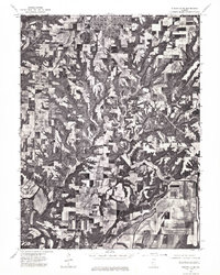
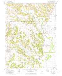 1980 Perry East1981 Print · USGSPike and Brown Counties appear in the late 1970s as a landscape of interconnected creek forks and small farming hubs. Researchers can locate numerous family burial grounds like Calhoun Cem, Rusk Cem, and Woods Cem near the banks of Mc Kee Creek.
 - 1980 Map of Cooperstown, 1981 Print
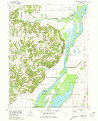 1980 Cooperstown1981 Print · USGSThe Illinois River valley in the early 1980s reveals a complex landscape of commercial river locks and expansive wildlife wetlands. Genealogists and historians can trace numerous rural burial grounds like Vandeventer Cem or Hulett Cem and locate landmarks like the La Grange Lock and Dam.
 - 1980 Map of Meredosia, 1981 Print
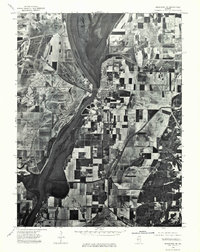
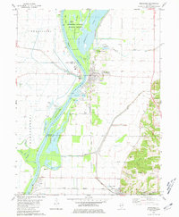 1980 Meredosia1981 Print · USGSThe Illinois River valley in the early 1980s reveals a landscape of massive levees, rail lines, and wetlands across four county borders. Researchers can trace family history at Oakland Cem or Fairview Cem and follow the Norfolk and Western tracks through Meredosia and Naples.
 - 1980 Map of Versailles, 1981 Print
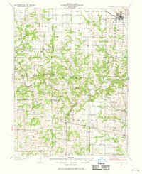
 1980 Versailles1981 Print · USGSBrown County's rural landscape is captured here in the early eighties, centered on the village of Versailles and the winding Camp Creek. Genealogists can trace family roots through numerous local burial sites, including Logan Creek, Hersman Cem, and Gilbirds Cem.
 - 1981 Map of Fishhook
 1981 Fishhook1981 Print · USGSThe rural borderlands of Adams and Pike Counties are captured here in the early 1980s. Researchers can locate family burial plots and old country churches like Mound Prairie Ch, Winner Cem, and the settlement at Chestline.
 - 1981 Map of Mt Sterling
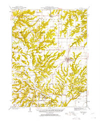
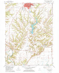
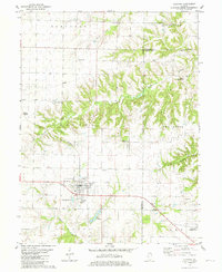
 1981 Mt Sterling1981 Print · USGSBrown County's rural townships and the county seat of Mt Sterling are captured here in the early 1980s. Genealogists and local historians can trace family roots through numerous burial sites like Cleaves Cem and Butler Cem or locate the old Fargo settlement.2 unique versions available
 - 1981 Map of Rushville South
 1981 Rushville South1981 Print · USGSSchuyler County life in the early eighties centers on the growth of Rushville and the recreation area around Schuy-Rush Lake. Researchers can locate numerous family burial sites like Haardscrabble Cem or find the Full Gospel Ch near Sugar Grove.
 - 1981 Map of Clayton
 1981 Clayton1981 Print · USGSWestern Illinois farm country and the village of Clayton are captured here in the early eighties. Researchers can locate numerous family burial grounds including Knight Cem and Howe Cem, or trace the rail-era footprint of Timewell (Mound Station).
 - 1981 Map of Perry West
 1981 Perry West1981 Print · USGSThe borderlands of Brown and Pike County in the mid-1970s reveal a landscape of deep-rooted family farms and rural hamlets. Researchers can trace ancestral locations across numerous sites including Morrelville, Fairmount Ch, and the FISHHOOK GAS FIELD.
Showing maps 1-25 of 93
Top cities of Brown County
- Mount Sterling historical maps
- Versailles historical maps
- Cooperstown historical maps
- Buckhorn historical maps
- Ripley historical maps
Frequently asked questions
- What are the different types of historical maps available for Brown County?
- What is the oldest map of Brown County?
- Where can I purchase historical maps of Brown County for my home or office?
- Where can I download high-res historical maps of Brown County?
- Are there historical topographic maps available for Brown County?
- Is there historical aerial imagery available for Brown County?
- Where are historical maps of Brown County sourced from?