Old Maps of Manlius, Illinois for Hiking & Exploration
Hike through history with 11 historic maps of Manlius. Explore old trails, ghost towns, and forgotten backroads — perfect for outdoor adventurers and local explorers.
- Rediscover forgotten places: Map out old mining camps, roads, and footpaths that no longer exist on modern maps.
- Layer with modern tools: Combine with LiDAR or satellite views to plan hikes through historical terrain.
- Made for exploration: Popular among hikers, overlanders, and local history lovers.
Use these maps to find adventure and explore the hidden past of Manlius.
Manlius, IL maps
(11)- 1921 Map of Buda, 1959 Print
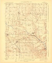
 1921 Buda1959 Print · USGSBureau County’s rail-and-water corridors are in full bloom in the 1920s, showing the intersection of heavy industry and small-town life. Trace family roots through dozens of local landmarks like the County Farm, Old Manlius Church, and the Illinois and Mississippi Canal.
 - 1923 Map of Buda
 1923 Buda1923 Print · USGSBureau County’s agricultural heartland is captured here in the 1920s, defined by its intensive network of railroads and the Illinois and Mississippi Canal. Genealogists and historians can locate scores of one-room schoolhouses like Hickory Grove School and family-named landmarks such as Cedar Bluff.2 unique versions available
 - 1958 Map of Aurora, 1969 Print
 1958 Aurora1969 Print · USGSNorthern Illinois in the late fifties shows a landscape of powerful river industry and expanding transport corridors. Genealogists and historians can trace the development of Aurora and Joliet or locate sites like the Elwood Ordnance Plant and Starved Rock.3 unique versions available
 - 1961 Map of Aurora
 1961 Aurora1961 Print · USGSNorthern Illinois at the height of the post-war era reveals a landscape of massive industrial works and thriving river towns. Genealogists and historians can trace the paths of the Lincoln Highway or locate long-standing landmarks like the Green River Ordnance Plant and Starved Rock State Park.
 - 1983 Map of Manlius, 1984 Print
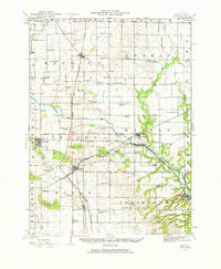
 1983 Manlius1984 Print · USGSThe agricultural plains of Bureau County come into sharp focus in the early eighties, centered on the rail-side settlement of Manlius. Researchers can trace old family burial grounds at Follett Cem or explore the historic waterworks of the Hennepin Canal.
 - 1985 Map of Kewanee
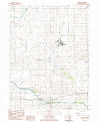
 1985 Kewanee1985 Print · USGSNorth-central Illinois in the mid-eighties shows a landscape of river-valley industry and prairie transit. Researchers can trace family roots through Evergreen Memory Garden or follow the historic Hennepin Canal past Tiskilwa and Wyanet.2 unique versions available
 - 2012 Map of Manlius, 2012 Print
 2012 Manlius2012 Print · USGSCovers Manlius, including Bureau County, United States, and other nearby areas
 - 2015 Map of Manlius, 2015 Print
 2015 Manlius2015 Print · USGSCovers Manlius, including Bureau County, United States, and other nearby areas
 - 2018 Map of Manlius, 2018 Print
 2018 Manlius2018 Print · USGSCovers Manlius, including Bureau County, United States, and other nearby areas
 - 2021 Map of Manlius, 2021 Print
 2021 Manlius2021 Print · USGSCovers Manlius, including Bureau County, United States, and other nearby areas
 - 2024 Map of Manlius, 2024 Print
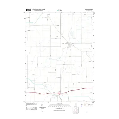
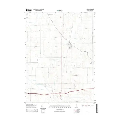
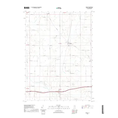
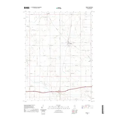
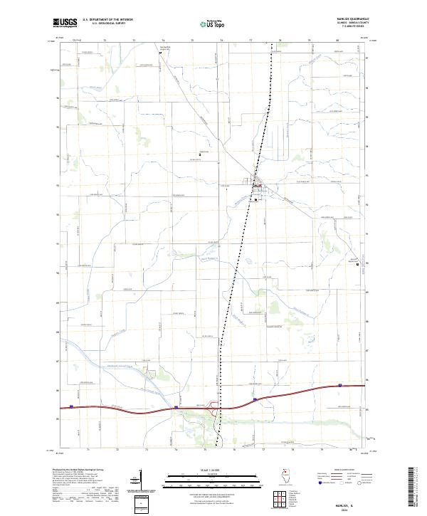 2024 Manlius2024 Print · USGSManlius and the surrounding Bureau County farmland are shown here in their contemporary layout, defined by a deep history of prairie drainage and agricultural settlement. Researchers can trace family roots at Manlius Cem, Follett Cem, or the Sand Hill Baptist Cem while following the courses of the Green River and Devils Slough Ditch.
End of results
Showing maps 1-11 of 11
Top cities near Manlius
- Kewanee historical maps
- Princeton historical maps
- Walnut historical maps
- Sheffield historical maps
- Annawan historical maps
- Wyanet historical maps
See more
Frequently asked questions
- What are the different types of historical maps available for Manlius?
- What is the oldest map of Manlius?
- Where can I purchase historical maps of Manlius for my home or office?
- Where can I download high-res historical maps of Manlius?
- Are there historical topographic maps available for Manlius?
- Is there historical aerial imagery available for Manlius?
- Where are historical maps of Manlius sourced from?