Old Maps of Mineral, Illinois for Academic Research
Study the evolution of Mineral with 11 high-resolution historic maps. Whether you're teaching, researching, or modeling changes in land use, these maps provide essential visual documentation of urban, environmental, and geographic change.
- Analyze long-term change: Track patterns in development, transportation, and natural features.
- Ideal for environmental or urban studies: Support academic projects with primary historical map data.
- Use in the classroom or lab: Educators and researchers rely on these maps to bring historical context to life.
These maps are a powerful tool for teaching, research, and visualizing how Mineral has changed over the decades.
Mineral, IL maps
(11)- 1929 Map of Annawan, 1966 Print
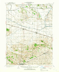 1929 Annawan1966 Print · USGSHenry and Bureau County life in the late 1920s was shaped by the engineering of the Illinois and Mississippi Canal and busy rail corridors. Researchers can trace dozens of rural schoolhouses and family sites like Brandenburg Corners, Kedron, and Francis Park.2 unique versions available
 - 1932 Map of Annawan
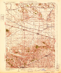 1932 Annawan1932 Print · USGSHenry and Bureau counties are captured here in the early thirties, showing a landscape shaped by the Illinois and Mississippi Canal. Genealogists can locate dozens of rural landmarks, from Brandenburg Corners to schools like Kuster Sch and Fairview Ch.
 - 1958 Map of Aurora, 1969 Print
 1958 Aurora1969 Print · USGSNorthern Illinois in the late fifties shows a landscape of powerful river industry and expanding transport corridors. Genealogists and historians can trace the development of Aurora and Joliet or locate sites like the Elwood Ordnance Plant and Starved Rock.3 unique versions available
 - 1961 Map of Aurora
 1961 Aurora1961 Print · USGSNorthern Illinois at the height of the post-war era reveals a landscape of massive industrial works and thriving river towns. Genealogists and historians can trace the paths of the Lincoln Highway or locate long-standing landmarks like the Green River Ordnance Plant and Starved Rock State Park.
 - 1983 Map of Mineral, 1984 Print
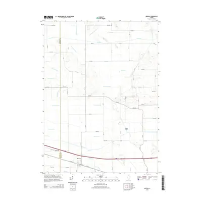
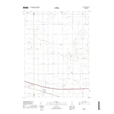
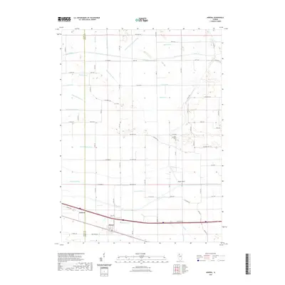
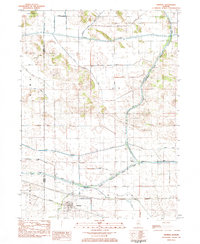 1983 Mineral1984 Print · USGSIn the early 1980s, the Illinois prairie around the Bureau and Henry county line was a landscape of rail-and-water commerce. Trace the path of the Iowa Railroad through Mineral or explore the historic infrastructure of Lock No 22 along the Hennepin Canal.
 - 1985 Map of Kewanee
 1985 Kewanee1985 Print · USGSNorth-central Illinois in the mid-eighties shows a landscape of river-valley industry and prairie transit. Researchers can trace family roots through Evergreen Memory Garden or follow the historic Hennepin Canal past Tiskilwa and Wyanet.2 unique versions available
 - 2012 Map of Mineral, 2012 Print
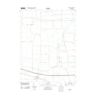 2012 Mineral2012 Print · USGSCovers Mineral, including Annawan, Henry County, and other nearby areas
 - 2015 Map of Mineral, 2015 Print
 2015 Mineral2015 Print · USGSCovers Mineral, including Annawan, Henry County, and other nearby areas
 - 2018 Map of Mineral, 2018 Print
 2018 Mineral2018 Print · USGSCovers Mineral, including Annawan, Henry County, and other nearby areas
 - 2021 Map of Mineral, 2021 Print
 2021 Mineral2021 Print · USGSCovers Mineral, including Annawan, Henry County, and other nearby areas
 - 2024 Map of Mineral, 2024 Print
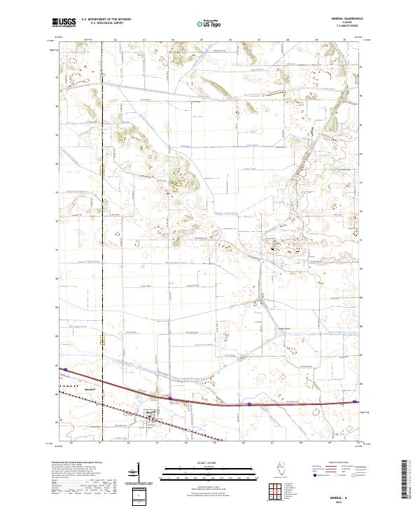 2024 Mineral2024 Print · USGSThe Henry and Bureau county borderlands come into focus in this contemporary survey of Illinois prairie and farmland. Genealogists and local researchers can locate Gold Township Cemetery and trace the complex waterway systems of Mineral Marsh Ditch and the Green River.
End of results
Showing maps 1-11 of 11
Top cities near Mineral
- Kewanee historical maps
- Galva historical maps
- Osceola historical maps
- Atkinson historical maps
- Sheffield historical maps
- Annawan historical maps
See more
Frequently asked questions
- What are the different types of historical maps available for Mineral?
- What is the oldest map of Mineral?
- Where can I purchase historical maps of Mineral for my home or office?
- Where can I download high-res historical maps of Mineral?
- Are there historical topographic maps available for Mineral?
- Is there historical aerial imagery available for Mineral?
- Where are historical maps of Mineral sourced from?