Old Maps of Birch Island, Illinois for Metal Detecting
Plan your next treasure hunt with 13 historic maps of Birch Island. Find old homesites, ghost towns, trails, and gathering spots that may be lost to time — perfect for identifying promising metal detecting locations.
- Locate forgotten sites: Uncover places like long-lost settlements, abandoned rail lines, or gathering spots.
- Plan better hunts: Use map overlays combined with LiDAR or satellite views to narrow in on historically rich areas.
- Made for detectorists: Thousands of hobbyists use these maps to discover relics, coins, and hidden history.
Use these historic maps to boost your research and find new opportunities beneath the surface of Birch Island.
Birch Island, IL maps
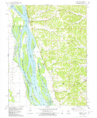
(13)- 1930 Map of Hardin
 1930 Hardin1930 Print · USGSCalhoun County's narrow peninsula is captured here between the two great rivers during the late Prohibition era. Genealogists and local researchers can locate numerous rural landmarks like Indian Creek Ch, Oases Ch, and a high concentration of schoolhouses including South Lincoln Sch.2 unique versions available
 - 1934 Map of Hardin, 1956 Print
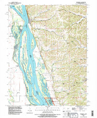
 1934 Hardin1956 Print · USGSThe river bluffs of Calhoun and Greene counties come alive in this mid-1930s survey of the Mississippi River and Illinois River valleys. Genealogists can trace family roots through numerous rural landmarks like Indian Creek Ch, St Andrew Ch, and the Pecan Grove Sch.2 unique versions available
 - 1938 Map of Hardin
 1938 Hardin1938 Print · USGSThe river-bound peninsula of Calhoun County is shown here in the 1930s, caught between the shifting chutes of the Mississippi and the Illinois rivers. Genealogists can trace family roots through numerous rural landmarks like Gilead Cemetery, the Poor Farm, and small communities such as Batchtown and Hamburg.2 unique versions available
 - 1948 Map of Quincy
 1948 Quincy1948 Print · USGSThe Mississippi and Illinois River valleys are captured at a post-war crossroads as rail and river travel met the expanding highway system. Genealogists can trace family settlements from Quincy to Hannibal and smaller towns like Vandalia and Jerseyville.2 unique versions available
 - 1956 Map of Quincy, 1967 Print
 1956 Quincy1967 Print · USGSThe river and rail corridors of the Illinois-Missouri border are documented here during the mid-1950s. Researchers can trace historic river landings and regional transit hubs from Quincy and Hannibal to smaller settlements like Meredosia and Roodhouse.3 unique versions available
 - 1978 Map of Hamburg
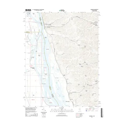
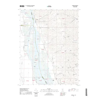
 1978 Hamburg1978 Print · USGSThe Illinois-Missouri borderlands along the Mississippi come into focus during the late seventies, showing the river’s complex channel and the steep bluff country. Trace historical river crossings at Hamburg Ferry and explore local landmarks like Indian Creek Ch and Sugar Loaf.
 - 1985 Map of Jerseyville
 1985 Jerseyville1985 Print · USGSThe confluence of the Illinois and Mississippi rivers defines this 1980s landscape of fertile bottomlands and rail-hub towns. Genealogists and historians can trace the foundations of communities like Jerseyville and White Hall alongside the Oak Grove Cem and St Mary Church.2 unique versions available
 - 1993 Map of Hamburg, 1996 Print
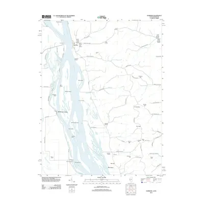
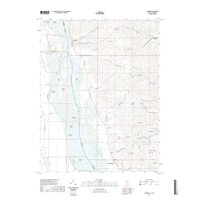
 1993 Hamburg1996 Print · USGSThe Mississippi River valley and the bluffs of Calhoun County are captured here in the 1990s as a landscape of rural hamlets and complex wetlands. Researchers can locate remote family burial grounds like Mt Hope Cem and trace historic river access points such as Old Westport Landing or Norton Woods Public Access.
 - 2012 Map of Hamburg, 2012 Print
 2012 Hamburg2012 Print · USGSCovers Birch Island, including Hardin, Hamburg, and other nearby areas
 - 2015 Map of Hamburg, 2015 Print
 2015 Hamburg2015 Print · USGSCovers Birch Island, including Hardin, Hamburg, and other nearby areas
 - 2018 Map of Hamburg, 2018 Print
 2018 Hamburg2018 Print · USGSCovers Birch Island, including Hardin, Hamburg, and other nearby areas
 - 2021 Map of Hamburg, 2021 Print
 2021 Hamburg2021 Print · USGSCovers Birch Island, including Hardin, Hamburg, and other nearby areas
 - 2024 Map of Hamburg, 2024 Print
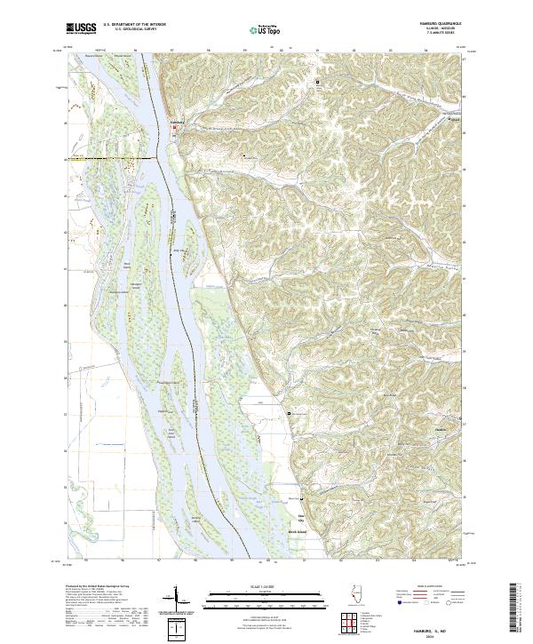 2024 Hamburg2024 Print · USGSCalhoun County's river-driven landscape is on full display in this 2024 survey of the Illinois-Missouri border. Local historians can trace family plots at Oak Grove Cem and Gresham Cem or explore the shifting island geography of Westport Island and Kickapoo Island.
End of results
Showing maps 1-13 of 13
Top cities near Birch Island
- Elsberry historical maps
- Moscow Mills historical maps
- Hardin historical maps
- Winfield historical maps
- Grafton historical maps
- Rosedale historical maps
See more
Frequently asked questions
- What are the different types of historical maps available for Birch Island?
- What is the oldest map of Birch Island?
- Where can I purchase historical maps of Birch Island for my home or office?
- Where can I download high-res historical maps of Birch Island?
- Are there historical topographic maps available for Birch Island?
- Is there historical aerial imagery available for Birch Island?
- Where are historical maps of Birch Island sourced from?