Old Maps of Tolono, Illinois
Explore 36 old maps of Tolono, spanning from 1907 to today. These high-resolution historic maps reveal how streets, neighborhoods, landmarks, and natural features evolved over time — perfect for genealogy, metal detecting, research, and local history exploration.
What you can do with these maps:
- See how Tolono changed over time: Compare historical maps to modern-day views to trace roads, homesites, rail lines & more.
- View detailed metadata: Each map includes creators, publishers, year, scale, and archive source.
- Overlay maps with satellite & LiDAR: Visualize the past alongside modern tools to explore terrain & human change.
- Trusted historical sources: Maps sourced from the USGS, Library of Congress, and other archives.
- Access maps your way: View online, download high-res files, or order prints for personal or research use.
Start exploring old maps of Tolono to uncover forgotten places, hidden landmarks, and the deep history beneath your feet.
Tolono, IL maps
(36)- 1907 Map of Mahomet
 1907 Mahomet1907 Print · USGSChampaign County at the peak of the rail era shows a landscape of burgeoning prairie towns and rural schools. Genealogists and historians can trace family locations near Mahomet, find the precise sites of Bunker Hill School and Fisher School, or follow the Sangamon River.5 unique versions available
 - 1950 Map of Tuscola, 1952 Print
 1950 Tuscola1952 Print · USGSMid-century Douglas and Champaign Counties are mapped here at a time when the rural school system was fading into history. Genealogists can trace family roots through numerous markers like Stewart Sch, Macedonia Ch, and Bailey Memorial Cem.4 unique versions available
 - 1956 Map of Villa Grove, 1957 Print
 1956 Villa Grove1957 Print · USGSVilla Grove and the rural townships of Douglas and Champaign Counties are shown in the mid-1950s, a period defined by small-town rail commerce and fertile prairie farmland. Genealogists can locate family landmarks like Patterson Springs, Lynn Grove Cem, and St Mary Sch.2 unique versions available
 - 1957 Map of Mahomet, 1958 Print
 1957 Mahomet1958 Print · USGSChampaign and its rural neighbors are captured in the late fifties as the city expanded westward toward the Sangamon River. Local researchers can trace family landmarks like Dunkard Cem, the St John Chi, and the University of Illinois Airport.2 unique versions available
 - 1957 Map of Bondville, 1958 Print
 1957 Bondville1958 Print · USGSChampaign and its western neighbors are captured in the late 1950s as suburban expansion meets rural prairie. Genealogists and historians can trace defunct landmarks like South Prairie School or the early layout of the University of Illinois Airport.
 - 1958 Map of Peoria, 1969 Print
 1958 Peoria1969 Print · USGSCentral Illinois thrived as a hub of education and transport during the late sixties, as the new interstate system began to reshape the prairie. Genealogists and historians can trace local landmarks like Springdale Cem, Bradley University, and the sprawling grounds of Chanute AFB.4 unique versions available
 - 1958 Map of Decatur, 1971 Print
 1958 Decatur1971 Print · USGSCentral Illinois in the mid-twentieth century shows a landscape defined by industrial rail hubs and the creation of large reservoirs. Researchers can trace historic corridors like the Penn Central or locate landmarks such as Lincoln Log Cabin State Park and Lake Springfield.3 unique versions available
 - 1961 Map of Peoria
 1961 Peoria1961 Print · USGSCentral Illinois thrived at the intersection of river trade and rail power during the late fifties. Genealogists and local historians can trace the rail networks of the Illinois Central and Wabash, alongside landmarks like Chanute AFB and Weldon Springs State Park.
 - 1961 Map of Decatur
 1961 Decatur1961 Print · USGSCentral Illinois in the late fifties was a bustling corridor of rail lines and prairie commerce centered on the state capital. Genealogists and historians can trace the intricate connections between Springfield, Decatur, and dozens of smaller settlements like Nokomis and Arcola.2 unique versions available
 - 1963 Map of Peoria
 1963 Peoria1963 Print · USGSCentral Illinois thrived as a rail and highway crossroads during the early sixties, centered on the bustling Illinois River valley. Genealogists and historians can trace the mid-century layout of Peoria, locate the grounds of Chanute Air Force Base, and follow historic lines like the Toledo Peoria and Western Railway.
 - 1970 Map of Bondville, 1972 Print
 1970 Bondville1972 Print · USGSChampaign and its western fringes reached a pivotal stage of growth in the early seventies, as residential grids began to meet the surrounding prairie. Genealogists and researchers can trace the locations of Prairieview Cem, local schools like Howard Sch, and the expansion of the University of Illinois-Willard Airport.2 unique versions available
 - 1975 Map of Bondville, 1976 Print
 1975 Bondville1976 Print · USGSChampaign and Savoy expanded rapidly during the mid-seventies, pushing new subdivisions and schools into former farmland. Genealogists and local historians can trace family-named sites and vanished rural features like Prairieview Cem, Staley, and the early layout of University of Illinois-Willard Airport.
 - 1975 Map of Tuscola NE, 1977 Print
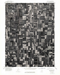 1975 Tuscola NE1977 Print · USGSChampaign County at the mid-point of the 1970s is shown in this detailed aerial perspective of its agricultural and rail landscape. Genealogists and local historians can trace farmstead footprints and the street grids of Tolono, Sadorus, and Pesotum.
 - 1982 Map of Villa Grove NW, 1983 Print
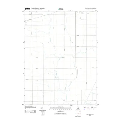
 1982 Villa Grove NW1983 Print · USGSThe Champaign and Douglas County line comes alive in the early eighties as the local rail-and-river economy persists. Trace family roots and rural landmarks from Jessee Cem to the tracks of the Norfolk and Western in Philo and Tolono.
 - 1983 Map of Tolono
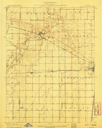
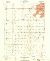
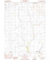
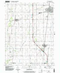
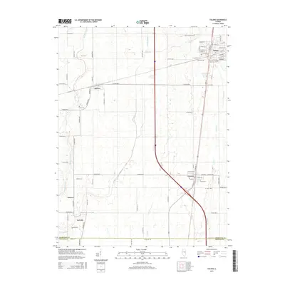
 1983 Tolono1983 Print · USGSChampaign County prairie life centered on the rail junctions of Tolono and Sadorus in the early 1980s. Genealogists can trace numerous local burial grounds including Rock Cem and Nelson Cem while exploring the rural reaches of Grange (Jimtown).
 - 1985 Map of Decatur
 1985 Decatur1985 Print · USGSCentral Illinois farming and rail hubs thrive in the mid-1980s as Decatur anchors a sprawling network of track and timber. Trace the paths of the Sangamon River and the Illinois Central Gulf RR through old towns like Cerro Gordo and Bement.2 unique versions available
 - 1985 Map of Champaign, 1986 Print
 1985 Champaign1986 Print · USGSThe Illinois prairie comes alive in this mid-eighties survey of the vital rail corridor between Bloomington and Champaign. Genealogists and historians can trace the development of township hubs like Saybrook and Bellflower or locate Chanute Air Force Base and the Sangamon River.2 unique versions available
 - 1990 Map of Peoria
 1990 Peoria1990 Print · USGSCentral Illinois at the start of the nineties reveals a landscape of industrial river towns and sprawling university campuses. Researchers can trace the legacy of major institutions like Chanute Air Force Base and the University of Illinois alongside regional landmarks such as Sand Ridge State Forest.
 - 1998 Map of Bondville, 2001 Print
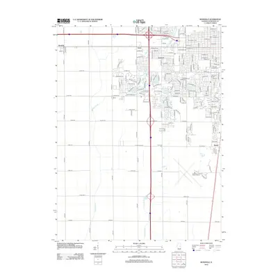
 1998 Bondville2001 Print · USGSThe western suburbs of Champaign and the village of Bondville are captured in the late nineties as the urban fringe met the prairie. Trace the development of Willard Airport and find local landmarks like Prairieview Cem and Kenwood Sch.
 - 1998 Map of Villa Grove NW, 2003 Print
 1998 Villa Grove NW2003 Print · USGSChampaign County at the close of the twentieth century reveals a highly organized agricultural landscape shaped by the Embarras River. Researchers can trace local heritage through sites like Jessee Cem, St Mary Sch, and the Townhall in Crittenden.
 - 1998 Map of Tolono, 2003 Print
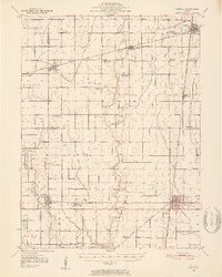
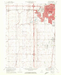
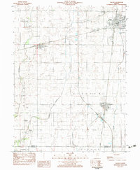
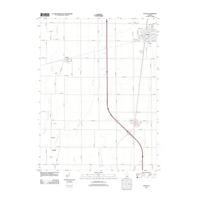
 1998 Tolono2003 Print · USGSChampaign County prairie life is centered on the railway and road corridors of the late twentieth century. Genealogists and local historians can trace family ties through several rural burial grounds, including Rock Cem, Sadorus Cem, and St Marys Cem.
 - 2012 Map of Tolono, 2012 Print
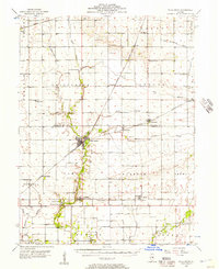
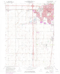
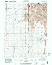
 2012 Tolono2012 Print · USGSCovers Tolono, including Pesotum, Sadorus, and other nearby areas
 - 2012 Map of Villa Grove NW, 2012 Print
 2012 Villa Grove NW2012 Print · USGSCovers Tolono, including Villa Grove, Philo, and other nearby areas
 - 2012 Map of Bondville, 2012 Print
 2012 Bondville2012 Print · USGSCovers Tolono, including Champaign, Savoy, and other nearby areas
 - 2015 Map of Tolono, 2015 Print
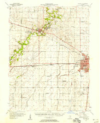
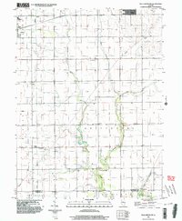
 2015 Tolono2015 Print · USGSCovers Tolono, including Pesotum, Sadorus, and other nearby areas
Showing maps 1-25 of 36
Top cities near Tolono
- Champaign historical maps
- Urbana historical maps
- Mahomet historical maps
- Savoy historical maps
- Tuscola historical maps
- Villa Grove historical maps
See more
Frequently asked questions
- What are the different types of historical maps available for Tolono?
- What is the oldest map of Tolono?
- Where can I purchase historical maps of Tolono for my home or office?
- Where can I download high-res historical maps of Tolono?
- Are there historical topographic maps available for Tolono?
- Is there historical aerial imagery available for Tolono?
- Where are historical maps of Tolono sourced from?