
1907 Map of Mahomet
USGS Topo · Published 1907About this map
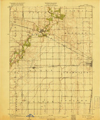
The Sangamon River meanders through the heart of this central Illinois landscape, while the headwaters of the Kaskaskia River emerge in the south, illustrating the drainage divide between these major regional waterways. Surveyed just after the turn of the century, the map reveals a dense agricultural grid punctuated by small railroad settlements and rural institutions. The Peoria and Eastern Division rail line cuts diagonally across the prairie, connecting Mahomet to the western edge of Champaign. Local social centers are captured at a granular level, from the Bunker Hill School and Fisher School to family-named landmarks like Blue Mound. The convergence of multiple rail lines, including the Wabash RR and the Illinois Central RR, underscores the importance of the steam-era transit network in facilitating the grain trade for townships like Scott and Hensley.
Find a feature on this map
34 named features on this map. Tap any name to fly to it.
Don’t see what you’re looking for? This feature index may not catch every label — zoom into the map to look around manually.
Map Details
Editions of this 1907 Mahomet Map
5 editions found
Other maps of this area

1906 · Urbana
USGS Topo · 1:62,500

1924 · Paxton
USGS Topo · 1:62,500

1927 · Paxton
USGS Topo · 1:62,500

1928 · Gibson City
USGS Topo · 1:62,500

1937 · Monticello
USGS Topo · 1:48,000

1943 · Monticello
USGS Topo · 1:62,500

1949 · Paxton
USGS Topo · 1:62,500

1950 · Tuscola
USGS Topo · 1:62,500

1952 · Arrowsmith
USGS Topo · 1:62,500

1955 · Bement
USGS Topo · 1:62,500