Old Maps of Champaign County, Illinois
Explore 202 old maps of Champaign County, spanning from 1906 to today. These high-resolution historic maps reveal how streets, neighborhoods, landmarks, and natural features evolved over time — perfect for genealogy, metal detecting, research, and local history exploration.
What you can do with these maps:
- See how Champaign County changed over time: Compare historical maps to modern-day views to trace roads, homesites, rail lines & more.
- View detailed metadata: Each map includes creators, publishers, year, scale, and archive source.
- Overlay maps with satellite & LiDAR: Visualize the past alongside modern tools to explore terrain & human change.
- Trusted historical sources: Maps sourced from the USGS, Library of Congress, and other archives.
- Access maps your way: View online, download high-res files, or order prints for personal or research use.
Start exploring old maps of Champaign County to uncover forgotten places, hidden landmarks, and the deep history beneath your feet.
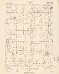
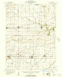
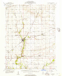
Champaign County, IL maps
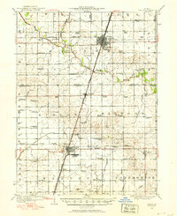
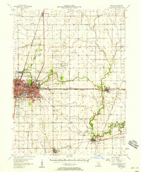
(202)- 1906 Map of Urbana
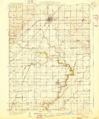
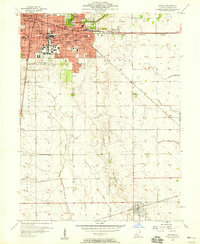
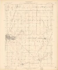 1906 Urbana1906 Print · USGSChampaign County at the turn of the century is a landscape of thriving railroad towns and prairie farmsteads. Trace the early growth of Champaign and Urbana or find the sites of vanished rural stops like Mayview, Glover, and Angerville.7 unique versions available
 - 1907 Map of Mahomet
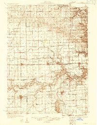
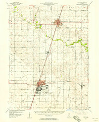
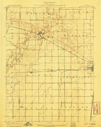 1907 Mahomet1907 Print · USGSChampaign County at the peak of the rail era shows a landscape of burgeoning prairie towns and rural schools. Genealogists and historians can trace family locations near Mahomet, find the precise sites of Bunker Hill School and Fisher School, or follow the Sangamon River.5 unique versions available
 - 1924 Map of Paxton, 1953 Print
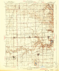
 1924 Paxton1953 Print · USGSEast-central Illinois comes into focus during the mid-twenties as the rail lines and early airfields transformed the prairie. Researchers can locate dozens of family-named schools like Lily Dell School and trace the original layout of Chanute Flying Field.
 - 1927 Map of Paxton
 1927 Paxton1927 Print · USGSIllinois prairie life in the mid-twenties is captured here through a dense network of township schools and the rise of military aviation. Genealogists and local historians can trace family locations near Chanute Flying Field or find long-standing rural landmarks like Lily Dell School and Glen Cemetery.2 unique versions available
 - 1928 Map of Gibson City
 1928 Gibson City1928 Print · USGSCentral Illinois farming life is captured here in the late 1920s, dominated by the major rail junction at Gibson City. Genealogists can locate dozens of country schools like Scotland School and Caledonia School along the Sangamon River.2 unique versions available
 - 1931 Map of Fithian
 1931 Fithian1931 Print · USGSVermilion County and its neighboring townships thrive in the early 1930s as a hub of rail travel and rural education. Genealogists can trace hundreds of family sites near Knights Branch Cem, Fowler Sch, and the busy rail yards of Homer.
 - 1936 Map of Potomac
 1936 Potomac1936 Print · USGSThe rural prairie of Vermilion County thrives as a rail-and-river economy during the mid-1930s. Researchers can trace dozens of country schools and family-named landmarks like St Lawrence Ch, Rankin Union Cem, and river crossings at Bass Ford.3 unique versions available
 - 1943 Map of Fithian
 1943 Fithian1943 Print · USGSVermilion and Champaign counties come alive in the 1940s as a hub of rail travel and small-town commerce. Genealogists and historians can trace the foundations of Fithian, Fairmount, and Homer while locating rural landmarks like Little Giant Sch and Stearns Cem.2 unique versions available
 - 1949 Map of Paxton
 1949 Paxton1949 Print · USGSCentral Illinois thrived as a rail and military corridor in the mid-1920s, anchored by the crossroads of two major rail lines. Researchers can trace the early footprint of Chanute Flying Field and locate dozens of vanished rural schoolhouses like Trickel Grove School and Farmersville School.
 - 1950 Map of Tuscola, 1952 Print
 1950 Tuscola1952 Print · USGSMid-century Douglas and Champaign Counties are mapped here at a time when the rural school system was fading into history. Genealogists can trace family roots through numerous markers like Stewart Sch, Macedonia Ch, and Bailey Memorial Cem.4 unique versions available
 - 1953 Map of Danville, 1965 Print
 1953 Danville1965 Print · USGSIndiana and Illinois crossroads come to life in this mid-century survey as the interstate era begins to reshape the river-and-rail landscape. Genealogists and collectors can trace the historic paths of the Nickel Plate railroad or locate smaller communities like Veedersburg, Goodland, and Bismarck.3 unique versions available
 - 1953 Map of Indianapolis, 1965 Print
 1953 Indianapolis1965 Print · USGSCentral Indiana and the Illinois borderlands are captured in the mid-sixties, showing the growth of Indianapolis and its industrial rail corridors. Genealogists and historians can trace the development of outlying towns like Zionsville or Beech Grove and find landmarks such as Atterbury AAF and Turkey Run State Park.4 unique versions available
 - 1955 Map of Danville
 1955 Danville1955 Print · USGSThe Indiana-Illinois borderlands during the mid-fifties reveal a landscape of thriving rail hubs and university towns. Researchers can trace the legacy of Purdue University, the Tippecanoe Battlefield, and the path of the Pennsylvania RR.
 - 1956 Map of Danville
 1956 Danville1956 Print · USGSMid-century Indiana and Illinois are captured here as the river-and-rail economy evolved into the modern highway era. Researchers can trace ancestral roots and old transport lines through Logansport, Battle Ground, and the dams at Lake Shafer.
 - 1956 Map of Indianapolis
 1956 Indianapolis1956 Print · USGSCentral Indiana in the mid-fifties is captured during a period of industrial growth and military presence. Genealogists and historians can trace the rail networks of the New York Central or locate regional landmarks like Fort Benjamin Harrison and Camp Atterbury.
 - 1956 Map of Newman, 1957 Print
 1956 Newman1957 Print · USGSThe borderlands of Champaign and Douglas counties are seen here in the mid-fifties, when small-town rail depots still served as the region's heartbeat. Genealogists can trace family names through rural landmarks like Stutler Cem, Fairfield Ch, and the small community of Maizetown.2 unique versions available
 - 1956 Map of Villa Grove, 1957 Print
 1956 Villa Grove1957 Print · USGSVilla Grove and the rural townships of Douglas and Champaign Counties are shown in the mid-1950s, a period defined by small-town rail commerce and fertile prairie farmland. Genealogists can locate family landmarks like Patterson Springs, Lynn Grove Cem, and St Mary Sch.2 unique versions available
 - 1957 Map of Indianapolis
 1957 Indianapolis1957 Print · USGSCentral Indiana in the mid-fifties is captured here as a crossroads of major rail lines and nascent federal highways. Genealogists and historians can trace family-named ridges like Poplar Ridge or locate strategic sites like Camp Atterbury and Speedway.2 unique versions available
 - 1957 Map of Urbana, 1958 Print
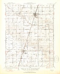
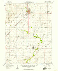
 1957 Urbana1958 Print · USGSCentral Illinois during the late fifties reveals the mid-century growth of the twin cities and their surrounding rail towns. Genealogists can locate family landmarks like Mt Olive Cem, Carley Ch, and the rural Locust Grove Sch.2 unique versions available
 - 1957 Map of Paxton, 1958 Print
 1957 Paxton1958 Print · USGSPost-war central Illinois thrives along the rail lines and at Chanute Air Force Base. Researchers can trace family roots at St Alfreds Chapel or locate several abandoned country schools like Moffett Sch (Abandoned).2 unique versions available
 - 1957 Map of Gibson City, 1958 Print
 1957 Gibson City1958 Print · USGSMid-century Ford and Champaign Counties are mapped here at the height of the railroad era. Genealogists can trace family names through landmarks like Walker Ch, Oregon Cem, and several schoolhouses like the Mounts Sch or the Blackford Sch.2 unique versions available
 - 1957 Map of Fithian, 1958 Print
 1957 Fithian1958 Print · USGSVermilion and Champaign counties come alive in the late fifties as a network of rail-side towns and river bends. Genealogists and historians can locate long-standing landmarks like Belgium Row, Corner Chapel, and the Township High Sch near the Salt Fork.3 unique versions available
 - 1957 Map of Urbana, 1958 Print
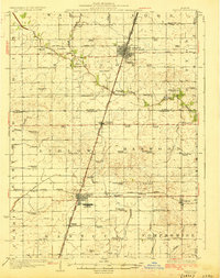
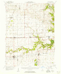
 1957 Urbana1958 Print · USGSThe twin cities of Champaign and Urbana are captured here in the late fifties, showing a dense network of university buildings, hospitals, and rail lines. Genealogists and local historians can trace legacy sites like Mt Hope Cemetery, Silver Sch, and the village of Philo.2 unique versions available
 - 1957 Map of Rising, 1958 Print
 1957 Rising1958 Print · USGSChampaign and its rural northern townships are shown here during the mid-century transition from family farming to suburban growth. Genealogists and local historians can trace rural landmarks like Phillippe Cem, the tiny settlement of Rising, and early residential plats near Switzer Sch.
 - 1957 Map of Mahomet, 1958 Print
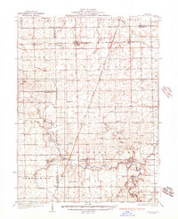
 1957 Mahomet1958 Print · USGSChampaign and its rural neighbors are captured in the late fifties as the city expanded westward toward the Sangamon River. Local researchers can trace family landmarks like Dunkard Cem, the St John Chi, and the University of Illinois Airport.2 unique versions available
Showing maps 1-25 of 202
Top cities of Champaign County
- Champaign historical maps
- Urbana historical maps
- Rantoul historical maps
- Mahomet historical maps
- Savoy historical maps
- Tolono historical maps
See more
Frequently asked questions
- What are the different types of historical maps available for Champaign County?
- What is the oldest map of Champaign County?
- Where can I purchase historical maps of Champaign County for my home or office?
- Where can I download high-res historical maps of Champaign County?
- Are there historical topographic maps available for Champaign County?
- Is there historical aerial imagery available for Champaign County?
- Where are historical maps of Champaign County sourced from?