1980s Maps of Champaign County, Illinois
Explore 20 historic maps of Champaign County from the 1980s. These maps offer a rare glimpse into what life looked like during the 1980s — showing old roads, neighborhoods, homes, and landmarks that have changed or disappeared over time.
Whether you're researching your family's past, planning a metal detecting trip, or studying how Champaign County's landscape evolved across the 1980s, these high-resolution maps are a powerful tool for exploring the history of this region.
- Focus on a specific era: All maps on this page are from the 1980s, giving you a focused view of this time period.
- See what’s changed: Compare century-old streets, trails, and buildings to today's modern landscape using overlays and satellite layers.
- Research with precision: Use these maps for genealogy, historical research, land use analysis, or educational projects.
- View, download, or print: Maps are fully viewable online in high resolution, and can be downloaded or printed for your own records.
Start exploring Champaign County's history through authentic maps from the 1980s. This is your window into the past.
Champaign County, IL maps
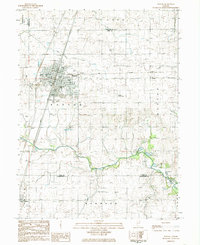
(20)- 1982 Map of Villa Grove NW, 1983 Print
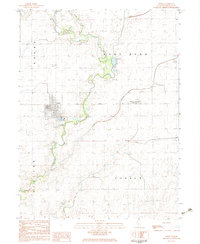
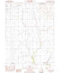 1982 Villa Grove NW1983 Print · USGSThe Champaign and Douglas County line comes alive in the early eighties as the local rail-and-river economy persists. Trace family roots and rural landmarks from Jessee Cem to the tracks of the Norfolk and Western in Philo and Tolono.
 - 1982 Map of Longview, 1983 Print
 1982 Longview1983 Print · USGSChampaign and Douglas Counties in the early eighties show a landscape of productive prairie farmland and tight-knit rail towns. Researchers can trace family history through local sites like Immaculate Conception Ch, St John Cem, and the village of Longview.
 - 1982 Map of Gibson City West, 1983 Print
 1982 Gibson City West1983 Print · USGSFord County farmland and the rail hub of Gibson City are documented here in the early 1980s. Researchers can locate specific local landmarks like Township Cem, the old Drive-in Theater, and the rural sidings at Harpster.
 - 1982 Map of Allerton, 1983 Print
 1982 Allerton1983 Print · USGSAllerton and the surrounding prairie were surveyed in the early eighties as the railroad still connected the agricultural hubs of Vermilion and Champaign counties. Researchers can locate the small settlement of Hastings, the Sch No 6 schoolhouse, and the quiet Lost Grove Cem.
 - 1983 Map of Fisher
 1983 Fisher1983 Print · USGSChampaign County farming communities thrive along the Sangamon River and the Illinois Central Gulf rail line in the early 1980s. Genealogists and local historians can locate several family burial grounds, including Beekman Cem and Knife Cem, alongside the village of Fisher.
 - 1983 Map of Gibson City East
 1983 Gibson City East1983 Print · USGSFord County farmland and the rail crossroads at Gibson City are captured here in the early eighties. Genealogists can locate family sites like Oregon Cem, Pontoppidan Ch, and the village of Elliott along the Norfolk and Western line.
 - 1983 Map of Ivesdale
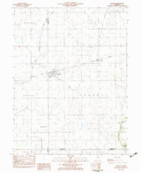 1983 Ivesdale1983 Print · USGSThe village of Ivesdale straddles the county line in the early 1980s, serving as a focal point for the surrounding prairie farmland. Researchers can trace the path of the Norfolk and Western railroad and locate rural landmarks like St Joseph Cem and Sloan Station.
 - 1983 Map of Tolono
 1983 Tolono1983 Print · USGSChampaign County prairie life centered on the rail junctions of Tolono and Sadorus in the early 1980s. Genealogists can trace numerous local burial grounds including Rock Cem and Nelson Cem while exploring the rural reaches of Grange (Jimtown).
 - 1984 Map of Paxton, 1985 Print
 1984 Paxton1985 Print · USGSIn the mid-1980s, the Illinois prairie around Paxton remained a critical rail junction and agricultural center. Family historians can locate several rural burial grounds including Trickle Grove Cem and Webber Cem, or trace the course of the Middle Fork Vermilion River.
 - 1984 Map of Danville, 1985 Print
 1984 Danville1985 Print · USGSEastern Illinois and western Indiana meet here in the mid-1980s, centered on the river forks and rail lines surrounding the industrial hub of Danville. Researchers can trace old transport routes and rural landmarks like Rossville Junction, Hope Ch, and the Univ of Ill Radio Telescope.
 - 1984 Map of Perdueville, 1985 Print
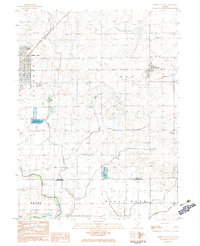
 1984 Perdueville1985 Print · USGSThe rural border of Ford and Champaign Counties comes into focus in the mid-1980s, showcasing an era of active rail transit and prairie drainage. Genealogists can locate family landmarks like Meharry Cem and Foster Cemetery near the tracks of the Norfolk and Western railroad.
 - 1984 Map of Penfield, 1985 Print
 1984 Penfield1985 Print · USGSNear the Vermilion and Champaign county line in the 1980s, this landscape is defined by the winding Middle Fork Vermilion River and quiet farming hamlets. Researchers can trace family history at Tomlinson Cem and Partlow Cem, or locate landmarks in Penfield and Armstrong.
 - 1984 Map of Rankin, 1985 Print
 1984 Rankin1985 Print · USGSRankin and its surrounding prairie townships are captured here in the mid-1980s. Local historians can trace the rail corridor through Clarence and locate rural landmarks such as Pleasant Grove Ch, Pellville Cem, and the Middle Fork Vermilion River.
 - 1984 Map of Rantoul, 1985 Print
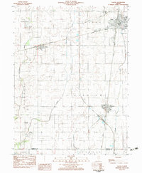
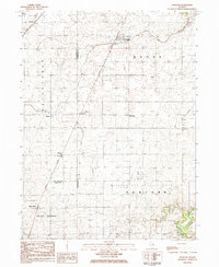
 1984 Rantoul1985 Print · USGSChampaign County in the mid-eighties centers on the expanding village of Rantoul and the active operations at Chanute Air Force Base. Researchers can trace old property lines near Ludlow Cem or follow the Illinois Central Gulf rail line past Thomasboro.
 - 1984 Map of Foosland, 1985 Print
 1984 Foosland1985 Print · USGSThe rural borderlands of Champaign and McLean counties come alive in the 1980s as a hub for rail transport and resource management. Genealogists and local historians can trace small prairie settlements like Lotus, Osman, and Dickerson, or locate family sites at Shiloh Cem and Naylor Cem.
 - 1984 Map of Gifford, 1985 Print
 1984 Gifford1985 Print · USGSChampaign County prairie life and the proximity of the airfield define this area during the mid-1980s. Researchers can trace the layout of Gifford and Dillsburg, locate the Holy Sepulchre Cem, or follow the course of the Spoon River.
 - 1985 Map of Decatur
 1985 Decatur1985 Print · USGSCentral Illinois farming and rail hubs thrive in the mid-1980s as Decatur anchors a sprawling network of track and timber. Trace the paths of the Sangamon River and the Illinois Central Gulf RR through old towns like Cerro Gordo and Bement.2 unique versions available
 - 1985 Map of Champaign, 1986 Print
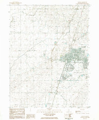
 1985 Champaign1986 Print · USGSThe Illinois prairie comes alive in this mid-eighties survey of the vital rail corridor between Bloomington and Champaign. Genealogists and historians can trace the development of township hubs like Saybrook and Bellflower or locate Chanute Air Force Base and the Sangamon River.2 unique versions available
 - 1986 Map of Paris
 1986 Paris1986 Print · USGSThe Illinois-Indiana borderlands thrive in the mid-1980s as a hub of river-side industry and fertile farmland. Genealogists and historians can trace rail-centered settlements like Chrisman and Metcalf, or locate family sites at the Quaker Cem and Bethel Ch.2 unique versions available
 - 1987 Map of Danville, 1994 Print
 1987 Danville1994 Print · USGSThe Illinois-Indiana borderlands thrived in the 1980s as a crossroads of rail commerce and river-fed agriculture. Genealogists and historians can trace the foundations of Danville and Covington while locating landmarks like Spring Hill Cemetery or the Vermilion County Courthouse.
End of results
Showing maps 1-20 of 20
Top cities of Champaign County
- Champaign historical maps
- Urbana historical maps
- Rantoul historical maps
- Mahomet historical maps
- Savoy historical maps
- Tolono historical maps
See more
Frequently asked questions
- What are the different types of historical maps available for Champaign County?
- What is the oldest map of Champaign County?
- Where can I purchase historical maps of Champaign County for my home or office?
- Where can I download high-res historical maps of Champaign County?
- Are there historical topographic maps available for Champaign County?
- Is there historical aerial imagery available for Champaign County?
- Where are historical maps of Champaign County sourced from?