1950s Maps of Champaign County, Illinois
Explore 21 historic maps of Champaign County from the 1950s. These maps offer a rare glimpse into what life looked like during the 1950s — showing old roads, neighborhoods, homes, and landmarks that have changed or disappeared over time.
Whether you're researching your family's past, planning a metal detecting trip, or studying how Champaign County's landscape evolved across the 1950s, these high-resolution maps are a powerful tool for exploring the history of this region.
- Focus on a specific era: All maps on this page are from the 1950s, giving you a focused view of this time period.
- See what’s changed: Compare century-old streets, trails, and buildings to today's modern landscape using overlays and satellite layers.
- Research with precision: Use these maps for genealogy, historical research, land use analysis, or educational projects.
- View, download, or print: Maps are fully viewable online in high resolution, and can be downloaded or printed for your own records.
Start exploring Champaign County's history through authentic maps from the 1950s. This is your window into the past.
Champaign County, IL maps
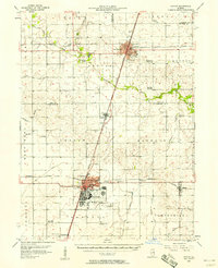
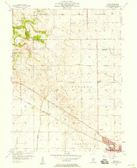
(21)- 1950 Map of Tuscola, 1952 Print
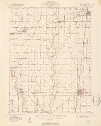 1950 Tuscola1952 Print · USGSMid-century Douglas and Champaign Counties are mapped here at a time when the rural school system was fading into history. Genealogists can trace family roots through numerous markers like Stewart Sch, Macedonia Ch, and Bailey Memorial Cem.4 unique versions available
 - 1953 Map of Danville, 1965 Print
 1953 Danville1965 Print · USGSIndiana and Illinois crossroads come to life in this mid-century survey as the interstate era begins to reshape the river-and-rail landscape. Genealogists and collectors can trace the historic paths of the Nickel Plate railroad or locate smaller communities like Veedersburg, Goodland, and Bismarck.3 unique versions available
 - 1953 Map of Indianapolis, 1965 Print
 1953 Indianapolis1965 Print · USGSCentral Indiana and the Illinois borderlands are captured in the mid-sixties, showing the growth of Indianapolis and its industrial rail corridors. Genealogists and historians can trace the development of outlying towns like Zionsville or Beech Grove and find landmarks such as Atterbury AAF and Turkey Run State Park.4 unique versions available
 - 1955 Map of Danville
 1955 Danville1955 Print · USGSThe Indiana-Illinois borderlands during the mid-fifties reveal a landscape of thriving rail hubs and university towns. Researchers can trace the legacy of Purdue University, the Tippecanoe Battlefield, and the path of the Pennsylvania RR.
 - 1956 Map of Danville
 1956 Danville1956 Print · USGSMid-century Indiana and Illinois are captured here as the river-and-rail economy evolved into the modern highway era. Researchers can trace ancestral roots and old transport lines through Logansport, Battle Ground, and the dams at Lake Shafer.
 - 1956 Map of Indianapolis
 1956 Indianapolis1956 Print · USGSCentral Indiana in the mid-fifties is captured during a period of industrial growth and military presence. Genealogists and historians can trace the rail networks of the New York Central or locate regional landmarks like Fort Benjamin Harrison and Camp Atterbury.
 - 1956 Map of Newman, 1957 Print
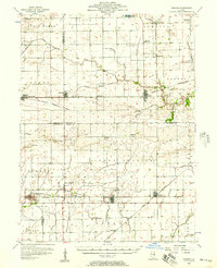 1956 Newman1957 Print · USGSThe borderlands of Champaign and Douglas counties are seen here in the mid-fifties, when small-town rail depots still served as the region's heartbeat. Genealogists can trace family names through rural landmarks like Stutler Cem, Fairfield Ch, and the small community of Maizetown.2 unique versions available
 - 1956 Map of Villa Grove, 1957 Print
 1956 Villa Grove1957 Print · USGSVilla Grove and the rural townships of Douglas and Champaign Counties are shown in the mid-1950s, a period defined by small-town rail commerce and fertile prairie farmland. Genealogists can locate family landmarks like Patterson Springs, Lynn Grove Cem, and St Mary Sch.2 unique versions available
 - 1957 Map of Indianapolis
 1957 Indianapolis1957 Print · USGSCentral Indiana in the mid-fifties is captured here as a crossroads of major rail lines and nascent federal highways. Genealogists and historians can trace family-named ridges like Poplar Ridge or locate strategic sites like Camp Atterbury and Speedway.2 unique versions available
 - 1957 Map of Urbana, 1958 Print
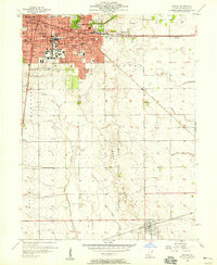
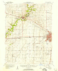
 1957 Urbana1958 Print · USGSCentral Illinois during the late fifties reveals the mid-century growth of the twin cities and their surrounding rail towns. Genealogists can locate family landmarks like Mt Olive Cem, Carley Ch, and the rural Locust Grove Sch.2 unique versions available
 - 1957 Map of Paxton, 1958 Print
 1957 Paxton1958 Print · USGSPost-war central Illinois thrives along the rail lines and at Chanute Air Force Base. Researchers can trace family roots at St Alfreds Chapel or locate several abandoned country schools like Moffett Sch (Abandoned).2 unique versions available
 - 1957 Map of Gibson City, 1958 Print
 1957 Gibson City1958 Print · USGSMid-century Ford and Champaign Counties are mapped here at the height of the railroad era. Genealogists can trace family names through landmarks like Walker Ch, Oregon Cem, and several schoolhouses like the Mounts Sch or the Blackford Sch.2 unique versions available
 - 1957 Map of Fithian, 1958 Print
 1957 Fithian1958 Print · USGSVermilion and Champaign counties come alive in the late fifties as a network of rail-side towns and river bends. Genealogists and historians can locate long-standing landmarks like Belgium Row, Corner Chapel, and the Township High Sch near the Salt Fork.3 unique versions available
 - 1957 Map of Urbana, 1958 Print
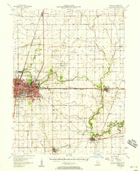
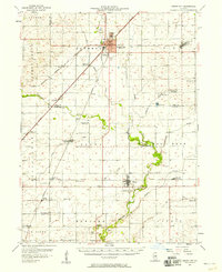
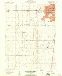
 1957 Urbana1958 Print · USGSThe twin cities of Champaign and Urbana are captured here in the late fifties, showing a dense network of university buildings, hospitals, and rail lines. Genealogists and local historians can trace legacy sites like Mt Hope Cemetery, Silver Sch, and the village of Philo.2 unique versions available
 - 1957 Map of Rising, 1958 Print
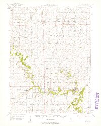
 1957 Rising1958 Print · USGSChampaign and its rural northern townships are shown here during the mid-century transition from family farming to suburban growth. Genealogists and local historians can trace rural landmarks like Phillippe Cem, the tiny settlement of Rising, and early residential plats near Switzer Sch.
 - 1957 Map of Mahomet, 1958 Print
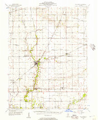
 1957 Mahomet1958 Print · USGSChampaign and its rural neighbors are captured in the late fifties as the city expanded westward toward the Sangamon River. Local researchers can trace family landmarks like Dunkard Cem, the St John Chi, and the University of Illinois Airport.2 unique versions available
 - 1957 Map of Bondville, 1958 Print
 1957 Bondville1958 Print · USGSChampaign and its western neighbors are captured in the late 1950s as suburban expansion meets rural prairie. Genealogists and historians can trace defunct landmarks like South Prairie School or the early layout of the University of Illinois Airport.
 - 1957 Map of Potomac, 1958 Print
 1957 Potomac1958 Print · USGSVermilion County rural life is captured here in the late fifties, showing a landscape defined by rail lines and river crossings. Trace family history through dozens of landmarks like St Lawrence Cem, Selsor Ford, and the Science Hill Sch.2 unique versions available
 - 1957 Map of Thomasboro, 1959 Print
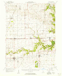
 1957 Thomasboro1959 Print · USGSChampaign County farming communities met mid-century growth in the years following the war, as the urban limits of Urbana and Champaign pushed northward. Researchers can locate rural landmarks like Fiedler Sch, the Illini Airport, and several family cemeteries such as Yearsley Cem.
 - 1958 Map of Peoria, 1969 Print
 1958 Peoria1969 Print · USGSCentral Illinois thrived as a hub of education and transport during the late sixties, as the new interstate system began to reshape the prairie. Genealogists and historians can trace local landmarks like Springdale Cem, Bradley University, and the sprawling grounds of Chanute AFB.4 unique versions available
 - 1958 Map of Decatur, 1971 Print
 1958 Decatur1971 Print · USGSCentral Illinois in the mid-twentieth century shows a landscape defined by industrial rail hubs and the creation of large reservoirs. Researchers can trace historic corridors like the Penn Central or locate landmarks such as Lincoln Log Cabin State Park and Lake Springfield.3 unique versions available
End of results
Showing maps 1-21 of 21
Top cities of Champaign County
- Champaign historical maps
- Urbana historical maps
- Rantoul historical maps
- Mahomet historical maps
- Savoy historical maps
- Tolono historical maps
See more
Frequently asked questions
- What are the different types of historical maps available for Champaign County?
- What is the oldest map of Champaign County?
- Where can I purchase historical maps of Champaign County for my home or office?
- Where can I download high-res historical maps of Champaign County?
- Are there historical topographic maps available for Champaign County?
- Is there historical aerial imagery available for Champaign County?
- Where are historical maps of Champaign County sourced from?