
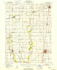
1950 Map of Tuscola
USGS Topo · Published 1952About this map
The East Fork Kaskaskia River and its numerous tributaries, including Twomile Slough and Scattering Fork, define the agrarian drainage patterns of this central Illinois landscape. This mid-century survey documents a transition in rural education, marking a significant number of defunct local schoolhouses such as Casey Sch, Chambers Sch, and Baldwin Sch. These sites, along with rural centers like Macedonia Ch and Cartwright Ch, offer critical landmarks for genealogists tracing family homesteads in the townships of Sadorus and Pesotum. The intersection of major rail lines, including the Illinois Central and the Wabash, anchors the development of commercial hubs at Tuscola and Tolono. The presence of Cooper Landing Field reflects early aviation infrastructure, while small family and community burial grounds like Craw Cem and O'Bryan Cem remain scattered across the farmland.
Find a feature on this map
68 named features on this map. Tap any name to fly to it.
Don’t see what you’re looking for? This feature index may not catch every label — zoom into the map to look around manually.
Map Details
Editions of this 1950 Tuscola Map
4 editions found
Other maps of this area

1906 · Urbana
USGS Topo · 1:62,500

1907 · Mahomet
USGS Topo · 1:62,500

1935 · Arcola
USGS Topo · 1:48,000

1935 · Sullivan
USGS Topo · 1:48,000

1936 · Oakland
USGS Topo · 1:48,000

1937 · Monticello
USGS Topo · 1:48,000

1940 · Sullivan
USGS Topo · 1:62,500

1940 · Arcola
USGS Topo · 1:62,500

1942 · Oakland
USGS Topo · 1:62,500

1943 · Monticello
USGS Topo · 1:62,500