
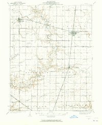
1935 Map of Arcola
USGS Topo · Published 1935About this map
The Kaskaskia River and its tributary Flat Branch carve a winding course through this central Illinois landscape, defining the boundaries between Douglas, Moultrie, and Coles Counties. Surveyed in the mid-1930s, the map reveals a dense rural infrastructure of one-room schoolhouses and country churches spaced almost perfectly to serve the surrounding farmsteads. Larger settlements like Arcola and Arthur are firmly anchored by the intersection of major rail lines, including the Illinois Central and Pennsylvania railroads. These transit corridors dictated the growth of small grain-shipping points like Galton and Chesterville. Notable for genealogists are the numerous family-named landmarks and rural institutions, such as Yoder Cem and the uniquely named Pulltight Sch. The concentration of African American history is marked by Quinn Chapel, while the varied school names like Business Knoll Sch and Bagdad Sch provide specific geographic anchors for tracing early 20th-century local history.
Find a feature on this map
80 named features on this map. Tap any name to fly to it.
Don’t see what you’re looking for? This feature index may not catch every label — zoom into the map to look around manually.
Map Details
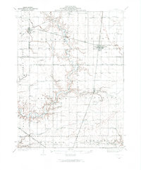
Editions of this 1935 Arcola Map
3 editions found
Other maps of this area

1933 · Toledo
USGS Topo · 1:62,500

1934 · Mattoon
USGS Topo · 1:62,500

1935 · Sullivan
USGS Topo · 1:48,000

1936 · Oakland
USGS Topo · 1:48,000

1937 · Mattoon
USGS Topo · 1:62,500

1938 · Toledo
USGS Topo · 1:62,500

1940 · Sullivan
USGS Topo · 1:62,500

1940 · Arcola
USGS Topo · 1:62,500

1942 · Oakland
USGS Topo · 1:62,500

1947 · Stewardson
USGS Topo · 1:62,500