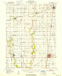
1950 Map of Tuscola
USGS Topo · Published 1952About this map
The Kaskaskia River and its tributaries define the flat, productive landscape of Central Illinois at mid-century, where the convergence of several major railroads drove the development of rural agricultural hubs. At the heart of this grid is Tuscola, a critical junction where the Illinois Central, Baltimore and Ohio, and Chicago and Eastern Illinois railroads meet, facilitating the shipment of grain from surrounding townships.
Find a feature on this map
54 named features on this map. Tap any name to fly to it.
Don’t see what you’re looking for? This feature index may not catch every label — zoom into the map to look around manually.
Map Details
Editions of this 1950 Tuscola Map
4 editions found

Other maps of this area

1906 · Urbana
USGS Topo · 1:62,500

1907 · Mahomet
USGS Topo · 1:62,500

1935 · Arcola
USGS Topo · 1:48,000

1935 · Sullivan
USGS Topo · 1:48,000

1936 · Oakland
USGS Topo · 1:48,000

1937 · Monticello
USGS Topo · 1:48,000

1940 · Sullivan
USGS Topo · 1:62,500

1940 · Arcola
USGS Topo · 1:62,500

1942 · Oakland
USGS Topo · 1:62,500

1943 · Monticello
USGS Topo · 1:62,500