1960s Maps of Champaign County, Illinois
Explore 8 historic maps of Champaign County from the 1960s. These maps offer a rare glimpse into what life looked like during the 1960s — showing old roads, neighborhoods, homes, and landmarks that have changed or disappeared over time.
Whether you're researching your family's past, planning a metal detecting trip, or studying how Champaign County's landscape evolved across the 1960s, these high-resolution maps are a powerful tool for exploring the history of this region.
- Focus on a specific era: All maps on this page are from the 1960s, giving you a focused view of this time period.
- See what’s changed: Compare century-old streets, trails, and buildings to today's modern landscape using overlays and satellite layers.
- Research with precision: Use these maps for genealogy, historical research, land use analysis, or educational projects.
- View, download, or print: Maps are fully viewable online in high resolution, and can be downloaded or printed for your own records.
Start exploring Champaign County's history through authentic maps from the 1960s. This is your window into the past.
Champaign County, IL maps
(8)- 1961 Map of Peoria
 1961 Peoria1961 Print · USGSCentral Illinois thrived at the intersection of river trade and rail power during the late fifties. Genealogists and local historians can trace the rail networks of the Illinois Central and Wabash, alongside landmarks like Chanute AFB and Weldon Springs State Park.
 - 1961 Map of Decatur
 1961 Decatur1961 Print · USGSCentral Illinois in the late fifties was a bustling corridor of rail lines and prairie commerce centered on the state capital. Genealogists and historians can trace the intricate connections between Springfield, Decatur, and dozens of smaller settlements like Nokomis and Arcola.2 unique versions available
 - 1962 Map of Indianapolis
 1962 Indianapolis1962 Print · USGSCentral Indiana and the Illinois borderlands are captured here in the early sixties, showing the region's dense rail networks and growing urban centers. Genealogists and historians can locate family-named landmarks and institutions like Crown Hill Cem, Indiana University, and the Indianapolis Motor Speedway.
 - 1963 Map of Peoria
 1963 Peoria1963 Print · USGSCentral Illinois thrived as a rail and highway crossroads during the early sixties, centered on the bustling Illinois River valley. Genealogists and historians can trace the mid-century layout of Peoria, locate the grounds of Chanute Air Force Base, and follow historic lines like the Toledo Peoria and Western Railway.
 - 1968 Map of St. Joseph, 1969 Print
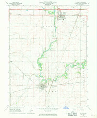 1968 St. Joseph1969 Print · USGSChampaign County prairie and rail junctions come to life in the late sixties, showing the landscape before significant urban expansion. Genealogists and rail historians can trace several burial grounds like Mt Olive Cem and the busy intersections of the Penn Central and Norfolk and Western railroads.
 - 1968 Map of Royal, 1969 Print
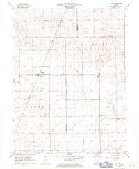 1968 Royal1969 Print · USGSThe eastern Illinois prairie comes into focus in the late 1960s, centered on the railroad hub of Royal. Researchers can trace the Chicago and Eastern Illinois line and locate local landmarks like Stearns Cem and Central Ch.
 - 1968 Map of Homer, 1969 Print
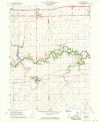 1968 Homer1969 Print · USGSChampaign County farming and rail life are at a crossroads in the late sixties as major water projects loom over the river valley. Trace the paths of the PENN CENTRAL and NORFOLK AND WESTERN railroads as they connect Homer, Ogden, and the riverside Homer Park.2 unique versions available
 - 1968 Map of Flatville, 1970 Print
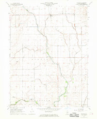 1968 Flatville1970 Print · USGSChampaign County farming communities thrived during the late sixties amidst a complex web of drainage canals and prairie roads. Genealogists and local historians can locate the Stanton Center Sch, family burial sites like Hulse Cem, and the tracks of the Chicago and Eastern Illinois railroad.2 unique versions available
End of results
Showing maps 1-8 of 8
Top cities of Champaign County
- Champaign historical maps
- Urbana historical maps
- Rantoul historical maps
- Mahomet historical maps
- Savoy historical maps
- Tolono historical maps
See more
Frequently asked questions
- What are the different types of historical maps available for Champaign County?
- What is the oldest map of Champaign County?
- Where can I purchase historical maps of Champaign County for my home or office?
- Where can I download high-res historical maps of Champaign County?
- Are there historical topographic maps available for Champaign County?
- Is there historical aerial imagery available for Champaign County?
- Where are historical maps of Champaign County sourced from?