Old Maps of Niles Township, Illinois for Metal Detecting
Plan your next treasure hunt with 56 historic maps of Niles Township. Find old homesites, ghost towns, trails, and gathering spots that may be lost to time — perfect for identifying promising metal detecting locations.
- Locate forgotten sites: Uncover places like long-lost settlements, abandoned rail lines, or gathering spots.
- Plan better hunts: Use map overlays combined with LiDAR or satellite views to narrow in on historically rich areas.
- Made for detectorists: Thousands of hobbyists use these maps to discover relics, coins, and hidden history.
Use these historic maps to boost your research and find new opportunities beneath the surface of Niles Township.
Niles Township, IL maps
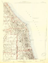
(56)- 1889 Map of Chicago
 1889 Chicago1889 Print · USGSChicago in the late Victorian era was a sprawling rail and maritime titan on the shores of Lake Michigan. Genealogists and historians can trace the early urban grid and massive rail yards of the Belt Railroad and Chicago and Northwestern R.R.
 - 1891 Map of Chicago
 1891 Chicago1891 Print · USGSChicago was a booming rail and water hub in the late nineteenth century, just before the turn of the century. Trace the intricate network of the Illinois and Michigan Canal and major lines like the Wisconsin Central R.R. and Belt Railroad.
 - 1891 Map of Riverside
 1891 Riverside1891 Print · USGSWest of Chicago in the early nineties, these developing suburbs formed a dense network of rail-side settlements and waterworks. Genealogists can trace early homesteads and vanished landmarks like the County Farm and Mammoth Springs alongside the banks of the Des Plaines River.
 - 1893 Map of Riverside
 1893 Riverside1893 Print · USGSWest of Chicago in the 1890s, the landscape was a growing network of rail-centered villages and industrial canals. Genealogists and local historians can trace early property and town layouts in Riverside, Maywood, and the Dunning County Farm alongside the Desplaines River.
 - 1899 Map of Evanston
 1899 Evanston1899 Print · USGSThe Illinois lakefront north of Chicago was undergoing rapid suburbanization during the late nineteenth century. Genealogists and historians can trace the early street grids of Evanston and Winnetka along the Chicago and Northwestern rail line.3 unique versions available
 - 1900 Map of Chicago
 1900 Chicago1900 Print · USGSChicago at the turn of the century shows a city of massive infrastructure, from its emerging park system to its complex rail hubs. Researchers can trace the development of early neighborhoods like Mayfair and South Lynn or locate grounds like Rose Hill Cemetery and the historic Illinois and Michigan Canal.
 - 1900 Map of Riverside
 1900 Riverside1900 Print · USGSThe western Chicago suburbs and the Desplaines River valley are captured here during a period of massive industrial and rail expansion. Genealogists can locate early settlements like Fullersburg and Lace, or trace family plots in Waldheim Cemetery.
 - 1900 Map of Highwood
 1900 Highwood1900 Print · USGSCoastal bluffs and river valleys north of Chicago come alive in this late nineteenth-century survey. Trace the early footprints of settlements like Highland Park and Arlington Heights or locate the historic military grounds at Fort Sheridan.5 unique versions available
 - 1901 Map of Riverside
 1901 Riverside1901 Print · USGSGreater Chicago and the Desplaines River valley are captured here at a moment of rapid rail expansion and civic engineering. Genealogists and historians can trace early settlements and burial sites like Waldheim Cemetery, the Chicago Union Transfer Railroad Yards, and Jefferson Park.4 unique versions available
 - 1901 Map of Chicago
 1901 Chicago1901 Print · USGSChicago was a booming industrial and rail hub in the late nineteenth century, defined by its lakefront and canal systems. Genealogists and urban historians can trace early neighborhood boundaries and rail corridors through Elsdon, Chicago Lawn, and Rose Hill Cemetery.5 unique versions available
 - 1928 Map of Evanston
 1928 Evanston1928 Print · USGSThe North Shore suburbs and the northern edge of Chicago are seen in detail during the late 1920s. Local researchers can trace early residential growth near Northwestern University and locate landmarks like the Gross Pt L H or Calvary Cemetery.5 unique versions available
 - 1928 Map of River Forest
 1928 River Forest1928 Print · USGSIn the late twenties, the Chicago city limits pushed westward toward the Des Plaines River, transforming prairie and farmland into a dense suburban grid. Genealogists and historians can trace family plots in St Joseph Cemetery or locate early landmarks like Rosary College and the Chicago State Hospital.4 unique versions available
 - 1929 Map of Park Ridge
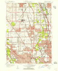
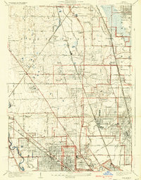 1929 Park Ridge1929 Print · USGSNorth of Chicago in the late twenties, this area was rapidly evolving from agricultural land into a network of suburban settlements. Genealogists and historians can trace institutional sites like the St Marys Mission House and early cemeteries such as Maine Cemetery or Sunset Cemetery.3 unique versions available
 - 1929 Map of Chicago Loop, 1939 Print
 1929 Chicago Loop1939 Print · USGSChicago and its lakefront are captured here between the world wars, showing a city defined by its rigid grid and grand public parks. Genealogists and historians can trace old neighborhoods near Rose Hill Cemetery, the grounds of Loyola University, or the original layout of the Municipal Pier.2 unique versions available
 - 1953 Map of River Forest, 1955 Print
 1953 River Forest1955 Print · USGSSuburban Cook County is seen in a period of dense growth during the early fifties, showing the maturing street grids of River Grove and Oak Park. Genealogists can locate numerous local landmarks like St Joseph Cemetery and schools such as Wright Jr College.
 - 1953 Map of Evanston, 1955 Print
 1953 Evanston1955 Print · USGSThe North Shore suburbs and northern Chicago lakefront are captured in the mid-1950s as these rail-connected communities reached their peak maturity. Researchers can trace historic campus footprints at Northwestern University or locate family sites near Calvary Cemetery and New Trier High Sch.
 - 1953 Map of Chicago Loop, 1956 Print
 1953 Chicago Loop1956 Print · USGSMid-century Chicago is captured here at a moment of significant infrastructure expansion and urban density. Genealogists and historians can trace neighborhood parish schools like St Michael High Sch, local cemeteries such as Rosehill Cemetery, and the rise of the Congress Street Expressway.
 - 1953 Map of Park Ridge, 1956 Print
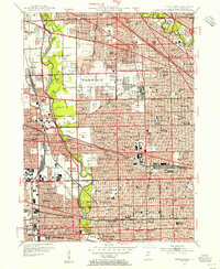
 1953 Park Ridge1956 Print · USGSThe northern Chicago suburbs are caught in a moment of rapid post-war suburbanization during the early fifties. Genealogists and local historians can trace family roots through numerous sites like Sunset Memorial Gardens, Maine Township High Sch, and the St Andrews Home.
 - 1953 Map of Chicago, 1964 Print
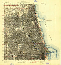
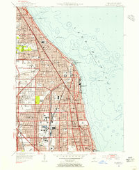
 1953 Chicago1964 Print · USGSThe southern Lake Michigan shoreline was rapidly modernizing in the mid-fifties, balancing heavy industry with its famous academic centers. Researchers can trace the footprints of Notre Dame University or locate vanished sites like the Kingsbury Ordnance Plant and Meigs Field.5 unique versions available
 - 1957 Map of Chicago
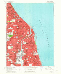
 1957 Chicago1957 Print · USGSThe industrial heartland and southern Great Lakes shoreline are captured here during the peak of mid-century growth. Researchers can trace the massive Gary Steel Works, the grounds of the University of Notre Dame, and the early paths of the Tri-State Tollway.
 - 1958 Map of Racine, 1971 Print
 1958 Racine1971 Print · USGSThe Lake Michigan shoreline in the late fifties was a study in contrasts between the industrial bustle of Kenosha and the quiet woods of the Allegan State Forest. Genealogists and historians can trace the urban footprint of Evanston or locate strategic sites like Fort Sheridan and the Wind Point Light.3 unique versions available
 - 1962 Map of Racine
 1962 Racine1962 Print · USGSThe Lake Michigan shoreline in the early sixties reveals a fascinating contrast between the dense industrial rail hubs of RACINE and CHICAGO and the forested dunes of Michigan. Local historians can trace military installations like Fort Sheridan or explore the numerous inland retreats around Paw Paw Lake and Sister Lakes.
 - 1963 Map of Evanston, 1964 Print
 1963 Evanston1964 Print · USGSThe North Shore suburbs of Chicago thrive during the early sixties, showcasing a landscape of established lakeside communities and prestigious universities. Genealogists and local historians can trace family locations near Calvary Cemetery or the historic Indian Boundary Treaty Line.5 unique versions available
 - 1963 Map of Park Ridge, 1964 Print
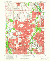 1963 Park Ridge1964 Print · USGSThe northern Chicago suburbs are caught in a period of rapid post-war maturity, showing the transition from village life to a modern metropolitan landscape. Genealogists can locate family sites among numerous plots like Ridgewood Cemetery or trace institutional roots at the Naval Air Station and St Marys Mission House.3 unique versions available
 - 1963 Map of Chicago Loop, 1964 Print
 1963 Chicago Loop1964 Print · USGSChicago's north side neighborhoods and the Loop are captured in the early sixties as the modern expressway system reshaped the urban grid. Researchers can trace historic parish boundaries through sites like St Hyacinth Sch or locate long-standing landmarks like Riverview Park and Rosehill Cemetery.3 unique versions available
Showing maps 1-25 of 56
Top cities near Niles Township
- Chicago historical maps
- Cicero historical maps
- Arlington Heights historical maps
- Evanston historical maps
- Skokie historical maps
- Des Plaines historical maps
See more
Top neighborhoods of Niles Township
Frequently asked questions
- What are the different types of historical maps available for Niles Township?
- What is the oldest map of Niles Township?
- Where can I purchase historical maps of Niles Township for my home or office?
- Where can I download high-res historical maps of Niles Township?
- Are there historical topographic maps available for Niles Township?
- Is there historical aerial imagery available for Niles Township?
- Where are historical maps of Niles Township sourced from?