Old Maps of DeWitt County, Illinois for Genealogy
Trace your family roots with 121 historic maps of DeWitt County. These high-res maps reveal old neighborhoods, homesites, landmarks, and streets — helping you uncover where your ancestors lived and how the area evolved over time.
- Explore historic neighborhoods: Identify where your relatives may have lived in the 1800s or 1900s.
- Compare maps over time: Trace the changes in streets, buildings, and landmarks for multi-generational research.
- Perfect for genealogy & ancestry research: Used by family historians and researchers to map out lineage and migration.
These maps are an incredible resource for exploring your personal connection to DeWitt County's past.
DeWitt County, IL maps
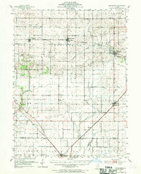
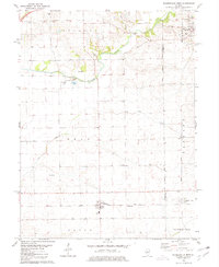
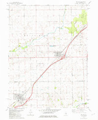
(121)- 1937 Map of Monticello
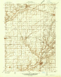 1937 Monticello1937 Print · USGSIn the mid-1930s, this portion of Piatt and DeWitt counties was a bustling corridor of rail lines and rural school districts. Genealogists can locate family landmarks like Campground Cem or trace the vanished district schools like Watson Sch and Harmony Sch.2 unique versions available
 - 1943 Map of Monticello
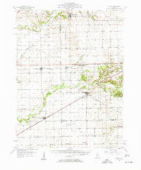
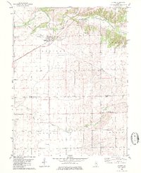
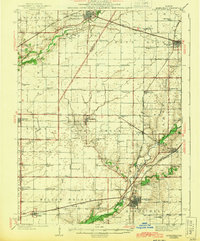 1943 Monticello1943 Print · USGSCentral Illinois at the height of the Second World War reveals a landscape of thriving rail towns and rural school districts. You can trace the path of the Wabash railroad through White Heath or locate family roots at Kentucky Ch and Greenleaf Cem.2 unique versions available
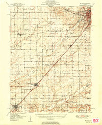
 - 1949 Map of Mc Lean, 1972 Print
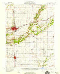
 1949 Mc Lean1972 Print · USGSMid-century McLean County is captured here at a time when small rural schools and parish churches still dotted the prairie landscape. Genealogists and historians can trace family roots through numerous sites like Mount Hope Cem, Alexander Sch, and the Ebenezer Ch.
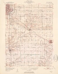
 - 1951 Map of McLean
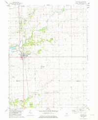
 1951 McLean1951 Print · USGSCentral Illinois during the early fifties reveals a landscape of thriving rail towns and rural school districts. Genealogists and historians can trace the foundations of Bloomington or find local landmarks like Forks Grove Ch and Sunny Point Sch.2 unique versions available
 - 1951 Map of Le Roy, 1952 Print
 1951 Le Roy1952 Print · USGSThe McLean and De Witt County line area comes alive in the early fifties as a landscape of rail-connected towns and fading country schoolhouses. Genealogists can trace family roots through Old Rutledge Cem or locate forgotten sites like Shamrock and Hendryx Sch.3 unique versions available
 - 1952 Map of Arrowsmith
 1952 Arrowsmith1952 Print · USGSAgriculture and the steam-and-diesel rail era meet in this Illinois heartland during the early fifties. Genealogists and historians can trace the foundations of Farmer City and Saybrook while locating rural sites like Prairie Chapel and Payne Cem.2 unique versions available
 - 1957 Map of Kenney, 1958 Print
 1957 Kenney1958 Print · USGSDe Witt and Logan Counties are captured in the late 1950s as the rail-and-river network shaped the prairie landscape. Genealogists can trace rural family plots at McClimans Cem or locate former landmarks like Mt Zion Sch.2 unique versions available
 - 1957 Map of Maroa, 1958 Print
 1957 Maroa1958 Print · USGSCentral Illinois during the late fifties reveals a landscape of thriving rail towns and quiet rural outposts. Genealogists can trace family footprints at Crum Cem or Shiloh Ch, and locate vanished landmarks like Texas Sch.2 unique versions available
 - 1958 Map of Peoria, 1969 Print
 1958 Peoria1969 Print · USGSCentral Illinois thrived as a hub of education and transport during the late sixties, as the new interstate system began to reshape the prairie. Genealogists and historians can trace local landmarks like Springdale Cem, Bradley University, and the sprawling grounds of Chanute AFB.4 unique versions available
 - 1961 Map of Peoria
 1961 Peoria1961 Print · USGSCentral Illinois thrived at the intersection of river trade and rail power during the late fifties. Genealogists and local historians can trace the rail networks of the Illinois Central and Wabash, alongside landmarks like Chanute AFB and Weldon Springs State Park.
 - 1963 Map of Peoria
 1963 Peoria1963 Print · USGSCentral Illinois thrived as a rail and highway crossroads during the early sixties, centered on the bustling Illinois River valley. Genealogists and historians can trace the mid-century layout of Peoria, locate the grounds of Chanute Air Force Base, and follow historic lines like the Toledo Peoria and Western Railway.
 - 1979 Map of Maroa, 1980 Print
 1979 Maroa1980 Print · USGSMaroa and the surrounding prairie are captured in the late seventies at a peak of rail-and-road connectivity on the De Witt and Macon County line. Researchers can locate the Maroa Cem, the Texas Ch, and small rail siding of Ospur amidst the fertile farmland.2 unique versions available
 - 1979 Map of De Witt, 1980 Print
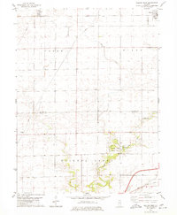
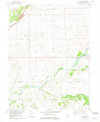
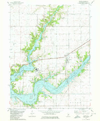 1979 De Witt1980 Print · USGSDe Witt County was undergoing a major transformation in the late seventies as the cooling waters of Clinton Lake were established. Genealogists can trace numerous family burial sites like Lisemby Cem and Willmore Cem, alongside rural landmarks like Centenary Ch.
 - 1979 Map of Farmer City South, 1980 Print
 1979 Farmer City South1980 Print · USGSThe rural landscapes of De Witt and Piatt counties are captured here in the late seventies as the new reservoir at Lake Clinton takes shape. Researchers can trace ancestral sites at Fullerton Church, St. Joseph Cemetery, and McCord Cemetery.
 - 1979 Map of Weldon West, 1980 Print
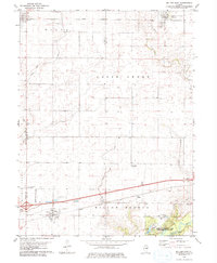
 1979 Weldon West1980 Print · USGSDe Witt County and the Macon County line are captured in the late seventies, a period of established prairie farming and rail transport. Genealogists can locate Shiloh Chapel, the Chandler Cem, and the rural community of Lane along the Illinois Central Gulf tracks.
 - 1979 Map of Mansfield, 1980 Print
 1979 Mansfield1980 Print · USGSMansfield and the surrounding Illinois prairie are shown during the late 1970s as a junction for the CONRAIL and NORFOLK AND WESTERN railroads. Researchers can locate family landmarks like Mackey Cem, Bethel Ch, and numerous private runways including the Weidner Landing Field.
 - 1979 Map of Clinton, 1980 Print
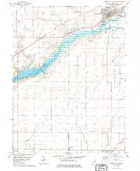
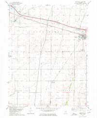
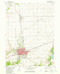 1979 Clinton1980 Print · USGSDe Witt County and the city of Clinton reached a modern peak of development in the late seventies as the local landscape balanced industry and recreation. Researchers can trace the Illinois Central Gulf rail lines or locate local landmarks like Woodlawn Cemetery, St John Sch, and Weldon Springs State Park.
 - 1979 Map of Weldon East, 1980 Print
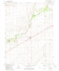
 1979 Weldon East1980 Print · USGSPiatt County farmland in the late seventies is marked by the busy Illinois Central Gulf rail line and quiet rural townships. Genealogists can locate family sites near Weldon, DeLand, or the wooded grounds of Robert Allerton Park.
 - 1980 Map of Chestnut
 1980 Chestnut1980 Print · USGSThe rural landscape of central Illinois is captured here in the early 1980s, centered on the village of Chestnut. Family historians can locate numerous burial grounds like Donnan Cem and Hays Cem or trace the route of the Illinois Central Gulf railroad.
 - 1980 Map of Waynesville East
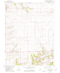 1980 Waynesville East1980 Print · USGSDe Witt County in the early 1980s reveals a structured agricultural landscape shaped by railroads and prairie creeks. Genealogists can locate several rural burial sites like Evergreen Cem and Barnett Cem, or trace the Illinois Central Gulf rail line through Hallsville.
 - 1980 Map of Waynesville West, 1981 Print
 1980 Waynesville West1981 Print · USGSLogan and De Witt counties appear at a transition point in the 1980s, defined by the rural rail lines and township grids of Central Illinois. Researchers can trace family history through numerous landmarks like Berryhill Cem, the rail siding at Tabor, and the streets of Beason.
 - 1980 Map of Kenney, 1981 Print
 1980 Kenney1981 Print · USGSRail-and-river life in De Witt County is frozen in time during the late twentieth century, centered on the village of Kenney. Researchers can locate several rural landmarks including Harmony Ch, Old Baptist Cem, and the small settlement of Rowell.
 - 1981 Map of Heyworth
 1981 Heyworth1981 Print · USGSCentral Illinois farmland near Heyworth is captured here in the early eighties, showcasing a landscape of winding creeks and pioneer cemeteries. Researchers can trace family history at Old Rutledge Cem or locate the old Illinois Central Gulf rail corridor.
 - 1981 Map of Funks Grove
 1981 Funks Grove1981 Print · USGSMcLean and De Witt counties were mapped in the early eighties as the modern highway system integrated with old rail corridors. Researchers can locate family burial sites at Fremont Cem or Halsey Cem and trace the path of the ILLINOIS CENTRAL GULF near Funks Grove.
 - 1981 Map of McLean
 1981 McLean1981 Print · USGSThe rail corridor between McLean and Atlanta comes alive in the early eighties as the Illinois Central Gulf cuts through the prairie. Researchers can find numerous pioneer burial sites and rural churches, including Mt Hope Cem, Brock Cem, and Funks Grove Ch.
Showing maps 1-25 of 121
Top cities of DeWitt County
- Clinton historical maps
- Farmer City historical maps
- Tunbridge historical maps
- Wapella historical maps
- Waynesville historical maps
- Weldon historical maps
See more
Frequently asked questions
- What are the different types of historical maps available for DeWitt County?
- What is the oldest map of DeWitt County?
- Where can I purchase historical maps of DeWitt County for my home or office?
- Where can I download high-res historical maps of DeWitt County?
- Are there historical topographic maps available for DeWitt County?
- Is there historical aerial imagery available for DeWitt County?
- Where are historical maps of DeWitt County sourced from?