Old Maps of Edgar County, Illinois
Explore 158 old maps of Edgar County, spanning from 1932 to today. These high-resolution historic maps reveal how streets, neighborhoods, landmarks, and natural features evolved over time — perfect for genealogy, metal detecting, research, and local history exploration.
What you can do with these maps:
- See how Edgar County changed over time: Compare historical maps to modern-day views to trace roads, homesites, rail lines & more.
- View detailed metadata: Each map includes creators, publishers, year, scale, and archive source.
- Overlay maps with satellite & LiDAR: Visualize the past alongside modern tools to explore terrain & human change.
- Trusted historical sources: Maps sourced from the USGS, Library of Congress, and other archives.
- Access maps your way: View online, download high-res files, or order prints for personal or research use.
Start exploring old maps of Edgar County to uncover forgotten places, hidden landmarks, and the deep history beneath your feet.
Edgar County, IL maps
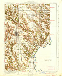
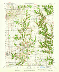
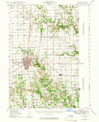
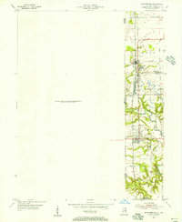
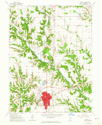
(158)- 1932 Map of Marshall, 1957 Print
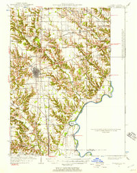 1932 Marshall1957 Print · USGSThe Illinois-Indiana borderlands of the early 1930s come alive through this survey of the Marshall rail corridor and Wabash River valley. Trace family roots and vanished landmarks like Bohn Ferry, Ziegler Cem, and the Airway Beacon.
 - 1936 Map of Casey
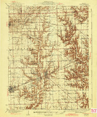
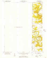
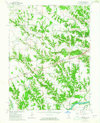
 1936 Casey1936 Print · USGSEast-central Illinois comes into focus in the mid-thirties as a hub of rail transport and early energy production. Genealogists can trace family names through dozens of rural sites, from Pikes Peak Ch to the Tank Farm and Oilfield settlement.
 - 1937 Map of Marshall
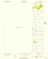
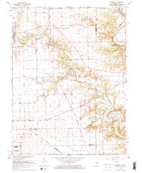
 1937 Marshall1937 Print · USGSClark and Edgar Counties are captured here in the 1930s, showing a landscape of river-bend settlements and dense rural school districts. Genealogists can trace family names through Forsythe Cem, identify remote crossings like Bohn Ferry, or locate lost schoolhouses like Rabbit Ridge Sch.2 unique versions available
 - 1942 Map of Dennison
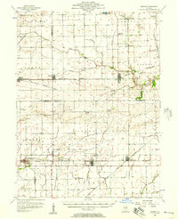
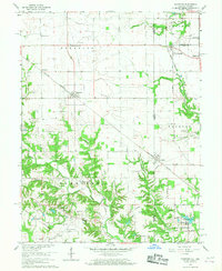
 1942 Dennison1942 Print · USGSThe Illinois-Indiana border comes alive in the early 1940s as the high bluffs of Clark County descend toward the Wabash River. Genealogists and local historians can trace the rural landscape of South Vigo and old routes like National Road and Darwin Road.2 unique versions available
 - 1942 Map of Casey, 1965 Print
 1942 Casey1965 Print · USGSEast-central Illinois comes to life in this mid-century survey of the rail and road networks connecting Casey and Martinsville. Genealogists can trace family legacies through numerous landmarks like Enlow Cem, Willis Chapel, and School No 3.2 unique versions available
 - 1943 Map of Casey
 1943 Casey1943 Print · USGSEastern Illinois during the late thirties and early forties reveals a landscape of railroad towns and emerging oil infrastructure. Genealogists and researchers can trace dozens of rural landmarks, from the Abraham Lincoln Sch to the industrial TANK FARM and the Airway Beacon near Martinsville.2 unique versions available
 - 1946 Map of Kansas, 1977 Print
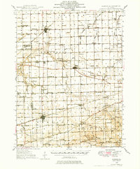 1946 Kansas1977 Print · USGSThe intersection of the New York Central and Chicago and St Louis railroads defines this Illinois prairie landscape shortly after the war. Researchers can trace rural lineages through numerous country schools and cemeteries like College Sch, Shields Cem, and Redmon.
 - 1947 Map of Ridge Farm
 1947 Ridge Farm1947 Print · USGSEastern Illinois and the Indiana border appear here just after the war, showcasing a landscape of rail-connected towns and country school districts. Researchers can trace family history through dozens of landmarks like Scotland Sta, Vermilion Grove, and Harrison Consolidated Sch.3 unique versions available
 - 1947 Map of Paris, 1967 Print
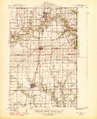
 1947 Paris1967 Print · USGSPost-war Edgar County and the Indiana borderlands are captured here at a time when rural schoolhouses and small family cemeteries still marked nearly every section. Genealogists can locate Edgar Cem, the Old Indian Boundary Line, and dozens of local schools like Plum Grove Sch.
 - 1949 Map of Kansas
 1949 Kansas1949 Print · USGSEastern Illinois at the end of the 1940s reveals a robust landscape of rail-connected towns and country schools. Genealogists can trace family names at Shields Cem or locate community hubs like Embarrass Ch and the settlement of Redmon.2 unique versions available
 - 1949 Map of Paris
 1949 Paris1949 Print · USGSEastern Illinois and the Indiana borderlands are captured here in the late 1940s, centered on the rail hub of Paris. Researchers can trace dozens of rural schoolhouses and family cemeteries, including St Aloysius Ch, Edgar Cem, and the path of the Old Indian Boundary Line.2 unique versions available
 - 1950 Map of Sandford, 1956 Print
 1950 Sandford1956 Print · USGSStraddling the Illinois and Indiana border at the middle of the century, this area reveals a landscape shaped by coal mining and heavy rail. Genealogists can trace family roots in Sandford or Libertyville, or locate Pisgah Ch and the Green Valley Mine.
 - 1951 Map of Saint Bernice, 1956 Print
 1951 Saint Bernice1956 Print · USGSThe Illinois-Indiana borderlands are captured here in the early 1950s, showcasing a landscape shaped by coal extraction and heavy rail. Researchers can trace the heritage of mining towns like Saint Bernice and Blanford alongside the Chicago Milwaukee St Paul and Pacific tracks.
 - 1953 Map of Indianapolis, 1965 Print
 1953 Indianapolis1965 Print · USGSCentral Indiana and the Illinois borderlands are captured in the mid-sixties, showing the growth of Indianapolis and its industrial rail corridors. Genealogists and historians can trace the development of outlying towns like Zionsville or Beech Grove and find landmarks such as Atterbury AAF and Turkey Run State Park.4 unique versions available
 - 1955 Map of Humrick, 1956 Print
 1955 Humrick1956 Print · USGSThe Illinois and Indiana borderlands come alive in the mid-fifties along the winding Vermilion River and the tracks of the Chicago and St Louis railroad. Genealogists can trace family names at Brown Cem and Patrick Cem or explore the sharp terrain of Devils Backbone.
 - 1955 Map of Scottland, 1957 Print
 1955 Scottland1957 Print · USGSThe Illinois-Indiana state line during the mid-fifties shows a landscape of rural rail junctions and early pioneer landmarks. Trace family history and regional industry through the Old Hopewell Cem, the village of Quaker, and the Baltimore and Ohio railroad corridor.
 - 1956 Map of Indianapolis
 1956 Indianapolis1956 Print · USGSCentral Indiana in the mid-fifties is captured during a period of industrial growth and military presence. Genealogists and historians can trace the rail networks of the New York Central or locate regional landmarks like Fort Benjamin Harrison and Camp Atterbury.
 - 1956 Map of Newman, 1957 Print
 1956 Newman1957 Print · USGSThe borderlands of Champaign and Douglas counties are seen here in the mid-fifties, when small-town rail depots still served as the region's heartbeat. Genealogists can trace family names through rural landmarks like Stutler Cem, Fairfield Ch, and the small community of Maizetown.2 unique versions available
 - 1957 Map of Indianapolis
 1957 Indianapolis1957 Print · USGSCentral Indiana in the mid-fifties is captured here as a crossroads of major rail lines and nascent federal highways. Genealogists and historians can trace family-named ridges like Poplar Ridge or locate strategic sites like Camp Atterbury and Speedway.2 unique versions available
 - 1962 Map of Indianapolis
 1962 Indianapolis1962 Print · USGSCentral Indiana and the Illinois borderlands are captured here in the early sixties, showing the region's dense rail networks and growing urban centers. Genealogists and historians can locate family-named landmarks and institutions like Crown Hill Cem, Indiana University, and the Indianapolis Motor Speedway.
 - 1964 Map of Marshall, 1965 Print
 1964 Marshall1965 Print · USGSMarshall and the surrounding Clark County countryside are captured here in the mid-1960s as a bustling crossroads of rail and road. Researchers can trace local lineage through sites like Laufman Cem, visit the town's Fairground, or follow the historic Lincoln Heritage Trail.2 unique versions available
 - 1964 Map of Dennison, 1965 Print
 1964 Dennison1965 Print · USGSThe Illinois-Indiana borderlands appear here in the mid-1960s, centered on the railroad towns and the fertile Wabash Valley. Genealogists and local historians can trace family locations near Ferris Cem, Dennison, and the rural Mt Moriah Ch.3 unique versions available
 - 1965 Map of Humrick, 1967 Print
 1965 Humrick1967 Print · USGSVermilion County transitions from prairie to river bluffs in the mid-1960s as rail lines converge near the state line. Researchers can trace the Old Indian Treaty Boundary and locate community sites like McKendree Ch or the Wingard Sch.2 unique versions available
 - 1965 Map of Scottland, 1967 Print
 1965 Scottland1967 Print · USGSThe Illinois-Indiana borderlands in the mid-1960s are defined here by a network of cross-state railways and quiet rural crossroads. Researchers can trace ancestral roots through numerous family and community sites like Old Hopewell Cemetery, Wesley Chapel, and Quaker.2 unique versions available
 - 1966 Map of Sandford, 1967 Print
 1966 Sandford1967 Print · USGSThe Illinois-Indiana borderlands come alive in the mid-1960s, showing a landscape defined by coal mining and cross-state rail lines. Genealogists and local historians can trace family locations near Sandford and Libertyville or find old burial sites like Vermilion Cem and Gymon Cem.3 unique versions available
Showing maps 1-25 of 158
Top cities of Edgar County
- Paris historical maps
- Chrisman historical maps
- Kansas historical maps
- Elbridge historical maps
- Grandview historical maps
- Edgar historical maps
See more
Frequently asked questions
- What are the different types of historical maps available for Edgar County?
- What is the oldest map of Edgar County?
- Where can I purchase historical maps of Edgar County for my home or office?
- Where can I download high-res historical maps of Edgar County?
- Are there historical topographic maps available for Edgar County?
- Is there historical aerial imagery available for Edgar County?
- Where are historical maps of Edgar County sourced from?