Old Maps of North City, Illinois for Hiking & Exploration
Hike through history with 27 historic maps of North City. Explore old trails, ghost towns, and forgotten backroads — perfect for outdoor adventurers and local explorers.
- Rediscover forgotten places: Map out old mining camps, roads, and footpaths that no longer exist on modern maps.
- Layer with modern tools: Combine with LiDAR or satellite views to plan hikes through historical terrain.
- Made for exploration: Popular among hikers, overlanders, and local history lovers.
Use these maps to find adventure and explore the hidden past of North City.
North City, IL maps
(27)- 1910 Map of Herrin
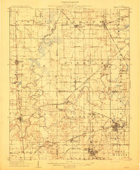 1910 Herrin1910 Print · USGSSouthern Illinois thrived at the height of its rail-and-coal era, with this 1910 survey capturing a landscape of growing towns and industrial spurs. Genealogists and historians can trace family roots through localized sites like Dewmaine, Old Duquoin, and the Oak Grove School.2 unique versions available
 - 1926 Map of Duquoin
 1926 Duquoin1926 Print · USGSSouthern Illinois coal country is at its industrial peak in the mid-twenties, with thriving rail towns and active collieries. You can trace early 20th-century family roots at Young's Chapel or locate old operations like the Big Ben Mine and Old Keller Mine.3 unique versions available
 - 1936 Map of Herrin
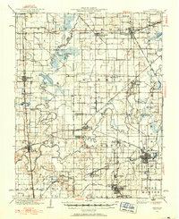 1936 Herrin1936 Print · USGSSouthern Illinois was defined by its coal-and-rail economy in the 1930s as industrial lines reached deep into the countryside. Trace the family landmarks of this era at Old Duquoin, Buckner Pond, and the Union Hill Church.2 unique versions available
 - 1949 Map of Paducah
 1949 Paducah1949 Print · USGSThe confluence of the Ohio, Mississippi, Tennessee, and Cumberland rivers at the close of the 1940s reveals a region bound by water and rail. Researchers can trace historic river landings, timberlands in the Shawnee National Forest, and the coal-mining infrastructure around West Frankfort and Herrin.2 unique versions available
 - 1950 Map of Paducah
 1950 Paducah1950 Print · USGSThe confluence of the great midwestern rivers defines this mid-century landscape at the intersection of Illinois, Kentucky, and Missouri. Genealogists and historians can trace the rail-and-river economy through the hubs of Paducah, Cairo, and Metropolis or locate family roots near the Wildcat Hills.
 - 1954 Map of Paducah
 1954 Paducah1954 Print · USGSSouthern Illinois and Western Kentucky intersect at the great river confluences during this mid-century era of rail and river industry. Genealogists and historians can trace family roots and commerce through river towns like Cairo, Metropolis, and Golconda, or along the tracks of the Illinois Central Railroad.2 unique versions available
 - 1958 Map of Belleville, 1973 Print
 1958 Belleville1973 Print · USGSSouthern Illinois during the mid-twentieth century reveals a landscape of industrial growth and massive new reservoirs. Genealogists and historians can trace the paths of the Illinois Central RR through towns like Centralia or locate landmarks such as Emerald Mound and the Looking Glass Prairie.3 unique versions available
 - 1961 Map of Paducah
 1961 Paducah1961 Print · USGSThe Lower Ohio Valley at mid-century is a landscape defined by its great rivers and newly formed reservoirs. Researchers can trace the riverfronts of Paducah and Metropolis, or locate smaller settlements like Old Shawneetown and Cave in Rock along the banks.2 unique versions available
 - 1962 Map of Belleville
 1962 Belleville1962 Print · USGSSouthern Illinois in the late fifties reveals a landscape of industrial growth and ancient landmarks before the full expansion of the interstate system. Genealogists can trace family names and rural post offices near Centralia, Salem, and the historic Monks Mound.
 - 1964 Map of Paducah
 1964 Paducah1964 Print · USGSThe river-and-rail corridor of Southern Illinois and Western Kentucky is captured here during the height of the mid-century industrial era. Genealogists and researchers can trace local landmarks across several counties, from the rail yards of Paducah to the waters of Crab Orchard Lake and Kentucky Reservoir.2 unique versions available
 - 1968 Map of Christopher, 1969 Print
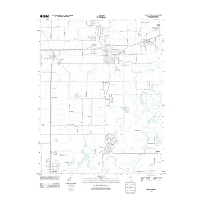
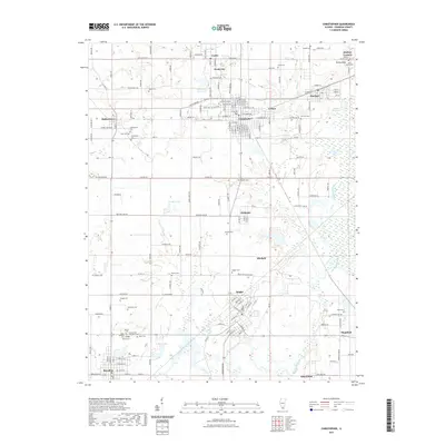
 1968 Christopher1969 Print · USGSFranklin County communities like Christopher, Zeigler, and Buckner are shown at their mid-century industrial peak. Researchers can trace family history through dozens of local landmarks, including the Miners Hospital, Old Mulkeytown Cem, and St Marys Cath Ch.2 unique versions available
 - 1975 Map of Sesser, 1977 Print
 1975 Sesser1977 Print · USGSDuring the mid-seventies, this area of Franklin County saw the industrial mining of the Old Ben No 21 Mine meet the growing waters of Rend Lake. Genealogists and local historians can trace rural cemeteries like Maple Hill Cem and Youngblood Cem alongside the BURLINGTON NORTHERN rail line.
 - 1984 Map of Carbondale, 1985 Print
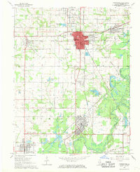
 1984 Carbondale1985 Print · USGSSouthern Illinois in the mid-1980s was a crossroads of major rail lines and vast conservation lands centered on Carbondale. Local researchers can trace the development of Southern Illinois University, the Menard Correctional Center, and the many shorelines of Crab Orchard Lake.
 - 1985 Map of Pinckneyville
 1985 Pinckneyville1985 Print · USGSSouthern Illinois in the mid-eighties shows a landscape of prairie farms, coal extraction, and vital rail corridors. Researchers can trace the rail-side growth of Venedy Station and New Memphis Station or locate landmarks like St Libory Church and Memorial Gardens Cem.2 unique versions available
 - 1986 Map of Carbondale
 1986 Carbondale1986 Print · USGSSouthern Illinois and the Mississippi River valley are captured in the mid-eighties as a landscape of diverse water systems and conservation lands. Researchers can trace the development of Southern Illinois University or locate landmarks like Fort Gage and St Marys Seminary.
 - 1987 Map of Paducah, 1988 Print
 1987 Paducah1988 Print · USGSThe Lower Ohio Valley and the Illinois Ozarks come alive in this late twentieth-century regional survey. Genealogists and local historians can trace river-town roots and state park landmarks from Metropolis to Cape Girardeau and Trail of Tears State Park.
 - 1998 Map of Sesser, 2000 Print
 1998 Sesser2000 Print · USGSSouthern Illinois coal country and the shoreline of Rend Lake are captured here in the late nineties. Genealogists can locate specific family sites like Bear Point Cem, the Old Ben No 21 Mine, and Wilson Sch.
 - 2012 Map of Sesser, 2012 Print
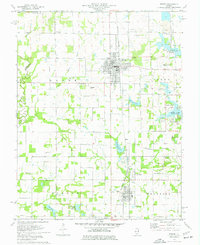
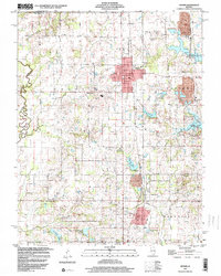
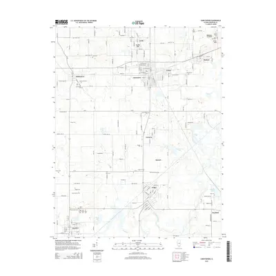
 2012 Sesser2012 Print · USGSCovers North City, including Sesser, Valier, and other nearby areas
 - 2012 Map of Christopher, 2012 Print
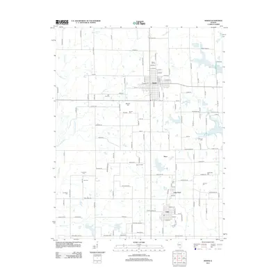
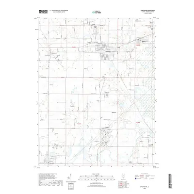
 2012 Christopher2012 Print · USGSCovers North City, including Christopher, Zeigler, and other nearby areas
 - 2015 Map of Sesser, 2015 Print
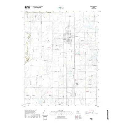
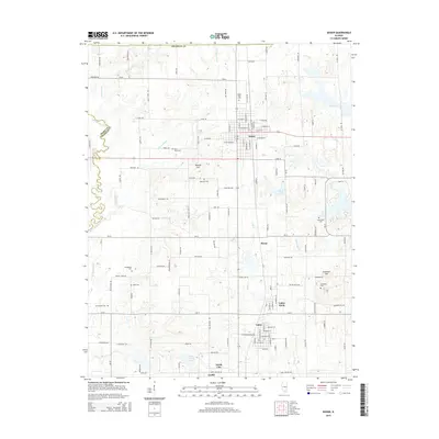 2015 Sesser2015 Print · USGSCovers North City, including Sesser, Valier, and other nearby areas
 - 2015 Map of Christopher, 2015 Print
 2015 Christopher2015 Print · USGSCovers North City, including Christopher, Zeigler, and other nearby areas
 - 2018 Map of Sesser, 2018 Print
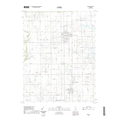
 2018 Sesser2018 Print · USGSCovers North City, including Sesser, Valier, and other nearby areas
 - 2018 Map of Christopher, 2018 Print
 2018 Christopher2018 Print · USGSCovers North City, including Christopher, Zeigler, and other nearby areas
 - 2021 Map of Sesser, 2021 Print
 2021 Sesser2021 Print · USGSCovers North City, including Sesser, Valier, and other nearby areas
 - 2021 Map of Christopher, 2021 Print
 2021 Christopher2021 Print · USGSCovers North City, including Christopher, Zeigler, and other nearby areas
Showing maps 1-25 of 27
Top cities near North City
- Carbondale historical maps
- Marion historical maps
- Herrin historical maps
- West Frankfort historical maps
- Murphysboro historical maps
- Benton historical maps
See more
Top neighborhoods of North City
Frequently asked questions
- What are the different types of historical maps available for North City?
- What is the oldest map of North City?
- Where can I purchase historical maps of North City for my home or office?
- Where can I download high-res historical maps of North City?
- Are there historical topographic maps available for North City?
- Is there historical aerial imagery available for North City?
- Where are historical maps of North City sourced from?