Old Maps of Greene County, Illinois for Metal Detecting
Plan your next treasure hunt with 125 historic maps of Greene County. Find old homesites, ghost towns, trails, and gathering spots that may be lost to time — perfect for identifying promising metal detecting locations.
- Locate forgotten sites: Uncover places like long-lost settlements, abandoned rail lines, or gathering spots.
- Plan better hunts: Use map overlays combined with LiDAR or satellite views to narrow in on historically rich areas.
- Made for detectorists: Thousands of hobbyists use these maps to discover relics, coins, and hidden history.
Use these historic maps to boost your research and find new opportunities beneath the surface of Greene County.
Greene County, IL maps
(125)- 1924 Map of Winchester
 1924 Winchester1924 Print · USGSScott and Morgan counties are shown here during the early twenties as a thriving network of small-town rail stops and rural schools. Genealogists can locate dozens of local landmarks like Oak Grove School, Seminary School, and the junction at Winchester.3 unique versions available
 - 1924 Map of Roodhouse, 1958 Print
 1924 Roodhouse1958 Print · USGSGreene County thrived as a railroad hub in the 1920s, defined by the busy yards at Roodhouse and the nearby center of White Hall. Genealogists can locate dozens of vanished rural landmarks, including the Swamp College School and the Martin Prairie Church.2 unique versions available
 - 1924 Map of Griggsville, 1959 Print
 1924 Griggsville1959 Print · USGSPike and Scott counties are captured during the mid-1920s as the Illinois River and Wabash RR defined local commerce. Researchers can trace rural life through dozens of named landmarks like Brush College School, Bethel Church, and Sleight Pond.2 unique versions available
 - 1925 Map of Brighton, 1958 Print
 1925 Brighton1958 Print · USGSSouthwestern Illinois was a bustling rail-and-farm corridor in the mid-1920s, characterized by numerous small settlements and village schoolhouses. Researchers can trace the vanished rural infrastructure of Medora, Piasa, and Woodburn, alongside over twenty named country schools like Brush College School.2 unique versions available
 - 1926 Map of Griggsville
 1926 Griggsville1926 Print · USGSThe Illinois River valley in the 1920s is captured here at the height of its rail-and-river economy. Genealogists and historians can trace dozens of rural schools and landmarks including Brush College School, Bethel Church, and the Wabash RR corridor.2 unique versions available
 - 1926 Map of Winchester
 1926 Winchester1926 Print · USGSScott and Morgan counties are shown in the mid-twenties, revealing a landscape of small agricultural villages and decentralized country schools. Genealogists can trace family footprints near Strawns Grove School, the Poor Farm, or the rail depot at Alsey.
 - 1926 Map of Roodhouse
 1926 Roodhouse1926 Print · USGSGreene County in the mid-1920s is a landscape of established rail towns and a high density of country schoolhouses. Genealogists and historians can trace family roots through numerous local landmarks like Swamp College School, Oakland Church, and the settlement of Berdan.2 unique versions available
 - 1928 Map of Brighton
 1928 Brighton1928 Print · USGSSouthwestern Illinois was a bustling network of rail-side towns and country school districts in the mid-1920s. Researchers can locate nearly thirty local schools including Brush College School and Washington School, or trace the tracks of the Chicago and Alton through Shipman and Brighton.2 unique versions available
 - 1930 Map of Pearl
 1930 Pearl1930 Print · USGSThe Illinois River valley in the late 1920s shows a landscape of river-bottom farms and rugged bluff-top settlements. Genealogists can locate family landmarks like Miller Cem, Farmers Ridge Ch, and schools such as Summit Grove Sch or Village Green Sch.3 unique versions available
 - 1930 Map of Hardin
 1930 Hardin1930 Print · USGSCalhoun County's narrow peninsula is captured here between the two great rivers during the late Prohibition era. Genealogists and local researchers can locate numerous rural landmarks like Indian Creek Ch, Oases Ch, and a high concentration of schoolhouses including South Lincoln Sch.2 unique versions available
 - 1930 Map of Jerseyville, 1965 Print
 1930 Jerseyville1965 Print · USGSJersey and Greene Counties are captured here between the world wars, showing a landscape defined by steam rail and one-room schoolhouses. Genealogists can trace the exact locations of Old Kane, the County Farm, and numerous local landmarks like St Marys Sch.2 unique versions available
 - 1932 Map of Greenfield
 1932 Greenfield1932 Print · USGSGreene and Macoupin counties thrive as a rail-centered agricultural heartland during the early thirties. Genealogists can trace family homesteads near numerous rural schools like Oak Hill Sch and Landreth Sch, or churches such as Mt Moriah Ch.3 unique versions available
 - 1932 Map of Jacksonville, 1965 Print
 1932 Jacksonville1965 Print · USGSCentral Illinois farm country and the growing hub of Jacksonville are captured in the early 1930s before modern highway expansion. Researchers can trace dozens of country schools and churches, including Douglas Institute, Whitlock Cem, and the rural post at Pisgah.2 unique versions available
 - 1933 Map of Jerseyville
 1933 Jerseyville1933 Print · USGSJersey County is captured in the early thirties as a hub of rail activity and rural education. Genealogists can trace family roots through numerous local landmarks like Bethany Ch, Otterville, and the remote Shakerag Sch.2 unique versions available
 - 1934 Map of Hardin, 1956 Print
 1934 Hardin1956 Print · USGSThe river bluffs of Calhoun and Greene counties come alive in this mid-1930s survey of the Mississippi River and Illinois River valleys. Genealogists can trace family roots through numerous rural landmarks like Indian Creek Ch, St Andrew Ch, and the Pecan Grove Sch.2 unique versions available
 - 1937 Map of Jacksonville
 1937 Jacksonville1937 Print · USGSMid-century Morgan County thrives as a rail and education hub just before the pre-war era. Researchers can trace ancestral roots at Whitlock Cem or locate defunct schools like Sulphur Springs Sch and Prairie College Sch.2 unique versions available
 - 1938 Map of Hardin
 1938 Hardin1938 Print · USGSThe river-bound peninsula of Calhoun County is shown here in the 1930s, caught between the shifting chutes of the Mississippi and the Illinois rivers. Genealogists can trace family roots through numerous rural landmarks like Gilead Cemetery, the Poor Farm, and small communities such as Batchtown and Hamburg.2 unique versions available
 - 1948 Map of Quincy
 1948 Quincy1948 Print · USGSThe Mississippi and Illinois River valleys are captured at a post-war crossroads as rail and river travel met the expanding highway system. Genealogists can trace family settlements from Quincy to Hannibal and smaller towns like Vandalia and Jerseyville.2 unique versions available
 - 1950 Map of Pearl, 1956 Print
 1950 Pearl1956 Print · USGSThe Illinois River valley in the mid-1950s reveals a landscape of river-bottom farms and bluff-side settlements. Local researchers can trace family roots through numerous rural landmarks like Farmers Ridge Ch, Miller Cem, and Robley Sch.
 - 1956 Map of Quincy, 1967 Print
 1956 Quincy1967 Print · USGSThe river and rail corridors of the Illinois-Missouri border are documented here during the mid-1950s. Researchers can trace historic river landings and regional transit hubs from Quincy and Hannibal to smaller settlements like Meredosia and Roodhouse.3 unique versions available
 - 1975 Map of Nutwood, 1978 Print
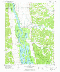 1975 Nutwood1978 Print · USGSAlong the Illinois River in the mid-seventies, this survey reveals the dense backwaters and bluff-side communities of Jersey and Calhoun counties. Researchers can trace family sites near Nutwood and Rosedale, or locate recreational camps like Camp Piasa and Camp Potawatomi.
 - 1978 Map of Hardin
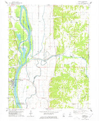 1978 Hardin1978 Print · USGSIn the late seventies, the Illinois River valley near Hardin remained a mosaic of backwater chutes and agricultural ridges. Genealogists can trace family names at Reddish Bridge or search for burial sites at Gunterman Cem and Clark Cem.
 - 1980 Map of Kampsville, 1981 Print
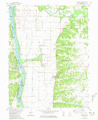 1980 Kampsville1981 Print · USGSThe Illinois River valley in the early 1980s reveals a landscape defined by historic landings and limestone bluffs. Genealogists can trace family roots through several sites like St Anselm Cem and Eldred Mem Gardens, or locate old industrial landmarks such as the Schumann Quarry.
 - 1980 Map of Bedford, 1981 Print
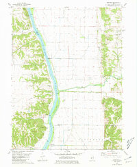 1980 Bedford1981 Print · USGSThe Illinois River valley in the early eighties shows a landscape of riverfront settlements and managed bottomlands. Genealogists and local researchers can locate Montezuma, Bedford, and several family burial sites including Clemmons Cem and Adams Cem.
 - 1980 Map of Pearl East, 1981 Print
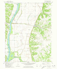 1980 Pearl East1981 Print · USGSGreene County bottomlands and bluffs come alive in this early 1980s survey of the Illinois River valley. Genealogists can trace family burial sites like Likely Cem and Kinser Cem while historians follow the Illinois Central Gulf rail line through Hillview.
Showing maps 1-25 of 125
Top cities of Greene County
- Carrollton historical maps
- White Hall historical maps
- Roodhouse historical maps
- Greenfield historical maps
- Kane historical maps
- Athensville historical maps
See more
Frequently asked questions
- What are the different types of historical maps available for Greene County?
- What is the oldest map of Greene County?
- Where can I purchase historical maps of Greene County for my home or office?
- Where can I download high-res historical maps of Greene County?
- Are there historical topographic maps available for Greene County?
- Is there historical aerial imagery available for Greene County?
- Where are historical maps of Greene County sourced from?