Old Maps of Woody, Illinois for Metal Detecting
Plan your next treasure hunt with 11 historic maps of Woody. Find old homesites, ghost towns, trails, and gathering spots that may be lost to time — perfect for identifying promising metal detecting locations.
- Locate forgotten sites: Uncover places like long-lost settlements, abandoned rail lines, or gathering spots.
- Plan better hunts: Use map overlays combined with LiDAR or satellite views to narrow in on historically rich areas.
- Made for detectorists: Thousands of hobbyists use these maps to discover relics, coins, and hidden history.
Use these historic maps to boost your research and find new opportunities beneath the surface of Woody.
Woody, IL maps
(11)- 1924 Map of Roodhouse, 1958 Print
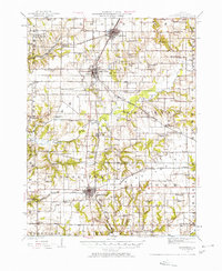 1924 Roodhouse1958 Print · USGSGreene County thrived as a railroad hub in the 1920s, defined by the busy yards at Roodhouse and the nearby center of White Hall. Genealogists can locate dozens of vanished rural landmarks, including the Swamp College School and the Martin Prairie Church.2 unique versions available
 - 1926 Map of Roodhouse
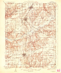 1926 Roodhouse1926 Print · USGSGreene County in the mid-1920s is a landscape of established rail towns and a high density of country schoolhouses. Genealogists and historians can trace family roots through numerous local landmarks like Swamp College School, Oakland Church, and the settlement of Berdan.2 unique versions available
 - 1948 Map of Quincy
 1948 Quincy1948 Print · USGSThe Mississippi and Illinois River valleys are captured at a post-war crossroads as rail and river travel met the expanding highway system. Genealogists can trace family settlements from Quincy to Hannibal and smaller towns like Vandalia and Jerseyville.2 unique versions available
 - 1956 Map of Quincy, 1967 Print
 1956 Quincy1967 Print · USGSThe river and rail corridors of the Illinois-Missouri border are documented here during the mid-1950s. Researchers can trace historic river landings and regional transit hubs from Quincy and Hannibal to smaller settlements like Meredosia and Roodhouse.3 unique versions available
 - 1983 Map of Carrollton, 1984 Print
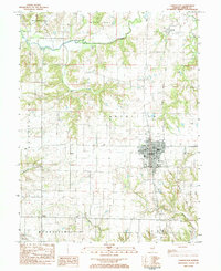 1983 Carrollton1984 Print · USGSGreene County in the early 1980s reveals a landscape of established farm communities and the central hub of Carrollton. Researchers can trace local genealogy through numerous burial sites like Pinkerton Cem and small settlements including Berdan and Woody.
 - 1985 Map of Jerseyville
 1985 Jerseyville1985 Print · USGSThe confluence of the Illinois and Mississippi rivers defines this 1980s landscape of fertile bottomlands and rail-hub towns. Genealogists and historians can trace the foundations of communities like Jerseyville and White Hall alongside the Oak Grove Cem and St Mary Church.2 unique versions available
 - 2012 Map of Carrollton, 2012 Print
 2012 Carrollton2012 Print · USGSCovers Woody, including Carrollton, Pegram, and other nearby areas
 - 2015 Map of Carrollton, 2015 Print
 2015 Carrollton2015 Print · USGSCovers Woody, including Carrollton, Pegram, and other nearby areas
 - 2018 Map of Carrollton, 2018 Print
 2018 Carrollton2018 Print · USGSCovers Woody, including Carrollton, Pegram, and other nearby areas
 - 2021 Map of Carrollton, 2021 Print
 2021 Carrollton2021 Print · USGSCovers Woody, including Carrollton, Pegram, and other nearby areas
 - 2024 Map of Carrollton, 2024 Print
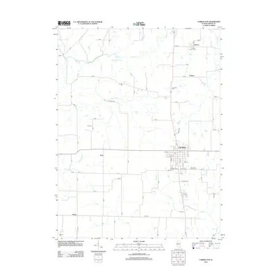
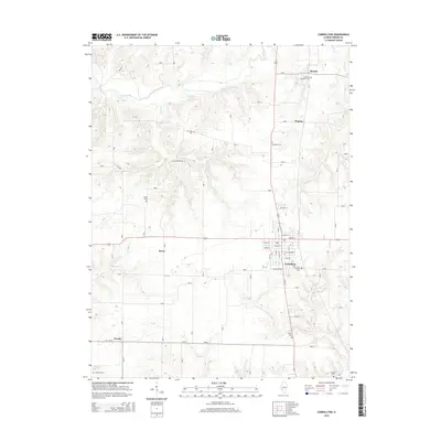
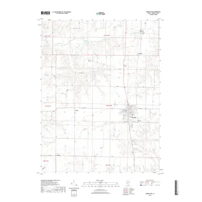
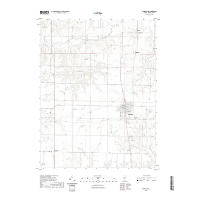
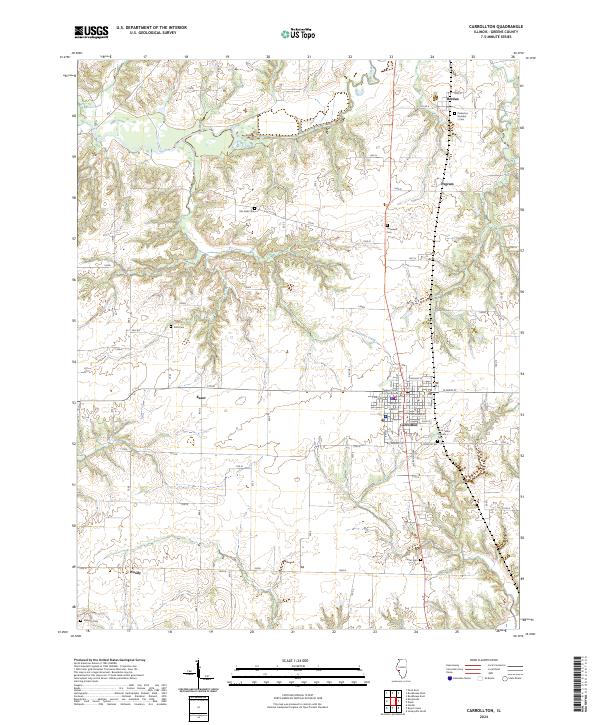 2024 Carrollton2024 Print · USGSGreene County’s agricultural landscape is documented here in the contemporary era, centered on the historic seat of Carrollton. Genealogists can locate several local burial grounds including Saint Johns Catholic Cem and Pinkerton Number 1 Cem.
End of results
Showing maps 1-11 of 11
Top cities near Woody
- Jerseyville historical maps
- Carrollton historical maps
- White Hall historical maps
- Roodhouse historical maps
- Hardin historical maps
- Patterson historical maps
See more
Frequently asked questions
- What are the different types of historical maps available for Woody?
- What is the oldest map of Woody?
- Where can I purchase historical maps of Woody for my home or office?
- Where can I download high-res historical maps of Woody?
- Are there historical topographic maps available for Woody?
- Is there historical aerial imagery available for Woody?
- Where are historical maps of Woody sourced from?