Old Maps of Nettle Creek Township, Illinois for Metal Detecting
Plan your next treasure hunt with 36 historic maps of Nettle Creek Township. Find old homesites, ghost towns, trails, and gathering spots that may be lost to time — perfect for identifying promising metal detecting locations.
- Locate forgotten sites: Uncover places like long-lost settlements, abandoned rail lines, or gathering spots.
- Plan better hunts: Use map overlays combined with LiDAR or satellite views to narrow in on historically rich areas.
- Made for detectorists: Thousands of hobbyists use these maps to discover relics, coins, and hidden history.
Use these historic maps to boost your research and find new opportunities beneath the surface of Nettle Creek Township.
Nettle Creek Township, IL maps
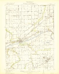
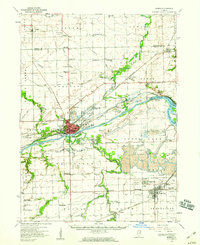
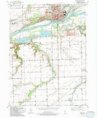
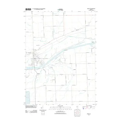
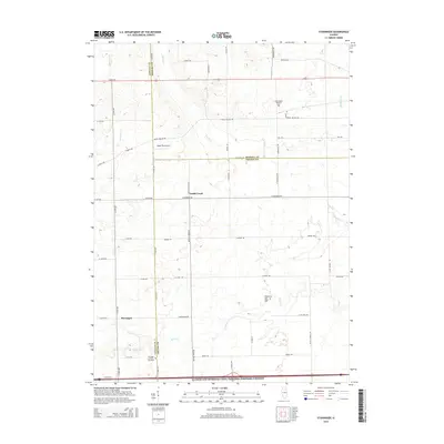
(36)- 1892 Map of Morris
 1892 Morris1892 Print · USGSGrundy County thrives as a transportation nexus in the 1890s, where the legendary canal system meets a growing web of iron rails. Trace early industrial footprints in Coal City or follow the path of the Illinois and Michigan Canal through Morris.3 unique versions available
 - 1892 Map of Marseilles
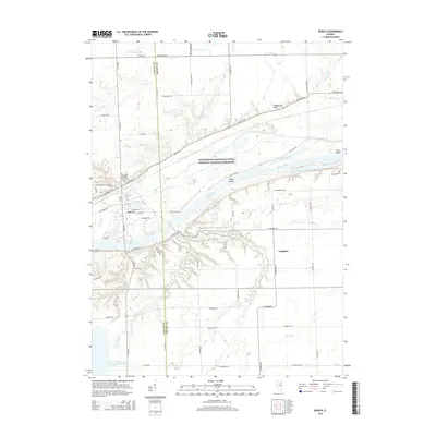
 1892 Marseilles1892 Print · USGSLaSalle County at the close of the nineteenth century showcases a bustling corridor of river commerce and rail expansion. Trace the historic path of the Illinois and Michigan Canal through Marseilles or locate early settlements like Norway and Stavanger.3 unique versions available
 - 1916 Map of Marseilles
 1916 Marseilles1916 Print · USGSThe Illinois River valley in the early twentieth century shows a busy network of canals, electric railways, and rural schools. Trace the early layout of Marseilles, the Michigan Canal, and dozens of local landmarks like Norway and the Fox River Academy.4 unique versions available
 - 1918 Map of Morris
 1918 Morris1918 Print · USGSGrundy County at the end of the Great War is a landscape defined by the Illinois River and a bustling coal industry. Researchers can trace historic school districts like Jugtown School, the path of the Michigan and Illinois Canal, and early mining settlements such as Carbon Hill and Eileen.3 unique versions available
 - 1940 Map of Marseilles, 1958 Print
 1940 Marseilles1958 Print · USGSLaSalle and Grundy counties appear here during the transition from the canal era to the railway age. Genealogists and local historians can trace family-named school sites like Ness School and Barry School or locate the village of Stavanger.
 - 1953 Map of Morris, 1955 Print
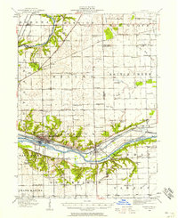
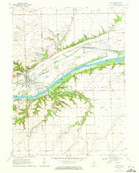
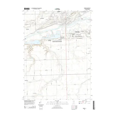
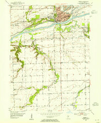 1953 Morris1955 Print · USGSMorris and the surrounding Grundy County river lands were thriving in the early fifties as industry and transit intersected along the Illinois River. Genealogists and local historians can trace rural school locations like Stein Sch and Haymond Sch, or locate family sites near Zion Ch and the Evergreen Cem.3 unique versions available
 - 1953 Map of Lisbon, 1955 Print
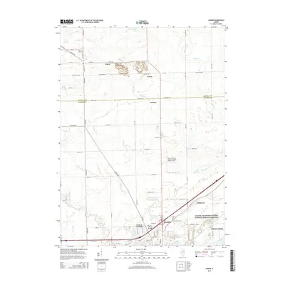
 1953 Lisbon1955 Print · USGSKendall and Grundy Counties were still defined by their rural character and rail-linked industry in the early fifties. Genealogists can locate several family-named landmarks and country schools including Porter Sch, Cryder Cem, and the Gore Sch.3 unique versions available
 - 1954 Map of Morris, 1960 Print
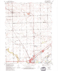
 1954 Morris1960 Print · USGSGrundy County in the mid-fifties is a landscape of industrial transition, where coal mining and river navigation drive local growth. Researchers can trace the extensive Strip Mine works around Coal City or locate family roots at Evergreen Cem and Sulphur Springs Sch.2 unique versions available
 - 1958 Map of Aurora, 1969 Print
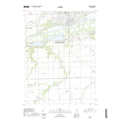
 1958 Aurora1969 Print · USGSNorthern Illinois in the late fifties shows a landscape of powerful river industry and expanding transport corridors. Genealogists and historians can trace the development of Aurora and Joliet or locate sites like the Elwood Ordnance Plant and Starved Rock.3 unique versions available
 - 1961 Map of Aurora
 1961 Aurora1961 Print · USGSNorthern Illinois at the height of the post-war era reveals a landscape of massive industrial works and thriving river towns. Genealogists and historians can trace the paths of the Lincoln Highway or locate long-standing landmarks like the Green River Ordnance Plant and Starved Rock State Park.
 - 1970 Map of Seneca, 1972 Print
 1970 Seneca1972 Print · USGSThe Seneca riverfront and its industrial corridor are captured here during the 1970s. Researchers can trace the path of the Illinois and Michigan Canal (Abandoned) and locate the U.S. Govt Reservation and the village of Langham.2 unique versions available
 - 1970 Map of Stavanger, 1972 Print
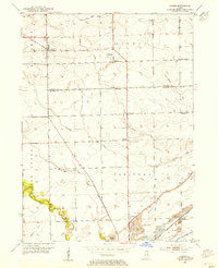
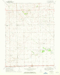 1970 Stavanger1972 Print · USGSThe rural prairie lands of Grundy and LaSalle counties are shown in detail as they appeared in the early seventies. Genealogists can locate family names at Holderman and Hoge Cem or trace the local community near Stavanger and the Nettle Creek Sch.
 - 1985 Map of Ottawa
 1985 Ottawa1985 Print · USGSThe Illinois River valley in the mid-1980s shows a landscape balancing river commerce with sprawling energy and mining operations. Researchers can trace the layout of mining towns like Coal City or find family landmarks such as Oakwood Memorial Cem and Smiths Mound.
 - 1991 Map of Ottawa
 1991 Ottawa1991 Print · USGSNorth-central Illinois in the early nineties remains a vital corridor of river commerce and heavy rail. Genealogists and historians can trace the legacy of industrial mining near Morris or explore the river-bluff geography of Starved Rock State Park and Buffalo Rock.
 - 1993 Map of Lisbon, 1994 Print
 1993 Lisbon1994 Print · USGSLisbon and Morris appear at the start of the nineties, where the quiet prairie of Kendall and Grundy counties meets the historic canal corridor. Researchers can trace family sites at Saratoga Cem and Saratoga Sch Cem or locate the Nelson Landing Strip and John Moore Park.
 - 1993 Map of Morris, 1994 Print
 1993 Morris1994 Print · USGSThe Illinois River corridor near Morris thrives as a hub of canal history and rail transport in the early nineties. Genealogists and local historians can locate Evergreen Cem, trace the CSX RR line, and find vanished rural landmarks like Pavilionville.
 - 2012 Map of Morris, 2012 Print
 2012 Morris2012 Print · USGSCovers Nettle Creek Township, including Morris, Wauponsee, and other nearby areas
 - 2012 Map of Lisbon, 2012 Print
 2012 Lisbon2012 Print · USGSCovers Nettle Creek Township, including Channahon, Morris, and other nearby areas
 - 2012 Map of Stavanger, 2012 Print
 2012 Stavanger2012 Print · USGSCovers Nettle Creek Township, including Nettle Creek, Miller Township, and other nearby areas
 - 2012 Map of Seneca, 2012 Print
 2012 Seneca2012 Print · USGSCovers Nettle Creek Township, including Miller Township, Langham, and other nearby areas
 - 2015 Map of Lisbon, 2015 Print
 2015 Lisbon2015 Print · USGSCovers Nettle Creek Township, including Channahon, Morris, and other nearby areas
 - 2015 Map of Seneca, 2015 Print
 2015 Seneca2015 Print · USGSCovers Nettle Creek Township, including Miller Township, Langham, and other nearby areas
 - 2015 Map of Morris, 2015 Print
 2015 Morris2015 Print · USGSCovers Nettle Creek Township, including Morris, Wauponsee, and other nearby areas
 - 2015 Map of Stavanger, 2015 Print
 2015 Stavanger2015 Print · USGSCovers Nettle Creek Township, including Nettle Creek, Miller Township, and other nearby areas
 - 2018 Map of Morris, 2018 Print
 2018 Morris2018 Print · USGSCovers Nettle Creek Township, including Morris, Wauponsee, and other nearby areas
Showing maps 1-25 of 36
Top cities near Nettle Creek Township
- Joliet historical maps
- Oswego historical maps
- Yorkville historical maps
- Channahon historical maps
- Morris historical maps
- Minooka historical maps
See more
Top neighborhoods of Nettle Creek Township
Frequently asked questions
- What are the different types of historical maps available for Nettle Creek Township?
- What is the oldest map of Nettle Creek Township?
- Where can I purchase historical maps of Nettle Creek Township for my home or office?
- Where can I download high-res historical maps of Nettle Creek Township?
- Are there historical topographic maps available for Nettle Creek Township?
- Is there historical aerial imagery available for Nettle Creek Township?
- Where are historical maps of Nettle Creek Township sourced from?