1900s (20th Century) Maps of Delafield, Illinois
Explore 6 historic maps of Delafield from the 1900s (20th Century). These maps offer a rare glimpse into what life looked like during the 1900s — showing old roads, neighborhoods, homes, and landmarks that have changed or disappeared over time.
Whether you're researching your family's past, planning a metal detecting trip, or studying how Delafield's landscape evolved across the 1900s, these high-resolution maps are a powerful tool for exploring the history of this region.
- Focus on a specific era: All maps on this page are from the 1900s, giving you a focused view of this time period.
- See what’s changed: Compare century-old streets, trails, and buildings to today's modern landscape using overlays and satellite layers.
- Research with precision: Use these maps for genealogy, historical research, land use analysis, or educational projects.
- View, download, or print: Maps are fully viewable online in high resolution, and can be downloaded or printed for your own records.
Start exploring Delafield's history through authentic maps from the 1900s. This is your window into the past.
Delafield, IL maps
(6)- 1942 Map of McLeansboro, 1961 Print
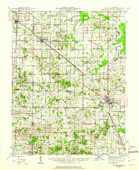 1942 McLeansboro1961 Print · USGSHamilton County in the early 1940s was a landscape of tightly-knit farming communities and small rail stops. Genealogists can trace family roots through a remarkable number of local landmarks like Piopolis, Seminary Sch, and Union Hill Cem.2 unique versions available
 - 1945 Map of McLeansboro
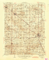 1945 McLeansboro1945 Print · USGSIn the mid-1940s, this portion of Southern Illinois was a landscape of steam-era rail junctions and tight-knit rural school districts. Genealogists can trace family roots through scores of rural landmarks, from Knight Prairie and Piopolis to the Sulphur Springs Sch.2 unique versions available
 - 1958 Map of Belleville, 1973 Print
 1958 Belleville1973 Print · USGSSouthern Illinois during the mid-twentieth century reveals a landscape of industrial growth and massive new reservoirs. Genealogists and historians can trace the paths of the Illinois Central RR through towns like Centralia or locate landmarks such as Emerald Mound and the Looking Glass Prairie.3 unique versions available
 - 1962 Map of Belleville
 1962 Belleville1962 Print · USGSSouthern Illinois in the late fifties reveals a landscape of industrial growth and ancient landmarks before the full expansion of the interstate system. Genealogists can trace family names and rural post offices near Centralia, Salem, and the historic Monks Mound.
 - 1974 Map of Belle Prairie City, 1977 Print
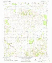 1974 Belle Prairie City1977 Print · USGSHamilton County in the mid-seventies retains its quiet rural character, centered on agricultural settlements and the railroad. Genealogists can trace family locations near Piopolis or locate burial sites at Blooming Grove Cem and Rawls Cem.
 - 1982 Map of Mount Vernon
 1982 Mount Vernon1982 Print · USGSSouthern Illinois and Southwestern Indiana meet here during a period of significant regional water management and transit growth. Researchers can trace the development of Rend Lake and locate vanished rail stops along the Southern RR near Bluford and Golden Gate.
End of results
Showing maps 1-6 of 6
Top cities near Delafield
- Fairfield historical maps
- McLeansboro historical maps
- Wayne City historical maps
- Bluford historical maps
- Dahlgren historical maps
- Belle Rive historical maps
See more
Frequently asked questions
- What are the different types of historical maps available for Delafield?
- What is the oldest map of Delafield?
- Where can I purchase historical maps of Delafield for my home or office?
- Where can I download high-res historical maps of Delafield?
- Are there historical topographic maps available for Delafield?
- Is there historical aerial imagery available for Delafield?
- Where are historical maps of Delafield sourced from?