Old Maps of Henderson County, Illinois for Metal Detecting
Plan your next treasure hunt with 97 historic maps of Henderson County. Find old homesites, ghost towns, trails, and gathering spots that may be lost to time — perfect for identifying promising metal detecting locations.
- Locate forgotten sites: Uncover places like long-lost settlements, abandoned rail lines, or gathering spots.
- Plan better hunts: Use map overlays combined with LiDAR or satellite views to narrow in on historically rich areas.
- Made for detectorists: Thousands of hobbyists use these maps to discover relics, coins, and hidden history.
Use these historic maps to boost your research and find new opportunities beneath the surface of Henderson County.
Henderson County, IL maps
(97)- 1918 Map of La Harpe
 1918 La Harpe1918 Print · USGSWestern Illinois farm life in the late teens is captured here through a remarkably dense grid of rural schools and rail-fed townships. Genealogists can trace family footprints across dozens of local districts like Sunny Ridge School and Waggy School or along the Santa Fe line.4 unique versions available
 - 1932 Map of Lomax, 1957 Print
 1932 Lomax1957 Print · USGSWestern Illinois river towns and railroad junctions thrive during the early 1930s as the river remains a central artery for commerce and life. Genealogists can trace family footprints across dozens of rural landmarks, including Dallas City, Gittings Mound, and the uniquely named Froggie Sch.
 - 1934 Map of Oquawka
 1934 Oquawka1934 Print · USGSHenderson County river life and prairie farming are captured here in the mid-thirties, from the Mississippi sloughs to the railroad towns. Genealogists can locate family landmarks including the County Farm, Coghill Cem, and the Little Brick Sch.3 unique versions available
 - 1934 Map of Burlington
 1934 Burlington1934 Print · USGSThe river bottomlands of Illinois and Iowa come alive in the mid-1930s, showing a landscape defined by the shifting currents and rail lines. Genealogists and historians can trace small rural communities and local education centers like Orchard City, Carthage Junc, and Crystal Lake Sch.2 unique versions available
 - 1935 Map of Keithsburg
 1935 Keithsburg1935 Print · USGSMercer County during the mid-thirties reveals a landscape of river towns and railroad junctions along the Mississippi. Genealogists and local historians can trace rural roots at Peniel Ch, Brick Cem, and numerous schoolhouses like Hazel Dell Sch.4 unique versions available
 - 1937 Map of Lomax
 1937 Lomax1937 Print · USGSThe riverfront and rail corridors of Henderson and Hancock Counties come alive in the late 1930s, documenting a time of active country schools and river commerce. Genealogists can locate family landmarks like Gittings Cem, Enterprise Ch, and distinctively named sites like Shake Rag Sch.2 unique versions available
 - 1940 Map of Oquawka
 1940 Oquawka1940 Print · USGSHenderson County's river-and-rail economy is captured here during the 1930s as the Mississippi River environment meets an expanding network of rural towns. Genealogists and historians can trace dozens of country schoolhouses and cemeteries, from the Little Brick Sch to South Henderson Cem.2 unique versions available
 - 1940 Map of Burlington
 1940 Burlington1940 Print · USGSThe Mississippi River floodplain comes alive in the mid-1930s, showing the intricate network of sloughs and rail lines between Illinois and Iowa. Genealogists and historians can locate rural landmarks like Merry Dell Sch, trace the Chicago Burlington and Quincy tracks, or explore the riverfront at Gulfport.3 unique versions available
 - 1941 Map of Keithsburg
 1941 Keithsburg1941 Print · USGSThe Mississippi River front in Mercer County thrived during the early 1940s as a hub of rail and river commerce. Genealogists can trace family footprints through dozens of rural landmarks, from Peniel Ch to schoolhouses like Prouty Sch and Lee Sch.2 unique versions available
 - 1958 Map of Burlington, 1968 Print
 1958 Burlington1968 Print · USGSThe tri-state river country of Iowa, Illinois, and Missouri is captured here in the mid-fifties, dominated by the Mississippi River and major rail lines. Genealogists and historians can trace the development of river towns like Keokuk or locate the sprawling Iowa Army Ammunition Plant.4 unique versions available
 - 1958 Map of Davenport, 1968 Print
 1958 Davenport1968 Print · USGSEastern Iowa and western Illinois thrive along the river during the late fifties, defined by the industrial Quad Cities and a robust rail network. Genealogists can trace family roots through settlements like Oasis and Stanwood or along the Cedar River.2 unique versions available
 - 1961 Map of Burlington
 1961 Burlington1961 Print · USGSThe tri-state borderlands along the Mississippi River are captured here during the late fifties and early sixties, showing the vital river-and-rail economy of Iowa, Illinois, and Missouri. Genealogists and historians can trace the development of major hubs like Galesburg and Macomb alongside landmark sites such as the Iowa Ordnance Plant and the historic river town of Nauvoo.
 - 1961 Map of Davenport
 1961 Davenport1961 Print · USGSThe Quad Cities and the eastern Iowa riverlands are captured here in the early sixties, showing the region's transition into a modern industrial and transit hub. Genealogists and historians can trace the paths of major railroads and find river landmarks like Rock Island Arsenal, Huron Island, and the Coralville Reservoir.
 - 1962 Map of Davenport
 1962 Davenport1962 Print · USGSThe Quad Cities and the Mississippi River corridor are shown at their industrial peak just before the interstate era fully transformed the region. Researchers can trace the sprawling rail networks of the Chicago Rock Island and Pacific and find landmarks like the Rock Island Arsenal and Wild Cat Den State Park.
 - 1963 Map of Burlington
 1963 Burlington1963 Print · USGSThe tri-state river country of the Mississippi and Illinois valleys comes alive in this mid-century survey. Genealogists and historians can trace the industrial and academic growth of the region, from the Iowa Ordnance Plant to campuses like Knox College and Western Illinois University.
 - 1964 Map of Burlington, 1965 Print
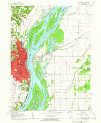 1964 Burlington1965 Print · USGSMid-century Burlington and the Mississippi riverfront are captured here as the city expanded westward toward the Burlington Municipal Airport. Genealogists can locate family landmarks like Sacred Heart Cemetery, St Johns School, and the scattered homes of Heapsville.3 unique versions available
 - 1964 Map of Lomax, 1965 Print
 1964 Lomax1965 Print · USGSThe Mississippi River floodplain and rail junctions of Henderson County are captured here in the mid-1960s. Genealogists can trace family sites at Gittings Cem and Freeland Cem or follow the heavy rail traffic through Lomax and Iowa Junction.
 - 1964 Map of Dallas City, 1965 Print
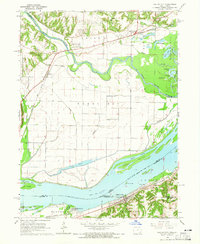 1964 Dallas City1965 Print · USGSThe Mississippi River floodplain in the 1960s reveals a landscape of industrial rail lines and intricate backwaters. Trace the historic tracks of the Atchison Topeka and Santa Fe or locate rural landmarks like Oak Grove Ch and Eureka Sch.4 unique versions available
 - 1964 Map of Kingston, 1966 Print
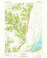 1964 Kingston1966 Print · USGSDes Moines County, Iowa, and the Mississippi River bottoms are captured here in the mid-1960s. Researchers can trace the river's path through Running Slough or locate local landmarks like Tama Sch and St Pauls Ch.2 unique versions available
 - 1974 Map of Stronghurst, 1978 Print
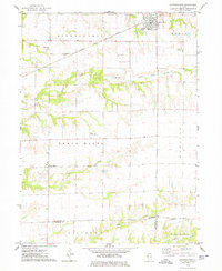 1974 Stronghurst1978 Print · USGSWestern Illinois farmland and the villages along the Santa Fe and Topeka Atchison railroad appear in this mid-seventies survey. Researchers can locate remote rural sites like the Old Bedford Ch, Smith Landing Strip, and Peasley Cem.
 - 1974 Map of Raritan, 1978 Print
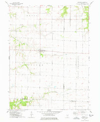 1974 Raritan1978 Print · USGSRaritan and the surrounding prairie townships are captured here in the mid-1970s, showcasing the intersection of three Illinois counties. Researchers can trace land divisions and local landmarks like St Patricks Ch and the headwaters of the La Moine River.
 - 1982 Map of Oquawka, 1983 Print
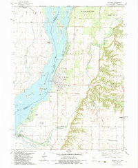 1982 Oquawka1983 Print · USGSThe Mississippi River's eastern banks in the early eighties reveal a landscape of protected wetlands and historic river towns. Genealogists and local historians can trace legacy sites like County Farm Cem, the Covered Bridge, and the riverfront at Oquawka.
 - 1982 Map of Kirkwood West, 1983 Print
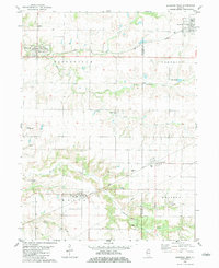 1982 Kirkwood West1983 Print · USGSHenderson and Warren Counties are seen here in the early eighties as the railroads supported a network of grain-handling prairie towns. Genealogists can locate family sites at Salters Grove Cem, Adair Cem, and Township Cem near the village of Media.
 - 1982 Map of Keithsburg, 1983 Print
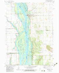 1982 Keithsburg1983 Print · USGSThe riverfront town of Keithsburg and its surrounding Illinois and Iowa bottomlands are captured here in the early eighties. Genealogists and historians can trace the Old Railroad Grade, locate the St Marys Cem, and explore the wetlands of the Mark Twain National Wildlife Refuge.
 - 1982 Map of Seaton, 1983 Print
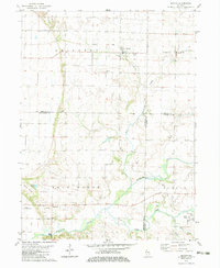 1982 Seaton1983 Print · USGSWestern Illinois farmland near the Mercer and Henderson county lines is documented here in the early eighties. Genealogists and local historians can trace the Old Railroad Grade near Seaton or locate rural landmarks like Belmont Ch and Hawkins Cem.
Showing maps 1-25 of 97
Top cities of Henderson County
- Oquawka historical maps
- Stronghurst historical maps
- Lomax historical maps
- Carman historical maps
- Biggsville historical maps
- Rozetta historical maps
See more
Frequently asked questions
- What are the different types of historical maps available for Henderson County?
- What is the oldest map of Henderson County?
- Where can I purchase historical maps of Henderson County for my home or office?
- Where can I download high-res historical maps of Henderson County?
- Are there historical topographic maps available for Henderson County?
- Is there historical aerial imagery available for Henderson County?
- Where are historical maps of Henderson County sourced from?