1970s Maps of Henderson County, Illinois
Explore 2 historic maps of Henderson County from the 1970s. These maps offer a rare glimpse into what life looked like during the 1970s — showing old roads, neighborhoods, homes, and landmarks that have changed or disappeared over time.
Whether you're researching your family's past, planning a metal detecting trip, or studying how Henderson County's landscape evolved across the 1970s, these high-resolution maps are a powerful tool for exploring the history of this region.
- Focus on a specific era: All maps on this page are from the 1970s, giving you a focused view of this time period.
- See what’s changed: Compare century-old streets, trails, and buildings to today's modern landscape using overlays and satellite layers.
- Research with precision: Use these maps for genealogy, historical research, land use analysis, or educational projects.
- View, download, or print: Maps are fully viewable online in high resolution, and can be downloaded or printed for your own records.
Start exploring Henderson County's history through authentic maps from the 1970s. This is your window into the past.
Henderson County, IL maps
(2)- 1974 Map of Stronghurst, 1978 Print
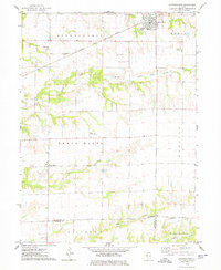 1974 Stronghurst1978 Print · USGSWestern Illinois farmland and the villages along the Santa Fe and Topeka Atchison railroad appear in this mid-seventies survey. Researchers can locate remote rural sites like the Old Bedford Ch, Smith Landing Strip, and Peasley Cem.
 - 1974 Map of Raritan, 1978 Print
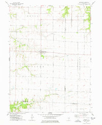 1974 Raritan1978 Print · USGSRaritan and the surrounding prairie townships are captured here in the mid-1970s, showcasing the intersection of three Illinois counties. Researchers can trace land divisions and local landmarks like St Patricks Ch and the headwaters of the La Moine River.
End of results
Showing maps 1-2 of 2
Top cities of Henderson County
- Oquawka historical maps
- Stronghurst historical maps
- Lomax historical maps
- Carman historical maps
- Biggsville historical maps
- Rozetta historical maps
See more
Frequently asked questions
- What are the different types of historical maps available for Henderson County?
- What is the oldest map of Henderson County?
- Where can I purchase historical maps of Henderson County for my home or office?
- Where can I download high-res historical maps of Henderson County?
- Are there historical topographic maps available for Henderson County?
- Is there historical aerial imagery available for Henderson County?
- Where are historical maps of Henderson County sourced from?