Old Maps of Shady Beach, Illinois for Academic Research
Study the evolution of Shady Beach with 12 high-resolution historic maps. Whether you're teaching, researching, or modeling changes in land use, these maps provide essential visual documentation of urban, environmental, and geographic change.
- Analyze long-term change: Track patterns in development, transportation, and natural features.
- Ideal for environmental or urban studies: Support academic projects with primary historical map data.
- Use in the classroom or lab: Educators and researchers rely on these maps to bring historical context to life.
These maps are a powerful tool for teaching, research, and visualizing how Shady Beach has changed over the decades.
Shady Beach, IL maps
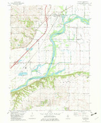
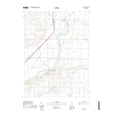
(12)- 1899 Map of Clinton
 1899 Clinton1899 Print · USGSThe Mississippi River valley comes alive in the late 1890s, capturing the river-and-rail economy of Iowa and Illinois before modern channelization. Genealogists and historians can trace early townships and river landings, finding precise locations for Low Moor, Folletts, and Pink Prairie.5 unique versions available
 - 1952 Map of Erie, 1953 Print
 1952 Erie1953 Print · USGSWhiteside and Henry counties are mapped here in the early fifties, showing a rural river-bound landscape along the Rock River. Local historians can trace family roots at Pink Prairie Cem or locate the site of the Old Stage Line Monument and Kingsbury Sch.2 unique versions available
 - 1958 Map of Davenport, 1968 Print
 1958 Davenport1968 Print · USGSEastern Iowa and western Illinois thrive along the river during the late fifties, defined by the industrial Quad Cities and a robust rail network. Genealogists can trace family roots through settlements like Oasis and Stanwood or along the Cedar River.2 unique versions available
 - 1961 Map of Davenport
 1961 Davenport1961 Print · USGSThe Quad Cities and the eastern Iowa riverlands are captured here in the early sixties, showing the region's transition into a modern industrial and transit hub. Genealogists and historians can trace the paths of major railroads and find river landmarks like Rock Island Arsenal, Huron Island, and the Coralville Reservoir.
 - 1962 Map of Davenport
 1962 Davenport1962 Print · USGSThe Quad Cities and the Mississippi River corridor are shown at their industrial peak just before the interstate era fully transformed the region. Researchers can trace the sprawling rail networks of the Chicago Rock Island and Pacific and find landmarks like the Rock Island Arsenal and Wild Cat Den State Park.
 - 1982 Map of Hillsdale
 1982 Hillsdale1982 Print · USGSIn the early 1980s, the Rock River valley near Hillsdale remained a land defined by its winding sloughs and rural cemeteries. Genealogists and local historians can locate Mount Moriah Cem and Bethesda Cem, or trace the old rail lines serving Joslin.
 - 1984 Map of Davenport, 1985 Print
 1984 Davenport1985 Print · USGSThe Quad Cities and the eastern Iowa riverlands are captured in the mid-eighties as industry and conservation converged along the Mississippi. Genealogists and local historians can trace rural roots through Stender Church, Oxford Mills, and the Elmwood Cem burial grounds.2 unique versions available
 - 2012 Map of Hillsdale, 2012 Print
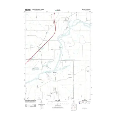 2012 Hillsdale2012 Print · USGSCovers Shady Beach, including Hillsdale, Joslin, and other nearby areas
 - 2015 Map of Hillsdale, 2015 Print
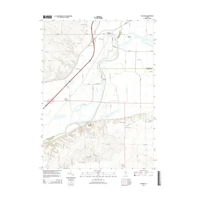 2015 Hillsdale2015 Print · USGSCovers Shady Beach, including Hillsdale, Joslin, and other nearby areas
 - 2018 Map of Hillsdale, 2018 Print
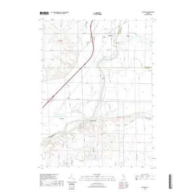 2018 Hillsdale2018 Print · USGSCovers Shady Beach, including Hillsdale, Joslin, and other nearby areas
 - 2021 Map of Hillsdale, 2021 Print
 2021 Hillsdale2021 Print · USGSCovers Shady Beach, including Hillsdale, Joslin, and other nearby areas
 - 2024 Map of Hillsdale, 2024 Print
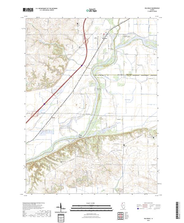 2024 Hillsdale2024 Print · USGSThe Rock River valley near the tri-county junction of Rock Island, Whiteside, and Henry is captured in this modern survey. Researchers can locate family sites at Bethesda Cem and McHenry Cem or trace old river-bottom routes along Angel Ferry Rd.
End of results
Showing maps 1-12 of 12
Top cities near Shady Beach
- Bettendorf historical maps
- East Moline historical maps
- Silvis historical maps
- Geneseo historical maps
- Colona historical maps
- Le Claire historical maps
See more
Frequently asked questions
- What are the different types of historical maps available for Shady Beach?
- What is the oldest map of Shady Beach?
- Where can I purchase historical maps of Shady Beach for my home or office?
- Where can I download high-res historical maps of Shady Beach?
- Are there historical topographic maps available for Shady Beach?
- Is there historical aerial imagery available for Shady Beach?
- Where are historical maps of Shady Beach sourced from?