1900s (20th Century) Maps of Pitchin, Illinois
Explore 8 historic maps of Pitchin from the 1900s (20th Century). These maps offer a rare glimpse into what life looked like during the 1900s — showing old roads, neighborhoods, homes, and landmarks that have changed or disappeared over time.
Whether you're researching your family's past, planning a metal detecting trip, or studying how Pitchin's landscape evolved across the 1900s, these high-resolution maps are a powerful tool for exploring the history of this region.
- Focus on a specific era: All maps on this page are from the 1900s, giving you a focused view of this time period.
- See what’s changed: Compare century-old streets, trails, and buildings to today's modern landscape using overlays and satellite layers.
- Research with precision: Use these maps for genealogy, historical research, land use analysis, or educational projects.
- View, download, or print: Maps are fully viewable online in high resolution, and can be downloaded or printed for your own records.
Start exploring Pitchin's history through authentic maps from the 1900s. This is your window into the past.
Pitchin, IL maps
(8)- 1939 Map of Cissna Park, 1940 Print
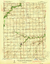 1939 Cissna Park1940 Print · USGSIroquois County at the end of the 1930s reveals a vast network of one-room schools and prairie rail stops. Genealogists can trace family footprints across dozens of rural landmarks, from Possum Trot Sch and Prairie Queen Sch to the quiet grounds of ASH GROVE CEM.
 - 1949 Map of Cissna Park
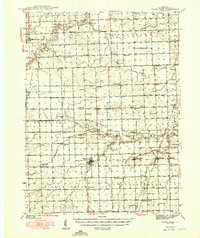 1949 Cissna Park1949 Print · USGSIroquois County's agricultural heartland is documented here in the years following World War II, showing a landscape defined by small farms and rail-stop villages. Researchers can locate dozens of localized landmarks, from Amity Cem to uniquely named rural schools like Possum Trot Sch and Pond Lily Sch.3 unique versions available
 - 1953 Map of Danville, 1965 Print
 1953 Danville1965 Print · USGSIndiana and Illinois crossroads come to life in this mid-century survey as the interstate era begins to reshape the river-and-rail landscape. Genealogists and collectors can trace the historic paths of the Nickel Plate railroad or locate smaller communities like Veedersburg, Goodland, and Bismarck.3 unique versions available
 - 1955 Map of Danville
 1955 Danville1955 Print · USGSThe Indiana-Illinois borderlands during the mid-fifties reveal a landscape of thriving rail hubs and university towns. Researchers can trace the legacy of Purdue University, the Tippecanoe Battlefield, and the path of the Pennsylvania RR.
 - 1956 Map of Danville
 1956 Danville1956 Print · USGSMid-century Indiana and Illinois are captured here as the river-and-rail economy evolved into the modern highway era. Researchers can trace ancestral roots and old transport lines through Logansport, Battle Ground, and the dams at Lake Shafer.
 - 1984 Map of Watseka, 1985 Print
 1984 Watseka1985 Print · USGSThe Illinois-Indiana borderlands thrived on a dense rail and river network during the mid-eighties. Genealogists and local historians can trace the foundations of rural life through landmarks like St Josephs College, the Iroquois Hospital, and towns like Milford and Beaverville.
 - 1986 Map of Claytonville
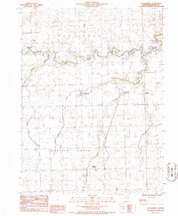 1986 Claytonville1986 Print · USGSIroquois County prairie life is documented in the 1980s across the townships of Ash Grove and Lovejoy. Genealogists and local historians can trace small-town footprints in Claytonville and Goodwine or locate family plots at several rural Cem sites.
 - 1990 Map of Watseka, 1991 Print
 1990 Watseka1991 Print · USGSThe Illinois and Indiana borderlands are captured here in the early nineties, showing a landscape defined by prairie drainage and rail lines. You can trace family roots through settlements like L'Erable and Raub or locate landmarks such as Saint Josephs College.
End of results
Showing maps 1-8 of 8
Top cities near Pitchin
- Hoopeston historical maps
- Watseka historical maps
- Paxton historical maps
- Gilman historical maps
- Onarga historical maps
- Milford historical maps
See more
Frequently asked questions
- What are the different types of historical maps available for Pitchin?
- What is the oldest map of Pitchin?
- Where can I purchase historical maps of Pitchin for my home or office?
- Where can I download high-res historical maps of Pitchin?
- Are there historical topographic maps available for Pitchin?
- Is there historical aerial imagery available for Pitchin?
- Where are historical maps of Pitchin sourced from?