1980s Maps of Jasper County, Illinois
Explore 18 historic maps of Jasper County from the 1980s. These maps offer a rare glimpse into what life looked like during the 1980s — showing old roads, neighborhoods, homes, and landmarks that have changed or disappeared over time.
Whether you're researching your family's past, planning a metal detecting trip, or studying how Jasper County's landscape evolved across the 1980s, these high-resolution maps are a powerful tool for exploring the history of this region.
- Focus on a specific era: All maps on this page are from the 1980s, giving you a focused view of this time period.
- See what’s changed: Compare century-old streets, trails, and buildings to today's modern landscape using overlays and satellite layers.
- Research with precision: Use these maps for genealogy, historical research, land use analysis, or educational projects.
- View, download, or print: Maps are fully viewable online in high resolution, and can be downloaded or printed for your own records.
Start exploring Jasper County's history through authentic maps from the 1980s. This is your window into the past.
Jasper County, IL maps
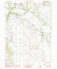
(18)- 1985 Map of Greenup
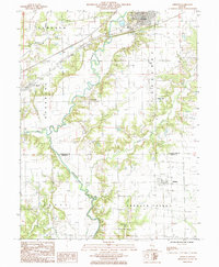 1985 Greenup1985 Print · USGSCumberland County’s river-bottom farms and rail towns are captured here in the mid-1980s as the landscape shifts toward modern infrastructure. Researchers can trace family roots through the grids of Greenup, Jewett, and Hidalgo, or locate historical sites like the Fairground and Liberty Hill.
 - 1985 Map of Latona
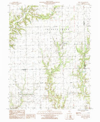
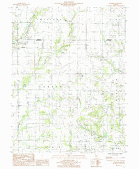
 1985 Latona1985 Print · USGSJasper County in the 1980s shows a unique mix of heavy energy infrastructure and dedicated wildlife conservation. Researchers can trace the development of Newton Lake near the Power Plant and locate rural hubs like Latona and Winterrowd.
 - 1985 Map of Woodbury
 1985 Woodbury1985 Print · USGSCumberland County at the mid-eighties shows a landscape defined by the Illinois Central Gulf railroad and small rural hubs. Local researchers can trace the old town sites of Woodbury and Roslyn or locate secluded cemeteries near the Jasper County line.
 - 1985 Map of Sailor Springs
 1985 Sailor Springs1985 Print · USGSThe rural borderlands of Clay and Jasper counties are captured here in the mid-1980s, centered on the village of Sailor Springs. Genealogists and local historians can trace the creek-side settlements of Ingraham and Wendelin or locate family plots near Big Muddy Creek.
 - 1985 Map of Hazel Dell
 1985 Hazel Dell1985 Print · USGSCumberland County’s rural landscape is captured in the mid-1980s, documenting the small settlements and local industry of east-central Illinois. Genealogists and researchers can trace family lands near Hazel Dell, locate isolated Oil Wells, and follow the banks of Crooked Creek.
 - 1985 Map of Dundas
 1985 Dundas1985 Print · USGSThe borderlands of Jasper and Richland counties in the mid-1980s show a landscape of quiet rural settlements and expanding reservoirs. Researchers can trace family sites near West Liberty, Dundas, and Rafetown, or locate old burials at several Cem locations near Olney Lake.
 - 1985 Map of Wheeler
 1985 Wheeler1985 Print · USGSSoutheastern Illinois farmland and the Jasper County countryside are documented in this mid-eighties survey. Researchers can locate the small settlements of Wheeler and Lis, along with rural landmarks like Island Grove and the winding Big Muddy Creek.
 - 1985 Map of Rose Hill
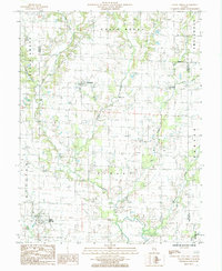
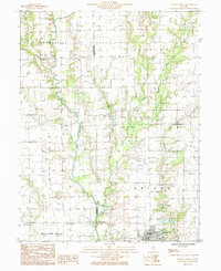
 1985 Rose Hill1985 Print · USGSIn the mid-1980s, this Jasper County landscape centered on the rural life of Rose Hill and Falmouth as the local rail lines went quiet. Researchers can trace family ties at various Cem sites, locate old Oil Fields, and explore the early trails of Sam Parr State Park.
 - 1985 Map of Ste Marie
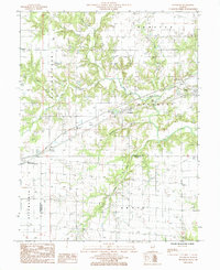
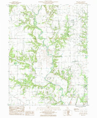
 1985 Ste Marie1985 Print · USGSJasper County in the mid-1980s reveals a quiet landscape of river bends and rural settlements along the Embarras River. Researchers can trace the layout of the Ste Marie community, locate the local St Marie Ch, or explore the terrain around the ancient Indian Mound.
 - 1985 Map of Wakefield
 1985 Wakefield1985 Print · USGSRichland and Jasper County farms and oil interests are shown in the mid-1980s as the region's rural character remained firmly intact. Genealogists can trace family locations near Wakefield, the settlement of Passport, and landmarks like Onion Hill or Berry Lake.
 - 1985 Map of Newton
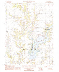
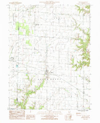
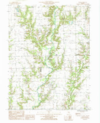
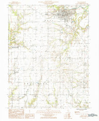 1985 Newton1985 Print · USGSJasper County in the mid-1980s reveals a landscape of river-valley agriculture and dedicated conservation land. Researchers can locate family homesteads near Bogota or Shamrock and trace the boundaries of the Jasper County State Prairie Chicken Sanctuary.
 - 1985 Map of Oblong North
 1985 Oblong North1985 Print · USGSCrawford and Jasper Counties come into focus during the mid-eighties as the local oil industry and river valley farming define the terrain. Genealogists and historians can trace the rural landscape from Kibbie and Dogwood to the banks of the North Fork Embarras River.
 - 1985 Map of Yale
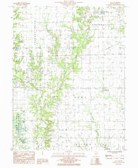 1985 Yale1985 Print · USGSJasper County in the mid-1980s reveals a landscape of active oil production and rural villages connected by the winding Crooked Creek. Trace local history through the streets of Yale, the layout of Hunt City, and the recreation areas at Sam Parr State Park.
 - 1985 Map of Moriah
 1985 Moriah1985 Print · USGSEastern Illinois farm country and the triple-county border of Clark, Jasper, and Crawford are captured here in the mid-1980s. Genealogists and local historians can trace small rural communities like Moonshine, Hogue Town, and Bellair along the North Fork Embarras River.
 - 1986 Map of Olney
 1986 Olney1986 Print · USGSSouth-central Illinois in the mid-eighties shows a landscape of small agricultural towns linked by historic rail lines and prairie preserves. Trace family roots and vanished rail stops near Kinmundy, the Prairie Chicken Sanctuary, and Salem.2 unique versions available
 - 1986 Map of Effingham
 1986 Effingham1986 Print · USGSCentral Illinois during the mid-eighties was a hub of rail travel and water recreation centered on the new reservoirs. Genealogists and historians can trace the rural landscape between Mattoon and Effingham, locating landmarks like St Paul Ch and Eagle Creek State Park.2 unique versions available
 - 1986 Map of Terre Haute
 1986 Terre Haute1986 Print · USGSThe Wabash River valley and the coal-rich hills of West-Central Indiana and East-Central Illinois are shown here in the mid-eighties. Genealogists and local historians can trace family-named corners like Barrick Corner, find rural churches like New Hope Ch, and locate industrial landmarks such as the Thunderbird Mine.2 unique versions available
 - 1986 Map of Vincennes
 1986 Vincennes1986 Print · USGSThe Wabash River valley in the mid-1980s shows a landscape defined by deep-rooted river towns and heavy industry. Researchers can trace the legacy of regional rail lines like the Conrail system or locate landmarks such as Vincennes University and St Francisville Church.2 unique versions available
End of results
Showing maps 1-18 of 18
Top cities of Jasper County
- Newton historical maps
- Hunt City historical maps
- Willow Hill historical maps
- Hidalgo historical maps
- Wheeler historical maps
- Yale historical maps
See more
Frequently asked questions
- What are the different types of historical maps available for Jasper County?
- What is the oldest map of Jasper County?
- Where can I purchase historical maps of Jasper County for my home or office?
- Where can I download high-res historical maps of Jasper County?
- Are there historical topographic maps available for Jasper County?
- Is there historical aerial imagery available for Jasper County?
- Where are historical maps of Jasper County sourced from?