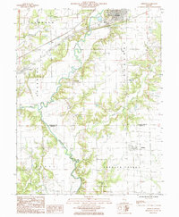
1985 Map of Greenup
USGS Topo · Published 1985About this map
The Embarras River carves a winding path through this portion of east-central Illinois, defining the landscape between the townships of Sumpter and Greenup. In the mid-1980s, the village of Greenup serves as a local hub, situated at the junction of the Illinois Central Gulf Railroad and the primary road network near the Fairground. The map documents a rural economy in transition, where an Abandoned R R corridor runs parallel to active lines, and scattered Oil Well sites dot the fields near Hidalgo and Crooked Creek.
Find a feature on this map
30 named features on this map. Tap any name to fly to it.
Don’t see what you’re looking for? This feature index may not catch every label — zoom into the map to look around manually.
Map Details
Editions of this 1985 Greenup Map
This is the sole edition of this map. No revisions or reprints were ever made.
Other maps of this area

1933 · Toledo
USGS Topo · 1:62,500

1934 · Mattoon
USGS Topo · 1:62,500

1937 · Mattoon
USGS Topo · 1:62,500

1938 · Toledo
USGS Topo · 1:62,500

1940 · Greenup
USGS Topo · 1:62,500

1943 · Greenup
USGS Topo · 1:62,500

1953 · Teutopolis
USGS Topo · 1:62,500

1958 · Decatur
USGS Topo · 1:250,000

1961 · Decatur
USGS Topo · 1:250,000
1984 · Toledo
USGS Topo · 1:24,000