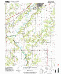
1998 Map of Greenup
USGS Topo · Published 2002About this map
The Embarras River winds through the heart of Cumberland and Jasper counties, defining a landscape of agricultural lowlands and wooded bluffs. In the north, the town of Greenup serves as a local hub, where the Fairground and extensive sewage disposal facilities sit just outside the main residential blocks. The river's meanders create a complex drainage system fed by Muddy Creek, Bruce Creek, and Cottonwood Creek, reflecting the traditional water-dependent settlement patterns of this Illinois region.
Find a feature on this map
26 named features on this map. Tap any name to fly to it.
Don’t see what you’re looking for? This feature index may not catch every label — zoom into the map to look around manually.
Map Details
Editions of this 1998 Greenup Map
This is the sole edition of this map. No revisions or reprints were ever made.
Other maps of this area

1933 · Toledo
USGS Topo · 1:62,500

1934 · Mattoon
USGS Topo · 1:62,500

1937 · Mattoon
USGS Topo · 1:62,500

1938 · Toledo
USGS Topo · 1:62,500

1940 · Greenup
USGS Topo · 1:62,500

1943 · Greenup
USGS Topo · 1:62,500

1953 · Teutopolis
USGS Topo · 1:62,500

1958 · Decatur
USGS Topo · 1:250,000

1961 · Decatur
USGS Topo · 1:250,000
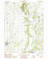
1984 · Toledo
USGS Topo · 1:24,000