Old Maps of Warren Township, Illinois
Explore 45 old maps of Warren Township, spanning from 1902 to today. These high-resolution historic maps reveal how streets, neighborhoods, landmarks, and natural features evolved over time — perfect for genealogy, metal detecting, research, and local history exploration.
What you can do with these maps:
- See how Warren Township changed over time: Compare historical maps to modern-day views to trace roads, homesites, rail lines & more.
- View detailed metadata: Each map includes creators, publishers, year, scale, and archive source.
- Overlay maps with satellite & LiDAR: Visualize the past alongside modern tools to explore terrain & human change.
- Trusted historical sources: Maps sourced from the USGS, Library of Congress, and other archives.
- Access maps your way: View online, download high-res files, or order prints for personal or research use.
Start exploring old maps of Warren Township to uncover forgotten places, hidden landmarks, and the deep history beneath your feet.
Warren Township, IL maps
(45)- 1902 Map of Mineral Point
 1902 Mineral Point1902 Print · USGSSouthwest Wisconsin and Northern Illinois are mapped here at the height of the regional mining era. Genealogists and historians can trace the rail lines of the Illinois Central to vanished junctions and local landmarks like Meekers Grove, Calamine, and Elk Grove.4 unique versions available
 - 1911 Map of Elizabeth
 1911 Elizabeth1911 Print · USGSNorthwestern Illinois at the start of the century was a landscape of ridge-top schools and valley-floor mines. Genealogists can trace early homesteads near Salem Church or locate historic mining operations like the Illinois Mines and Skene Mine.2 unique versions available
 - 1923 Map of South Wayne
 1923 South Wayne1923 Print · USGSSouthern Wisconsin and northern Illinois are shown in the early twenties as a landscape of interconnected river valleys and rail lines. Genealogists can trace dozens of country schoolhouses and churches, including Apple Grove Church, Reed School, and the community at South Wayne.3 unique versions available
 - 1936 Map of Elizabeth, 1957 Print
 1936 Elizabeth1957 Print · USGSNorthwest Illinois is shown in the mid-1930s as a landscape of isolated mounds and active lead mines. Genealogists can trace rural communities through dozens of local schoolhouses like Equal Rights School and small mining sites such as the Illinois Mine.2 unique versions available
 - 1937 Map of Lena
 1937 Lena1937 Print · USGSNorthwestern Illinois at the close of the Depression era shows a landscape dense with rural life and rail activity. Genealogists can trace family roots through numerous landmarks like Chelsea Ch, Blair Cem, and the Blackhawk Battlefield and Monument.
 - 1942 Map of Lena, 1963 Print
 1942 Lena1963 Print · USGSNorthwestern Illinois is documented here just as the rural rail-and-school network reached its peak. Genealogists and historians can trace family roots through numerous country schools like Eells Sch and historic sites such as the Blackhawk Battlefield and Monument.
 - 1943 Map of Lena
 1943 Lena1943 Print · USGSNorthwestern Illinois during the early years of the war shows a landscape shaped by two major railroads and small farming townships. Genealogists can locate dozens of family-named schools and churches, including Puckett Sch, St Marys Ch, and the Blackhawk Battlefield And Monument.2 unique versions available
 - 1954 Map of Rockford
 1954 Rockford1954 Print · USGSThe Rock River valley and the Illinois-Wisconsin borderlands are captured here in the mid-1950s during a period of robust industrial and agricultural activity. Genealogists and historians can trace rail-era corridors like the Illinois Central RR and locate landmarks from Big Foot Prairie to Lake Geneva.
 - 1955 Map of Rockford
 1955 Rockford1955 Print · USGSThe Rock River valley and southern Wisconsin dairy country are shown here in the mid-fifties as the region's manufacturing centers grew. Genealogists and historians can trace the paths of the Chicago and North Western RR and Illinois Central RR through hubs like Rockford and Beloit.
 - 1958 Map of Rockford, 1974 Print
 1958 Rockford1974 Print · USGSNorthern Illinois and southern Wisconsin are shown here in the mid-twentieth century as rail-dependent industrial towns began to interface with growing lakefront communities. Genealogists can trace family roots through settlements like Saylesville and Tess Corners or locate historical landmarks like the Rockford Ordnance Depot.4 unique versions available
 - 1959 Map of Dubuque, 1982 Print
 1959 Dubuque1982 Print · USGSThe Tri-State region comes alive in the mid-twentieth century as a hub of river commerce and rail transit. Genealogists and historians can trace the paths of the Illinois Central Gulf through Dubuque or locate the Savanna Ordnance Depot and Lock and Dam No 11.
 - 1961 Map of Dubuque
 1961 Dubuque1961 Print · USGSThe Tri-State region's river-and-rail landscape is captured here during the early sixties, showing the convergence of Iowa, Illinois, and Wisconsin. Trace mid-century rail lines like the Chicago Great Western Ry and explore sites like the Savanna Ordnance Depot and Backbone State Park.
 - 1962 Map of Dubuque
 1962 Dubuque1962 Print · USGSThe Tri-State region's river-and-rail economy is captured here in the early sixties, centered on the Mississippi River bluffs. Genealogists and historians can locate Numerous lead and zinc mines, the New Melleray Abbey Monastery, and rural hubs like Saint Olaf.2 unique versions available
 - 1962 Map of South Wayne, 1964 Print
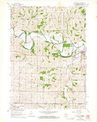 1962 South Wayne1964 Print · USGSLafayette County dairy and river country is captured here in the early sixties, centered on the junction of the Pecatonica River and the railroad. Genealogists and local historians can trace rural schoolhouse locations like Mud Hollow Sch and family burial sites such as Hoffman Cem.
 - 1962 Map of Apple River, 1964 Print
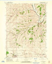 1962 Apple River1964 Print · USGSThe Illinois-Wisconsin borderlands appear in the early sixties as a network of rail-reliant villages and country school districts. Genealogists and local historians can trace family ties at Highland Cem, locate the Salty Hollow Sch, or follow the Pecatonica River past Gratiot.
 - 1962 Map of South Wayne, 1964 Print
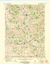 1962 South Wayne1964 Print · USGSCrossing the Illinois border in the 1960s, this area of Lafayette and Green Counties features a landscape shaped by the Pecatonica River and its many tributaries. Researchers can locate numerous rural schoolhouses and family cemeteries like Porter Sch and the Sauterman Cem.
 - 1963 Map of Rockford
 1963 Rockford1963 Print · USGSThe mid-century industrial corridor along the Rock River is shown here during a period of rapid post-war growth. Researchers can trace the extensive rail lines of the Chicago and North Western or locate local landmarks like the Rockford Ordnance Depot and Holy Hill.
 - 1968 Map of Elizabeth NE, 1970 Print
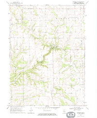 1968 Elizabeth NE1970 Print · USGSUpper Illinois in the late sixties reveals a landscape of limestone bluffs and quiet rural townships. Researchers can trace the history of family plots and vanished hamlets through sites like Millville, Thompson Cem, and the high peak of Benton Mound.
 - 1971 Map of Warren, 1974 Print
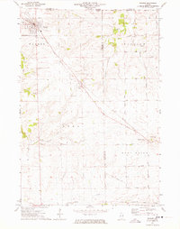 1971 Warren1974 Print · USGSThe Illinois-Wisconsin borderlands and Jo Daviess County countryside are captured here in the early 1970s. Trace family roots at St Anns Cem and Waddams Grove Cem, or follow the Illinois Central Gulf rail line past the Fairground.
 - 1976 Map of Dubuque
 1976 Dubuque1976 Print · USGSThe tri-state borderlands of Iowa, Wisconsin, and Illinois come alive during the mid-seventies, showing a region built on river commerce and mining. Genealogists and historians can trace the paths of the Illinois Central railroad or locate heritage sites like the New Melleray Abbey Monastery and Backbone State Park.
 - 1981 Map of Monroe
 1981 Monroe1981 Print · USGSSouthern Wisconsin and the Illinois borderlands come into focus in the early 1980s, showcasing a landscape defined by dairy farming and river valleys. Genealogists can trace family roots through historic hubs like Monroe, Stoughton, and Brodhead, or locate regional landmarks such as Yellowstone Lake and the Sugar River.
 - 1981 Map of Rockford
 1981 Rockford1981 Print · USGSNorthern Illinois during the early eighties shows a landscape shaped by river valleys and a maturing rail network. Genealogists can trace family roots through settlements like Morseville and Buckhorn Corners while exploring the Rock River valley.2 unique versions available
 - 1984 Map of Dubuque North, 1985 Print
 1984 Dubuque North1985 Print · USGSThis Tri-State region was a hub of Midwestern mining and river commerce in the mid-eighties. Researchers can trace the legacy of the Lead District through specific sites like Annie Mine or locate early civic centers such as First Capitol State Park.2 unique versions available
 - 1984 Map of Dubuque South, 1985 Print
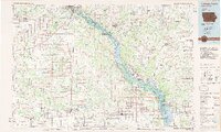 1984 Dubuque South1985 Print · USGSEastern Iowa and Northwest Illinois meet along the Mississippi in the mid-eighties, a landscape defined by river industry and limestone bluffs. Trace the rail lines of the Illinois Central Gulf or explore notable sites like the Savanna Army Depot and Maquoketa Caves State Park.4 unique versions available
 - 2010 Map of South Wayne, 2010 Print
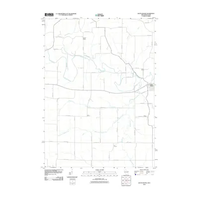 2010 South Wayne2010 Print · USGSThe Illinois-Wisconsin border country comes into focus in the early 2000s, centered on the Pecatonica River valley. Researchers can trace family legacies through numerous burial sites like West Wiota Lutheran Cemetery, Brown Cemetery, and Zion Cemetery.
Showing maps 1-25 of 45
Top cities near Warren Township
- Lena historical maps
- Darlington historical maps
- Stockton historical maps
- Warren historical maps
- Shullsburg historical maps
- Wiota historical maps
See more
Top neighborhoods of Warren Township
Frequently asked questions
- What are the different types of historical maps available for Warren Township?
- What is the oldest map of Warren Township?
- Where can I purchase historical maps of Warren Township for my home or office?
- Where can I download high-res historical maps of Warren Township?
- Are there historical topographic maps available for Warren Township?
- Is there historical aerial imagery available for Warren Township?
- Where are historical maps of Warren Township sourced from?