Old Maps of LaSalle County, Illinois
Explore 85 old maps of LaSalle County, spanning from 1892 to today. These high-resolution historic maps reveal how streets, neighborhoods, landmarks, and natural features evolved over time — perfect for genealogy, metal detecting, research, and local history exploration.
What you can do with these maps:
- See how LaSalle County changed over time: Compare historical maps to modern-day views to trace roads, homesites, rail lines & more.
- View detailed metadata: Each map includes creators, publishers, year, scale, and archive source.
- Overlay maps with satellite & LiDAR: Visualize the past alongside modern tools to explore terrain & human change.
- Trusted historical sources: Maps sourced from the USGS, Library of Congress, and other archives.
- Access maps your way: View online, download high-res files, or order prints for personal or research use.
Start exploring old maps of LaSalle County to uncover forgotten places, hidden landmarks, and the deep history beneath your feet.
LaSalle County, IL maps
(85)- 1892 Map of Marseilles
 1892 Marseilles1892 Print · USGSCovers LaSalle County, including Marseilles, Serena, and other nearby areas3 unique versions available
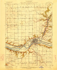
 - 1892 Map of Ottawa
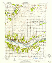
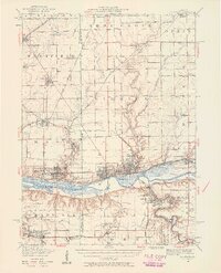
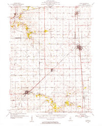
 1892 Ottawa1892 Print · USGSCovers LaSalle County, including Dayton, Naplate, and other nearby areas9 unique versions available
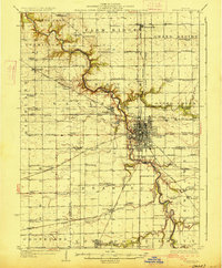
 - 1893 Map of Lasalle
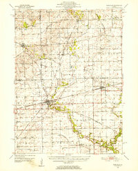
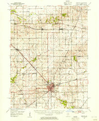
 1893 Lasalle1893 Print · USGSCovers LaSalle County, including Peru, LaSalle, and other nearby areas4 unique versions available
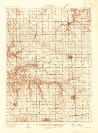
 - 1911 Map of La Salle
 1911 La Salle1911 Print · USGSCovers LaSalle County, including Peru, LaSalle, and other nearby areas
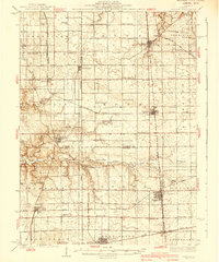
 - 1913 Map of La Salle
 1913 La Salle1913 Print · USGSCovers LaSalle County, including Peru, LaSalle, and other nearby areas4 unique versions available
 - 1915 Map of Ottawa
 1915 Ottawa1915 Print · USGSCovers LaSalle County, including Dayton, Naplate, and other nearby areas7 unique versions available
 - 1916 Map of Marseilles
 1916 Marseilles1916 Print · USGSCovers LaSalle County, including Marseilles, Serena, and other nearby areas4 unique versions available
 - 1925 Map of Streator, 1964 Print
 1925 Streator1964 Print · USGSCovers LaSalle County, including Streator, Farm Ridge, and other nearby areas2 unique versions available
 - 1927 Map of Streator
 1927 Streator1927 Print · USGSCovers LaSalle County, including Streator, Farm Ridge, and other nearby areas2 unique versions available
 - 1934 Map of Wenona
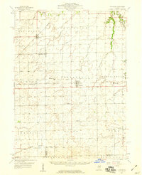
 1934 Wenona1934 Print · USGSCovers LaSalle County, including Evans, Toluca, and other nearby areas2 unique versions available
 - 1939 Map of Wenona
 1939 Wenona1939 Print · USGSCovers LaSalle County, including Evans, Toluca, and other nearby areas2 unique versions available
 - 1940 Map of Marseilles, 1958 Print
 1940 Marseilles1958 Print · USGSCovers LaSalle County, including Marseilles, Serena, and other nearby areas
 - 1946 Map of Ottawa, 1963 Print
 1946 Ottawa1963 Print · USGSCovers LaSalle County, including Dayton, Naplate, and other nearby areas2 unique versions available
 - 1947 Map of La Salle, 1958 Print
 1947 La Salle1958 Print · USGSCovers LaSalle County, including Peru, LaSalle, and other nearby areas2 unique versions available
 - 1948 Map of Sandwich, 1965 Print
 1948 Sandwich1965 Print · USGSCovers LaSalle County, including Yorkville, Plano, and other nearby areas
 - 1950 Map of Sandwich
 1950 Sandwich1950 Print · USGSCovers LaSalle County, including Yorkville, Plano, and other nearby areas2 unique versions available
 - 1951 Map of Earlville, 1952 Print
 1951 Earlville1952 Print · USGSCovers LaSalle County, including Earlville, Leland, and other nearby areas2 unique versions available
 - 1952 Map of Mendota, 1954 Print
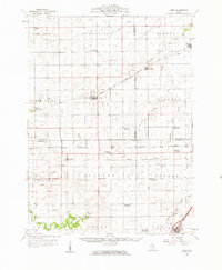
 1952 Mendota1954 Print · USGSCovers LaSalle County, including Mendota, Sublette, and other nearby areas3 unique versions available
 - 1955 Map of Minonk, 1956 Print
 1955 Minonk1956 Print · USGSCovers LaSalle County, including El Paso, Minonk, and other nearby areas
 - 1958 Map of Flanagan, 1959 Print
 1958 Flanagan1959 Print · USGSCovers LaSalle County, including Gridley, Flanagan, and other nearby areas2 unique versions available
 - 1958 Map of Odell, 1959 Print
 1958 Odell1959 Print · USGSCovers LaSalle County, including Nevada, Odell, and other nearby areas
 - 1958 Map of Aurora, 1969 Print
 1958 Aurora1969 Print · USGSCovers LaSalle County, including Aurora, Joliet, and other nearby areas3 unique versions available
 - 1958 Map of Peoria, 1969 Print
 1958 Peoria1969 Print · USGSCovers LaSalle County, including Peoria, Champaign, and other nearby areas4 unique versions available
 - 1961 Map of Aurora
 1961 Aurora1961 Print · USGSCovers LaSalle County, including Aurora, Joliet, and other nearby areas
 - 1961 Map of Peoria
 1961 Peoria1961 Print · USGSCovers LaSalle County, including Peoria, Champaign, and other nearby areas
Showing maps 1-25 of 85
Top cities of LaSalle County
- Streator historical maps
- Peru historical maps
- LaSalle historical maps
- Marseilles historical maps
- Oglesby historical maps
- Dayton historical maps
See more
Frequently asked questions
- What are the different types of historical maps available for LaSalle County?
- What is the oldest map of LaSalle County?
- Where can I purchase historical maps of LaSalle County for my home or office?
- Where can I download high-res historical maps of LaSalle County?
- Are there historical topographic maps available for LaSalle County?
- Is there historical aerial imagery available for LaSalle County?
- Where are historical maps of LaSalle County sourced from?