2020s Maps of Chatsworth, Illinois
Explore 4 historic maps of Chatsworth from the 2020s. These maps offer a rare glimpse into what life looked like during the 2020s — showing old roads, neighborhoods, homes, and landmarks that have changed or disappeared over time.
Whether you're researching your family's past, planning a metal detecting trip, or studying how Chatsworth's landscape evolved across the 2020s, these high-resolution maps are a powerful tool for exploring the history of this region.
- Focus on a specific era: All maps on this page are from the 2020s, giving you a focused view of this time period.
- See what’s changed: Compare century-old streets, trails, and buildings to today's modern landscape using overlays and satellite layers.
- Research with precision: Use these maps for genealogy, historical research, land use analysis, or educational projects.
- View, download, or print: Maps are fully viewable online in high resolution, and can be downloaded or printed for your own records.
Start exploring Chatsworth's history through authentic maps from the 2020s. This is your window into the past.
Chatsworth, IL maps
(4)- 2021 Map of Chatsworth South, 2021 Print
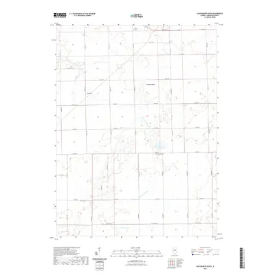 2021 Chatsworth South2021 Print · USGSCovers Chatsworth, including Cereal, Livingston County, and other nearby areas
 - 2021 Map of Chatsworth North, 2021 Print
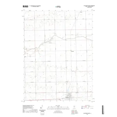 2021 Chatsworth North2021 Print · USGSCovers Chatsworth, including Cullom, Charlotte, and other nearby areas
 - 2024 Map of Chatsworth South, 2024 Print
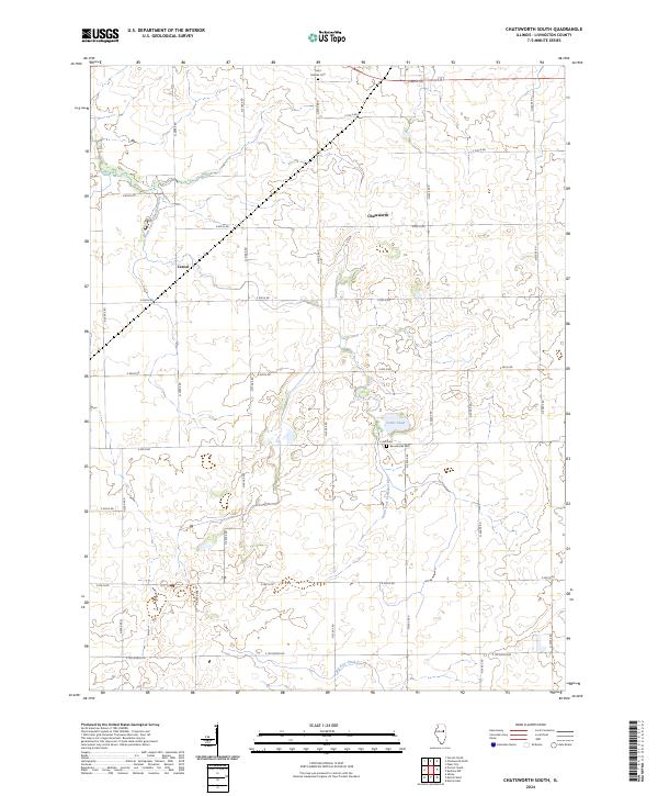 2024 Chatsworth South2024 Print · USGSLivingston County is shown in detail during the early 2020s, revealing the enduring agricultural layout of the Illinois prairie. Researchers can pinpoint Saint Patricks Cem, the settlement of Cereal, and the course of the South Fork Vermilion River.
 - 2024 Map of Chatsworth North, 2024 Print
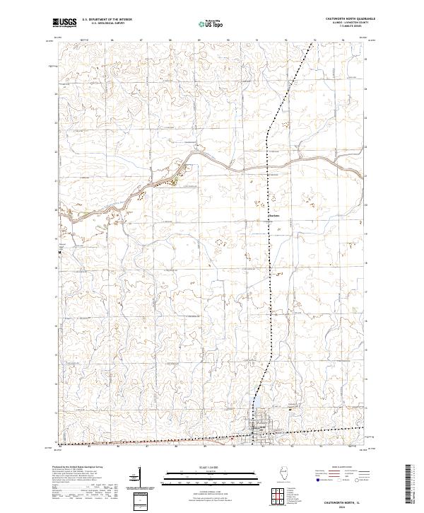 2024 Chatsworth North2024 Print · USGSLivingston County's agricultural heartland is documented here in the early twenty-first century, centered on the transit corridors of the Illinois prairie. Genealogists can trace family connections at Chatsworth Charlotte Cem or locate property relative to Charlotte and the North Fork Vermilion River.
End of results
Showing maps 1-4 of 4
Top cities near Chatsworth
- Fairbury historical maps
- Forrest historical maps
- Piper City historical maps
- Cullom historical maps
- Melvin historical maps
- Saunemin historical maps
See more
Frequently asked questions
- What are the different types of historical maps available for Chatsworth?
- What is the oldest map of Chatsworth?
- Where can I purchase historical maps of Chatsworth for my home or office?
- Where can I download high-res historical maps of Chatsworth?
- Are there historical topographic maps available for Chatsworth?
- Is there historical aerial imagery available for Chatsworth?
- Where are historical maps of Chatsworth sourced from?