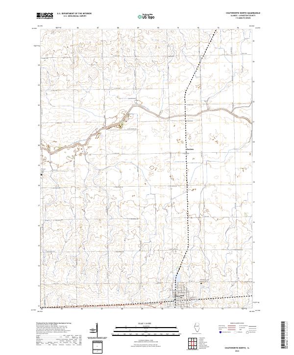
2024 Map of Chatsworth North
USGS Topo · Published 2024About this map
The agricultural landscape of eastern Livingston County is defined by the meandering course of the North Fork Vermilion River, which bisects this prairie region. The southern edge of the map features the northern expansion of Chatsworth, where the grid iron street plan including E Walnut St and E Locust St meets the section-line road system. Further north, the smaller settlement of Charlotte serves as a secondary focal point for the surrounding farming community. For genealogists and local historians, the map provides precise locations for significant burial grounds, including the Chatsworth Charlotte Cem near the town center and the more isolated Pleasant Ridge Cem to the west. This modern survey demonstrates the persistence of the original township road grid, where routes like Co Hwy 3 and Co Hwy 19 continue to facilitate the transport of crops across this productive Illinois terrain.
Find a feature on this map
40 named features on this map. Tap any name to fly to it.
Don’t see what you’re looking for? This feature index may not catch every label — zoom into the map to look around manually.
Map Details
Editions of this 2024 Chatsworth North Map
This is the sole edition of this map. No revisions or reprints were ever made.
Other maps of this area

1944 · Piper City
USGS Topo · 1:48,000

1947 · Piper City
USGS Topo · 1:62,500

1947 · Sibley
USGS Topo · 1:62,500

1947 · Cullom
USGS Topo · 1:62,500

1948 · Buckley
USGS Topo · 1:62,500

1949 · Buckley
USGS Topo · 1:62,500

1949 · Cullom
USGS Topo · 1:62,500

1949 · Sibley
USGS Topo · 1:62,500

1958 · Peoria
USGS Topo · 1:250,000

1961 · Peoria
USGS Topo · 1:250,000