1980s Maps of Chatsworth, Illinois
Explore 3 historic maps of Chatsworth from the 1980s. These maps offer a rare glimpse into what life looked like during the 1980s — showing old roads, neighborhoods, homes, and landmarks that have changed or disappeared over time.
Whether you're researching your family's past, planning a metal detecting trip, or studying how Chatsworth's landscape evolved across the 1980s, these high-resolution maps are a powerful tool for exploring the history of this region.
- Focus on a specific era: All maps on this page are from the 1980s, giving you a focused view of this time period.
- See what’s changed: Compare century-old streets, trails, and buildings to today's modern landscape using overlays and satellite layers.
- Research with precision: Use these maps for genealogy, historical research, land use analysis, or educational projects.
- View, download, or print: Maps are fully viewable online in high resolution, and can be downloaded or printed for your own records.
Start exploring Chatsworth's history through authentic maps from the 1980s. This is your window into the past.
Chatsworth, IL maps
(3)- 1983 Map of Chatsworth North
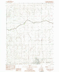 1983 Chatsworth North1983 Print · USGSLivingston County in the early 1980s is shown as a productive agricultural landscape defined by rail lines and rural townships. Genealogists and local historians can trace family roots at Pleasant Ridge Cem or locate the site of Charlotte Ch along the North Fork Vermilion River.
 - 1985 Map of Fairbury
 1985 Fairbury1985 Print · USGSCentral Illinois in the mid-1980s reveals a landscape shaped by the Illinois Central Gulf rail network and the Vermilion River basin. Trace the roots of local communities from Fairbury to Pontiac, and locate landmarks like the State Correctional Center and High Chapel.2 unique versions available
 - 1986 Map of Chatsworth South
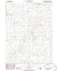 1986 Chatsworth South1986 Print · USGSLivingston County's agricultural heartland is documented in the mid-1980s as rural townships began a new era of modernization. Researchers can trace the drainage of the Big Four Ditch and find small settlements like Cereal and the edge of Chatsworth.
End of results
Showing maps 1-3 of 3
Top cities near Chatsworth
- Fairbury historical maps
- Forrest historical maps
- Piper City historical maps
- Cullom historical maps
- Melvin historical maps
- Saunemin historical maps
See more
Frequently asked questions
- What are the different types of historical maps available for Chatsworth?
- What is the oldest map of Chatsworth?
- Where can I purchase historical maps of Chatsworth for my home or office?
- Where can I download high-res historical maps of Chatsworth?
- Are there historical topographic maps available for Chatsworth?
- Is there historical aerial imagery available for Chatsworth?
- Where are historical maps of Chatsworth sourced from?