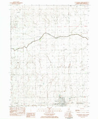
1983 Map of Chatsworth North
USGS Topo · Published 1983About this map
Chatsworth anchor this Livingston County landscape during the early 1980s, situated at a junction of rail and river commerce. The Toledo Peoria and Western railroad cuts east-west through the southern portion of the map, serving as a primary corridor for the grain-growing region. To the north, the North Fork Vermilion River meanders through the townships of Sullivan and Charlotte, where the small settlement of Charlotte and the nearby Charlotte Ch mark the rural community center.
Find a feature on this map
16 named features on this map. Tap any name to fly to it.
Don’t see what you’re looking for? This feature index may not catch every label — zoom into the map to look around manually.
Map Details
Editions of this 1983 Chatsworth North Map
This is the sole edition of this map. No revisions or reprints were ever made.
Other maps of this area

1944 · Piper City
USGS Topo · 1:48,000

1947 · Piper City
USGS Topo · 1:62,500

1947 · Sibley
USGS Topo · 1:62,500

1947 · Cullom
USGS Topo · 1:62,500

1948 · Buckley
USGS Topo · 1:62,500

1949 · Buckley
USGS Topo · 1:62,500

1949 · Cullom
USGS Topo · 1:62,500

1949 · Sibley
USGS Topo · 1:62,500

1958 · Peoria
USGS Topo · 1:250,000

1961 · Peoria
USGS Topo · 1:250,000