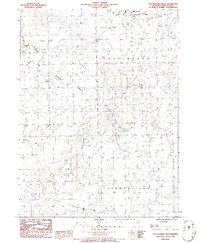
1986 Map of Chatsworth South
USGS Topo · Published 1986About this map
The agricultural landscape of Livingston County is captured here in the mid-1980s, centered on the southern outskirts of Chatsworth. This survey illustrates the organized township structure of central Illinois, clearly delineating the boundaries of Forrest, Germanville, and Fayette. The terrain is defined by its water management and drainage systems, essential for the local prairie farming economy, including the prominent Big Four Ditch in the south and the meandering path of the South Fork Vermilion River.
Find a feature on this map
11 named features on this map. Tap any name to fly to it.
Don’t see what you’re looking for? This feature index may not catch every label — zoom into the map to look around manually.
Map Details
Editions of this 1986 Chatsworth South Map
This is the sole edition of this map. No revisions or reprints were ever made.
Other maps of this area

1944 · Piper City
USGS Topo · 1:48,000

1947 · Piper City
USGS Topo · 1:62,500

1947 · Sibley
USGS Topo · 1:62,500

1947 · Cullom
USGS Topo · 1:62,500

1948 · Buckley
USGS Topo · 1:62,500

1949 · Buckley
USGS Topo · 1:62,500

1949 · Cullom
USGS Topo · 1:62,500

1949 · Sibley
USGS Topo · 1:62,500

1958 · Peoria
USGS Topo · 1:250,000

1961 · Peoria
USGS Topo · 1:250,000