Old Maps of Henry, Illinois for Academic Research
Study the evolution of Henry with 24 high-resolution historic maps. Whether you're teaching, researching, or modeling changes in land use, these maps provide essential visual documentation of urban, environmental, and geographic change.
- Analyze long-term change: Track patterns in development, transportation, and natural features.
- Ideal for environmental or urban studies: Support academic projects with primary historical map data.
- Use in the classroom or lab: Educators and researchers rely on these maps to bring historical context to life.
These maps are a powerful tool for teaching, research, and visualizing how Henry has changed over the decades.
Henry, IL maps
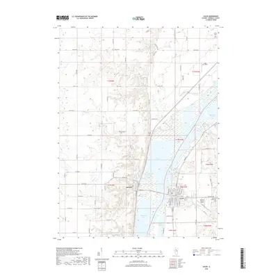
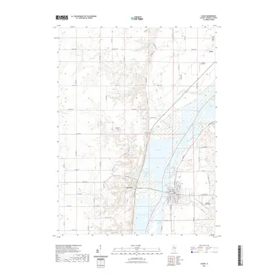
(24)- 1893 Map of Lacon
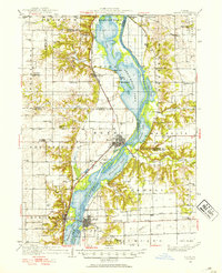
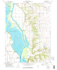
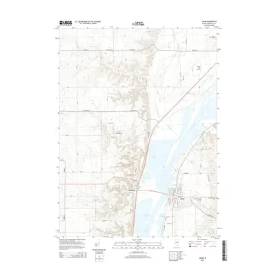
 1893 Lacon1893 Print · USGSThe Illinois River valley in the early 1890s reveals a landscape of river-port towns and sprawling backwater lakes. Genealogists and local historians can trace the early rail corridors of the Chicago and Alton Railroad and find long-established river settlements like Henry and Sparland.4 unique versions available
 - 1933 Map of Lacon
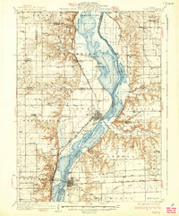
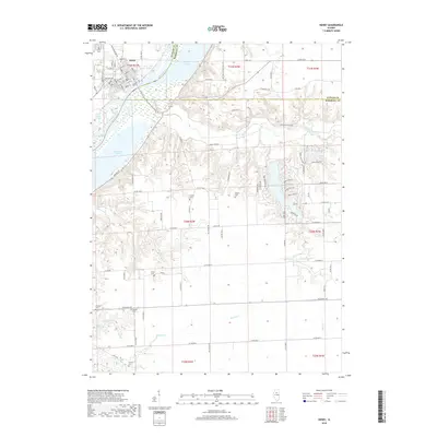
 1933 Lacon1933 Print · USGSThe Illinois River valley in the early 1930s reveals a complex network of backwater lakes and rail-dependent towns. Researchers can locate family landmarks like St Joseph Cem, the Whitefield Town Hall, and dozens of rural schoolhouses such as Brush College Sch.3 unique versions available
 - 1937 Map of Lacon
 1937 Lacon1937 Print · USGSMid-century life along the Illinois River valley reveals a landscape of thriving river towns and rural school districts in the 1930s. Trace the vanished local footprints of Whitefield Town Hall, the Alton RR corridor, and family-named sites like Bonham Cem.2 unique versions available
 - 1958 Map of Aurora, 1969 Print
 1958 Aurora1969 Print · USGSNorthern Illinois in the late fifties shows a landscape of powerful river industry and expanding transport corridors. Genealogists and historians can trace the development of Aurora and Joliet or locate sites like the Elwood Ordnance Plant and Starved Rock.3 unique versions available
 - 1961 Map of Aurora
 1961 Aurora1961 Print · USGSNorthern Illinois at the height of the post-war era reveals a landscape of massive industrial works and thriving river towns. Genealogists and historians can trace the paths of the Lincoln Highway or locate long-standing landmarks like the Green River Ordnance Plant and Starved Rock State Park.
 - 1972 Map of Henry, 1974 Print
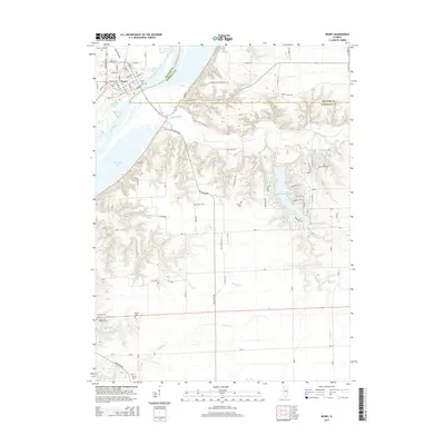
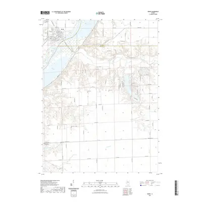
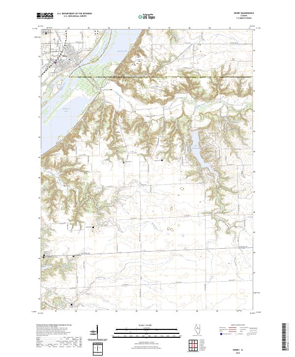
 1972 Henry1974 Print · USGSMarshall County in the early seventies centers on the riverfront life of the community of Henry and the surrounding agricultural townships. Genealogists can locate several family-named burial sites like Forbes Cem and Harris Cem, or trace the winding course of Sandy Creek through the rural landscape.2 unique versions available
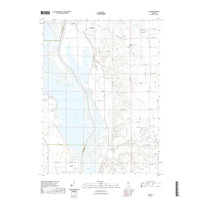
 - 1972 Map of Lacon, 1974 Print
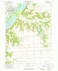
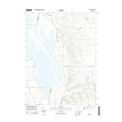
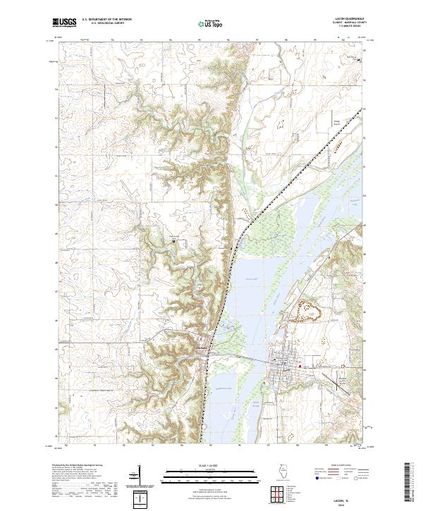
 1972 Lacon1974 Print · USGSThe Illinois River valley in the early seventies shows a landscape defined by industrial rail lines and protected river bottomlands. Genealogists and local historians can locate family landmarks like Nighswonger Cem or trace the early paths of the Illinois Central Gulf railroad.2 unique versions available
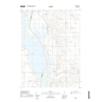
 - 1972 Map of Florid, 1974 Print
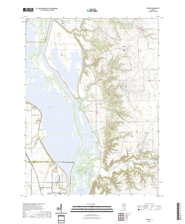
 1972 Florid1974 Print · USGSThe Illinois River bottomlands in the early 1970s reveal a landscape of vast backwater lakes and upland farming communities. Trace family roots at Riverside Cem or follow the Chicago Rock Island and Pacific rails past Hilderbrant.2 unique versions available
 - 1985 Map of Kewanee
 1985 Kewanee1985 Print · USGSNorth-central Illinois in the mid-eighties shows a landscape of river-valley industry and prairie transit. Researchers can trace family roots through Evergreen Memory Garden or follow the historic Hennepin Canal past Tiskilwa and Wyanet.2 unique versions available
 - 2012 Map of Florid, 2012 Print
 2012 Florid2012 Print · USGSCovers Henry, including Hennepin, Undercliff, and other nearby areas
 - 2012 Map of Henry, 2012 Print
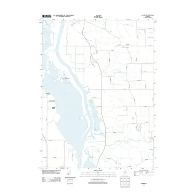
 2012 Henry2012 Print · USGSCovers Henry, including Putnam County, Marshall County, and other nearby areas
 - 2012 Map of Lacon, 2012 Print
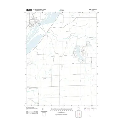
 2012 Lacon2012 Print · USGSCovers Henry, including Lacon, Sparland, and other nearby areas
 - 2015 Map of Henry, 2015 Print
 2015 Henry2015 Print · USGSCovers Henry, including Putnam County, Marshall County, and other nearby areas
 - 2015 Map of Lacon, 2015 Print
 2015 Lacon2015 Print · USGSCovers Henry, including Lacon, Sparland, and other nearby areas
 - 2015 Map of Florid, 2015 Print
 2015 Florid2015 Print · USGSCovers Henry, including Hennepin, Undercliff, and other nearby areas
 - 2018 Map of Henry, 2018 Print
 2018 Henry2018 Print · USGSCovers Henry, including Putnam County, Marshall County, and other nearby areas
 - 2018 Map of Lacon, 2018 Print
 2018 Lacon2018 Print · USGSCovers Henry, including Lacon, Sparland, and other nearby areas
 - 2018 Map of Florid, 2018 Print
 2018 Florid2018 Print · USGSCovers Henry, including Hennepin, Undercliff, and other nearby areas
 - 2021 Map of Florid, 2021 Print
 2021 Florid2021 Print · USGSCovers Henry, including Hennepin, Undercliff, and other nearby areas
 - 2021 Map of Henry, 2021 Print
 2021 Henry2021 Print · USGSCovers Henry, including Putnam County, Marshall County, and other nearby areas
 - 2021 Map of Lacon, 2021 Print
 2021 Lacon2021 Print · USGSCovers Henry, including Lacon, Sparland, and other nearby areas
 - 2024 Map of Florid, 2024 Print
 2024 Florid2024 Print · USGSThe Illinois River valley comes into sharp focus here in 2024, showing the winding waterway between Hennepin and Henry. Genealogists can trace family plots at Florid Cem or Murphy Cem while exploring the backroads and oxbow lakes like Senachwine Lake.
 - 2024 Map of Lacon, 2024 Print
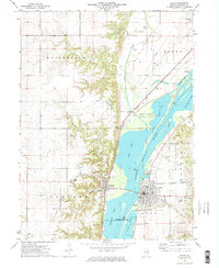
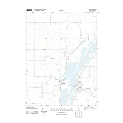
 2024 Lacon2024 Print · USGSMarshall County's riverfront comes into focus in this contemporary survey of the Illinois River valley. Researchers can trace the civic layout of Lacon near the Marshall County Courthouse or locate family sites like Bonham Cem and Nighswonger Cem.
 - 2024 Map of Henry, 2024 Print
 2024 Henry2024 Print · USGSThe river town of Henry is shown here in the 2020s, highlighting its position along the Illinois River and the surrounding marshlands. Genealogists can locate several family burial grounds including Jason and Broadus Cem and Greeves Cem, alongside the Chautauqua National Wildlife Refuge.
End of results
Showing maps 1-24 of 24
Top cities near Henry
- Peru historical maps
- Chillicothe historical maps
- Spring Valley historical maps
- Lacon historical maps
- Granville historical maps
- Toluca historical maps
See more
Frequently asked questions
- What are the different types of historical maps available for Henry?
- What is the oldest map of Henry?
- Where can I purchase historical maps of Henry for my home or office?
- Where can I download high-res historical maps of Henry?
- Are there historical topographic maps available for Henry?
- Is there historical aerial imagery available for Henry?
- Where are historical maps of Henry sourced from?