Old Maps of Marshall County, Illinois for Hiking & Exploration
Hike through history with 126 historic maps of Marshall County. Explore old trails, ghost towns, and forgotten backroads — perfect for outdoor adventurers and local explorers.
- Rediscover forgotten places: Map out old mining camps, roads, and footpaths that no longer exist on modern maps.
- Layer with modern tools: Combine with LiDAR or satellite views to plan hikes through historical terrain.
- Made for exploration: Popular among hikers, overlanders, and local history lovers.
Use these maps to find adventure and explore the hidden past of Marshall County.
Marshall County, IL maps
(126)- 1893 Map of Lacon
 1893 Lacon1893 Print · USGSThe Illinois River valley in the early 1890s reveals a landscape of river-port towns and sprawling backwater lakes. Genealogists and local historians can trace the early rail corridors of the Chicago and Alton Railroad and find long-established river settlements like Henry and Sparland.4 unique versions available
 - 1893 Map of Metamora
 1893 Metamora1893 Print · USGSWoodford and Marshall counties are shown in the 1890s as the rail networks and river towns of the Illinois valley reached maturity. Researchers can trace the early footprints of Metamora, Washburn, and Rome alongside the path of the Chicago and Alton Railroad.4 unique versions available
 - 1893 Map of Dunlap
 1893 Dunlap1893 Print · USGSPeoria County and the Illinois River valley are seen here in the 1890s, when the region was a bustling network of rail towns and river bluffs. Genealogists can trace family roots in early settlements like Dunlap, Princeville, and the river community of Mossville.
 - 1898 Map of Dunlap
 1898 Dunlap1898 Print · USGSPeoria County and its neighboring townships thrive along the river bluffs and rail lines during the late 1890s. Researchers can trace the path of the Atchison Topeka and Santa Fe Railroad and locate vanished rural centers like Wady Petra and Orange Prairie.4 unique versions available
 - 1932 Map of Dunlap
 1932 Dunlap1932 Print · USGSNorth of Peoria in the late nineteenth century, the prairie landscape was being reshaped by a dense network of competing rail lines. Trace old homesteads and vanished stops like Orange Prairie and Wady Petra along the Illinois River bluffs.
 - 1933 Map of Dunlap
 1933 Dunlap1933 Print · USGSPeoria County's agricultural heartland and river bluffs are captured here between the world wars, when coal mines and early airfields sat alongside rural hamlets. Family historians can locate dozens of country schools, family-named cemeteries like Dickison Cem, and the historic Evans Mill Bridge.
 - 1933 Map of Lacon
 1933 Lacon1933 Print · USGSThe Illinois River valley in the early 1930s reveals a complex network of backwater lakes and rail-dependent towns. Researchers can locate family landmarks like St Joseph Cem, the Whitefield Town Hall, and dozens of rural schoolhouses such as Brush College Sch.3 unique versions available
 - 1933 Map of Camp Grove
 1933 Camp Grove1933 Print · USGSThe Illinois prairie between Bradford and Camp Grove in the 1930s reveals a landscape of vanished rural schools and early rail lines. Genealogists can trace family footprints at St Johns Cem, Union Ch, or the small settlement of Red Town.
 - 1934 Map of Wenona
 1934 Wenona1934 Print · USGSThe crossroads of Marshall, Putnam, and La Salle counties are captured here in the mid-1930s, revealing a landscape defined by railroad junctions and rural school districts. Genealogists can locate family-named landmarks like Hullinger Sch and Beckwith Sch, or trace the tracks of the Illinois Central through Wenona.2 unique versions available
 - 1937 Map of Metamora
 1937 Metamora1937 Print · USGSThe Illinois River valley and its complex network of sloughs and lakes define this Depression-era portrait of Woodford and Marshall counties. You can trace early 20th-century rural life through dozens of named schoolhouses like Hytex Sch and local landmarks such as Lourdes Ch or the County Home.3 unique versions available
 - 1937 Map of Dunlap
 1937 Dunlap1937 Print · USGSPeoria County and its river bluffs are shown in the 1930s as a vital transportation hub of railroads and early airfields. Researchers can trace rural lineages through the many schools and burial grounds like Lawn Ridge Cem, Prospect Cem, and Hazel Dell Sch.3 unique versions available
 - 1937 Map of Lacon
 1937 Lacon1937 Print · USGSMid-century life along the Illinois River valley reveals a landscape of thriving river towns and rural school districts in the 1930s. Trace the vanished local footprints of Whitefield Town Hall, the Alton RR corridor, and family-named sites like Bonham Cem.2 unique versions available
 - 1939 Map of Wenona
 1939 Wenona1939 Print · USGSNorth-central Illinois agricultural and rail hubs are captured here in the late 1930s as steam-era infrastructure reached its peak. Researchers can locate dozens of country schools and trace the tracks of the Illinois Central through Wenona and Tonica.2 unique versions available
 - 1945 Map of Bradford
 1945 Bradford1945 Print · USGSSettlement and agriculture in Stark and Bureau Counties reached a peak of rural infrastructure in the mid-1940s. Genealogists can trace family footprints across dozens of country school sites like Osceola Center Sch and churches such as Willow Springs Ch.3 unique versions available
 - 1948 Map of Metamora, 1965 Print
 1948 Metamora1965 Print · USGSMid-century Woodford and Peoria Counties are captured here as the river-and-rail economy shaped the landscape. Genealogists can trace dozens of rural schoolhouses like Oakhill Sch and Maple Grove Sch, alongside historic sites like Lourdes Ch.
 - 1955 Map of Minonk, 1956 Print
 1955 Minonk1956 Print · USGSWoodford and Marshall counties at mid-century reveal a thriving rail-and-coal economy across the Illinois prairie. Family researchers and historians can trace lineage at Mennonite Ch, find old Mine Dumps, or locate vanished landmarks like Spring Hill Sch.
 - 1958 Map of Aurora, 1969 Print
 1958 Aurora1969 Print · USGSNorthern Illinois in the late fifties shows a landscape of powerful river industry and expanding transport corridors. Genealogists and historians can trace the development of Aurora and Joliet or locate sites like the Elwood Ordnance Plant and Starved Rock.3 unique versions available
 - 1958 Map of Peoria, 1969 Print
 1958 Peoria1969 Print · USGSCentral Illinois thrived as a hub of education and transport during the late sixties, as the new interstate system began to reshape the prairie. Genealogists and historians can trace local landmarks like Springdale Cem, Bradley University, and the sprawling grounds of Chanute AFB.4 unique versions available
 - 1961 Map of Aurora
 1961 Aurora1961 Print · USGSNorthern Illinois at the height of the post-war era reveals a landscape of massive industrial works and thriving river towns. Genealogists and historians can trace the paths of the Lincoln Highway or locate long-standing landmarks like the Green River Ordnance Plant and Starved Rock State Park.
 - 1961 Map of Peoria
 1961 Peoria1961 Print · USGSCentral Illinois thrived at the intersection of river trade and rail power during the late fifties. Genealogists and local historians can trace the rail networks of the Illinois Central and Wabash, alongside landmarks like Chanute AFB and Weldon Springs State Park.
 - 1963 Map of Peoria
 1963 Peoria1963 Print · USGSCentral Illinois thrived as a rail and highway crossroads during the early sixties, centered on the bustling Illinois River valley. Genealogists and historians can trace the mid-century layout of Peoria, locate the grounds of Chanute Air Force Base, and follow historic lines like the Toledo Peoria and Western Railway.
 - 1972 Map of Chillicothe, 1974 Print
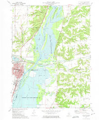 1972 Chillicothe1974 Print · USGSChillicothe and the Illinois River valley are captured in the early seventies as a major rail-and-river hub surrounded by expansive conservation wetlands. Genealogists can locate family landmarks such as Hammett Cem, New Salem Cem, and Lincoln Valley Central High Sch.2 unique versions available
 - 1972 Map of Putnam, 1974 Print
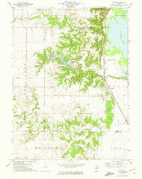 1972 Putnam1974 Print · USGSThe Illinois River valley and the community of Putnam are captured here in the early 1970s. Researchers can trace the Chicago Rock Island and Pacific rail line and locate local landmarks like Sugar Grove Cem and Lake Thunderbird.2 unique versions available
 - 1972 Map of Henry, 1974 Print
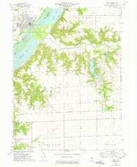 1972 Henry1974 Print · USGSMarshall County in the early seventies centers on the riverfront life of the community of Henry and the surrounding agricultural townships. Genealogists can locate several family-named burial sites like Forbes Cem and Harris Cem, or trace the winding course of Sandy Creek through the rural landscape.2 unique versions available
 - 1972 Map of Lacon, 1974 Print
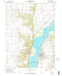 1972 Lacon1974 Print · USGSThe Illinois River valley in the early seventies shows a landscape defined by industrial rail lines and protected river bottomlands. Genealogists and local historians can locate family landmarks like Nighswonger Cem or trace the early paths of the Illinois Central Gulf railroad.2 unique versions available
Showing maps 1-25 of 126
Top cities of Marshall County
- Henry historical maps
- Lacon historical maps
- Evans historical maps
- Toluca historical maps
- Sparland historical maps
- Hopewell historical maps
See more
Frequently asked questions
- What are the different types of historical maps available for Marshall County?
- What is the oldest map of Marshall County?
- Where can I purchase historical maps of Marshall County for my home or office?
- Where can I download high-res historical maps of Marshall County?
- Are there historical topographic maps available for Marshall County?
- Is there historical aerial imagery available for Marshall County?
- Where are historical maps of Marshall County sourced from?