Old Maps of Morgan County, Illinois for Metal Detecting
Plan your next treasure hunt with 119 historic maps of Morgan County. Find old homesites, ghost towns, trails, and gathering spots that may be lost to time — perfect for identifying promising metal detecting locations.
- Locate forgotten sites: Uncover places like long-lost settlements, abandoned rail lines, or gathering spots.
- Plan better hunts: Use map overlays combined with LiDAR or satellite views to narrow in on historically rich areas.
- Made for detectorists: Thousands of hobbyists use these maps to discover relics, coins, and hidden history.
Use these historic maps to boost your research and find new opportunities beneath the surface of Morgan County.
Morgan County, IL maps
(119)- 1909 Map of Tallula
 1909 Tallula1909 Print · USGSCentral Illinois at the turn of the century shows a landscape defined by the Sangamon River and a dense rail network. Researchers can trace the early footprints of Pleasant Plains, Tallula, and Berlin, as well as several smaller stops along the Chicago and Alton RR.3 unique versions available
 - 1924 Map of Winchester
 1924 Winchester1924 Print · USGSScott and Morgan counties are shown here during the early twenties as a thriving network of small-town rail stops and rural schools. Genealogists can locate dozens of local landmarks like Oak Grove School, Seminary School, and the junction at Winchester.3 unique versions available
 - 1924 Map of Waverly
 1924 Waverly1924 Print · USGSCentral Illinois at the height of the rail era shows a landscape dotted with country schoolhouses and bustling farming hubs. Trace the path of the Illinois Traction and locate family sites near Mound Seminary School or McClain Church.2 unique versions available
 - 1926 Map of Winchester
 1926 Winchester1926 Print · USGSScott and Morgan counties are shown in the mid-twenties, revealing a landscape of small agricultural villages and decentralized country schools. Genealogists can trace family footprints near Strawns Grove School, the Poor Farm, or the rail depot at Alsey.
 - 1926 Map of Waverly
 1926 Waverly1926 Print · USGSIn the mid-1920s, this portion of central Illinois was a bustling intersection of steam railroads and electric interurbans. Genealogists can trace the rural communities of Waverly, New Berlin, and Loami, alongside dozens of local landmarks like Rohrer Church and the Highwater Mark School.2 unique versions available
 - 1928 Map of Meredosia, 1958 Print
 1928 Meredosia1958 Print · USGSThe Illinois River valley in the late 1920s was a bustling corridor of river locks, pumping stations, and rail lines. Genealogists and local historians can trace family roots through numerous rural landmarks like Ham Sch, Reich Landing, and the Perry Spring's Sta rail stop.2 unique versions available
 - 1929 Map of Arenzville, 1969 Print
 1929 Arenzville1969 Print · USGSThe fertile bottomlands of Cass and Morgan Counties are seen here in the late twenties, defined by a dense grid of family farms and rural schools. Genealogists can locate specific landmarks like the Neelyville PO, St Peters Ch, and Jersey College Sch.2 unique versions available
 - 1931 Map of Meredosia
 1931 Meredosia1931 Print · USGSThe Illinois River valley in the late twenties is captured here at a peak of rail and river activity. Genealogists can trace family roots through numerous country schools like Sand Ridge Sch and the important La Grange Locks complex.2 unique versions available
 - 1932 Map of Arenzville
 1932 Arenzville1932 Print · USGSThe bluffs and bottomlands of Cass and Morgan Counties are meticulously documented here in the early thirties. Local historians can trace family roots through dozens of rural landmarks, including Jersey College Sch, Bethel Chapel, and the settlement of Joy Prairie.
 - 1932 Map of Jacksonville, 1965 Print
 1932 Jacksonville1965 Print · USGSCentral Illinois farm country and the growing hub of Jacksonville are captured in the early 1930s before modern highway expansion. Researchers can trace dozens of country schools and churches, including Douglas Institute, Whitlock Cem, and the rural post at Pisgah.2 unique versions available
 - 1932 Map of Virginia, 1965 Print
 1932 Virginia1965 Print · USGSCentral Illinois farm country and the Sangamon river breaks are captured here in the early 1930s as the rail and road network matured. Researchers can locate dozens of country schools and churches, from Brush College Sch and Zion Ch to the old settlement of Old Princeton.2 unique versions available
 - 1936 Map of Virginia
 1936 Virginia1936 Print · USGSCentral Illinois during the mid-thirties shows a landscape of busy rail towns and rural school districts centered on Virginia and Ashland. Researchers can trace old family schoolhouses like Science Hill Sch and country churches such as Eckman Chapel.2 unique versions available
 - 1937 Map of Jacksonville
 1937 Jacksonville1937 Print · USGSMid-century Morgan County thrives as a rail and education hub just before the pre-war era. Researchers can trace ancestral roots at Whitlock Cem or locate defunct schools like Sulphur Springs Sch and Prairie College Sch.2 unique versions available
 - 1940 Map of Tallula, 1956 Print
 1940 Tallula1956 Print · USGSCentral Illinois during the late thirties and early forties reveals a landscape of river-bluff history and active rail towns. Genealogists can trace family connections in Tallula, Salisbury, and Berlin, or locate the historic New Salem State Park.2 unique versions available
 - 1948 Map of Quincy
 1948 Quincy1948 Print · USGSThe Mississippi and Illinois River valleys are captured at a post-war crossroads as rail and river travel met the expanding highway system. Genealogists can trace family settlements from Quincy to Hannibal and smaller towns like Vandalia and Jerseyville.2 unique versions available
 - 1956 Map of Quincy, 1967 Print
 1956 Quincy1967 Print · USGSThe river and rail corridors of the Illinois-Missouri border are documented here during the mid-1950s. Researchers can trace historic river landings and regional transit hubs from Quincy and Hannibal to smaller settlements like Meredosia and Roodhouse.3 unique versions available
 - 1958 Map of Decatur, 1971 Print
 1958 Decatur1971 Print · USGSCentral Illinois in the mid-twentieth century shows a landscape defined by industrial rail hubs and the creation of large reservoirs. Researchers can trace historic corridors like the Penn Central or locate landmarks such as Lincoln Log Cabin State Park and Lake Springfield.3 unique versions available
 - 1961 Map of Decatur
 1961 Decatur1961 Print · USGSCentral Illinois in the late fifties was a bustling corridor of rail lines and prairie commerce centered on the state capital. Genealogists and historians can trace the intricate connections between Springfield, Decatur, and dozens of smaller settlements like Nokomis and Arcola.2 unique versions available
 - 1971 Map of Pleasant Plains, 1973 Print
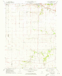 1971 Pleasant Plains1973 Print · USGSCentral Illinois farm country is captured here in the early seventies as the Baltimore and Ohio railroad serves the grain elevators of Pleasant Plains. Researchers can trace old property lines and rural landmarks like Berlin, the Island Grove Ch, and local cemeteries.
 - 1975 Map of Meredosia SE, 1976 Print
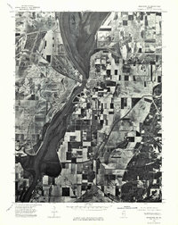 1975 Meredosia SE1976 Print · USGSThe Illinois River valley in the mid-1970s shows a landscape of riverfront commerce and productive floodplains. Genealogists and local historians can trace the footprints of Meredosia, Naples, and the edge of Bluffs as they appeared decades ago.
 - 1980 Map of Cooperstown, 1981 Print
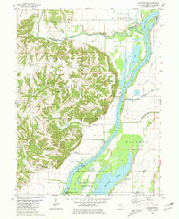 1980 Cooperstown1981 Print · USGSThe Illinois River valley in the early 1980s reveals a complex landscape of commercial river locks and expansive wildlife wetlands. Genealogists and historians can trace numerous rural burial grounds like Vandeventer Cem or Hulett Cem and locate landmarks like the La Grange Lock and Dam.
 - 1980 Map of Meredosia, 1981 Print
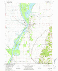 1980 Meredosia1981 Print · USGSThe Illinois River valley in the early 1980s reveals a landscape of massive levees, rail lines, and wetlands across four county borders. Researchers can trace family history at Oakland Cem or Fairview Cem and follow the Norfolk and Western tracks through Meredosia and Naples.
 - 1983 Map of Manchester
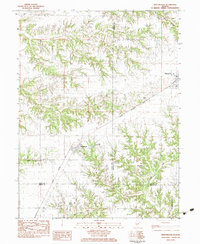 1983 Manchester1983 Print · USGSManchester and Murrayville are captured here in the early eighties as agricultural and rail hubs. Trace the path of the Illinois Central Gulf railroad or locate rural landmarks like East Union Church and Bethel Cemetery.
 - 1983 Map of Franklin
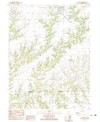 1983 Franklin1983 Print · USGSMorgan and Macoupin counties come alive in the early eighties, centered on the rail-linked town of Franklin. Genealogists can trace rural roots at Harts Prairie Ch, Providence Cem, and the small settlement of Centerville.
 - 1983 Map of Chapin
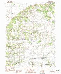 1983 Chapin1983 Print · USGSRailroad activity defined this Morgan County landscape in the early 1980s, where two major lines intersected at Chapin. Genealogists can trace family roots through numerous rural landmarks like Trinity Ch, Morgan City Cem, and the settlement of Bethel.
Showing maps 1-25 of 119
Top cities of Morgan County
- Jacksonville historical maps
- South Jacksonville historical maps
- Waverly historical maps
- Meredosia historical maps
- Murrayville historical maps
- Chapin historical maps
See more
Frequently asked questions
- What are the different types of historical maps available for Morgan County?
- What is the oldest map of Morgan County?
- Where can I purchase historical maps of Morgan County for my home or office?
- Where can I download high-res historical maps of Morgan County?
- Are there historical topographic maps available for Morgan County?
- Is there historical aerial imagery available for Morgan County?
- Where are historical maps of Morgan County sourced from?